A prescient Boston Globe
article:
The year is 2010, and tourists are scurrying across the surface of the submerged Central Artery, avoiding cars and checking maps to get from Faneuil Hall to the Aquarium. Mothers with strollers are leaning into a gusty wind, passing through a barren park where no one lingers.
I have made one small change to the quote. The authors felt they were exaggerating when they wrote those words in 1999. However, a mere ten years later, the
Rose Kennedy Greenway has already become the barren park that they had envisioned.
But you don't have to take my word for it. In late 2011, a political movement known as
Occupy Boston took over the open space near South Station called Dewey Square -- part of the southernmost portion of the Greenway. Eventually a Suffolk Superior Court
ruled that the city could evict them. As part of that ruling, the judge provided a description of the space:
Developed as parkland, the locus in quo is a hundred-foot wide median strip, which covers an interstate highway tunnel and is bounded by an exit ramp and heavily trafficked streets. It is operated by the Rose Fitzgerald Kennedy Greenway Conservancy, Inc. and is known as Dewey Square.
Many decades and dozens of billions of taxpayer dollars were spent on designing and constructing the Big Dig. It was supposed to
open up nearly 30 acres of prime downtown real-estate, and reunite the city. But when former environmental secretary John DeVillars approved the plan,
he inserted an arbitrary stipulation that 75% of the land be used for "open space." Also: as it is constructed, the tunnel underneath
will not support any building taller than a few stories. As a result, nearly all proposals for the land focused on different ways to turn it into a
park, or worse,
a parking lot. And in the end, what have we got for all of the effort? A six lane divided highway, at-grade, with "open space" in the middle. See for yourself:
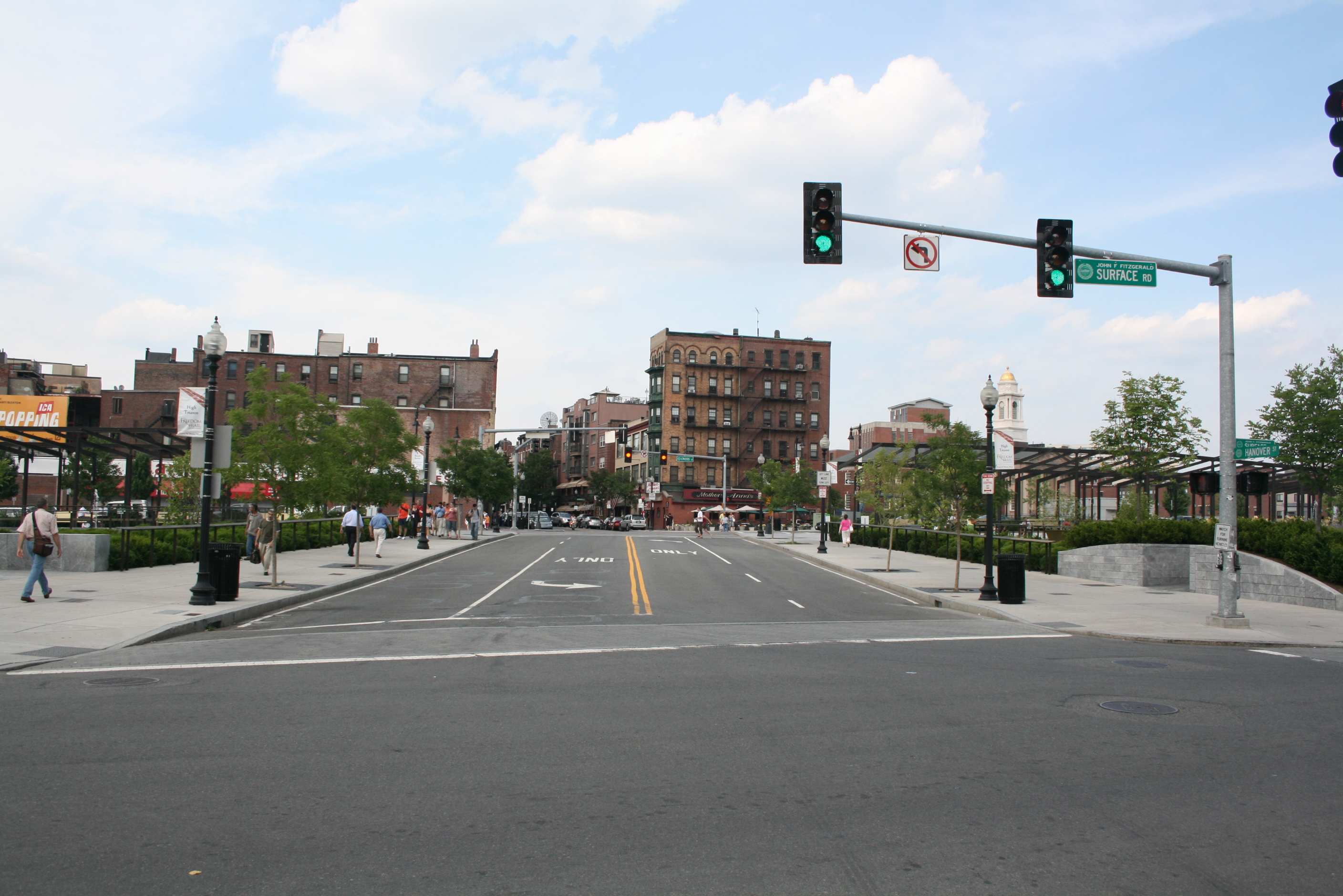 |
| "Pedestrian friendly" connection to the North End (source) |
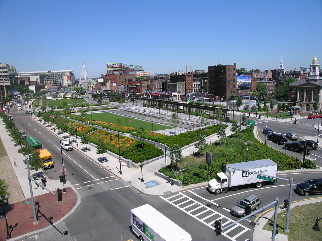 |
| Northernmost section - perhaps the nicest part but still very highway-like (source) |
We didn't get redevelopment of the urban fabric to replace what was demolished fifty years ago. And we didn't get much of a park either. Just a barren "open space." Or as Charlie Gardner put it:
they made a desert and called it a park.
He also asks: did anyone consider the option of removing the Central Artery, and not replacing it? After all, the 1989 Loma Prieta earthquake forced San Francisco to do that to the
Embarcadero Freeway, and the result has been overwhelmingly positive for them. While people have made
comparisons between that highway and Boston's Central Artery, nobody seems to consider if what worked for them might have worked for us as well.
Consider
this segment from a
fascinating interview with Fred Salvucci, where he explains how the idea for the Big Dig came about:
Initially Bill Reynolds, who was a highway builder and the head New England Road Builders, came up to me and said that, "This big ugly elevated road is like a neon sign flashing, 'Roads are bad.' And it's just a bad advertisement for our industry and I'm convinced that the only way we'll fix this anti-highway attitude is by correcting the mistake and putting it underground." And my first reaction was, "This is crazy. You know, how are we going to shut the city down for ten years while we build a new road?"
Two things: perversely, the Big Dig project grew out of the anti-highway movement (the interview discusses this at length), and Salvucci felt that shutting down the Central Artery was tantamount to shutting down the city. As far as I can tell from my research, that presumption -- spoken or not -- is never questioned.


Matthew: thanks for linking the Salvucci interview and for finding that remarkable quote. I guess that goes some way toward explaining why a boulevard-only alternative was never considered. A highway builder simply wasn't going to suggest freeway removal, and it looks as though Salvucci seized on the idea as an engineering challenge rather than pausing to ponder alternatives. The perverse incentives of federal funding also can't be ignored – the city might not have been able to obtain federal support for a street-level boulevard.
ReplyDeleteAre you planning on writing additional parts in this series? I'd be interested to see an exploration of the cost/benefit breakdown for the project, of which there don't seem to be many available on the net.
I had a couple of possible things in mind that could make up a part 3. I was thinking about exploring some other parts of that interview, and also looking more at that connection between the anti-highway movement in the 70s and the Big Dig. If I find something interesting regarding cost/benefit analysis, I'll put that up too.
ReplyDeleteHas anyone done any traffic modeling on a downtown I-93 removal and boulevard substitution?
ReplyDelete