Pages

Wednesday, February 29, 2012

The need for mixed uses

Downtown, the Pittsburgh Parking Authority's garages are operating at only between 10 and 20 percent of capacity by eight o'clock in the evening, except for the central Mellon Square garage which may reach 50 percent if something is doing at the hotels. (Like parks and consumer shops, parking and traffic facilities are innately inefficient and wasteful without time spread of users.) Meantime, the parking problem three miles from downtown in a section called Oakland is something fierce. "No sooner does one crowd move out of that place than another moves in," explains an Authority official. "It's a headache." It is also easy to understand. Oakland contains the Pittsburgh symphony, the civic light opera, the little-theater group, the most fashionable restaurant, the Pittsburgh Athletic Association, two other major clubs, the main Carnegie library, museum and art galleries, the Historical Society, the Shriners' Mosque, the Mellon Institute, a favorite hotel for parties, the Y.M.H.A., headquarters of the Board of Education, and all the major hospitals.
When I first read this paragraph, I was shocked. I had lived in Pittsburgh for a while in the past decade. This description could have been written any time then, or even now. Did Jane Jacobs possess a time machine and decide to write about a city forty or fifty years ahead of her time? Or has Pittsburgh remained fundamentally the same for the past fifty years? I'm going to assume the latter. But why, despite all the talk of improving things for many decades, has it remained the same?

When I lived there, I hardly ever went downtown. After 5pm, all the stores closed. Even the bookstores. Soon, there would be nobody left on the street but some bums. Everyone had retreated back to their neighborhoods. For me, that was East Pittsburgh: Oakland, Shadyside, Squirrel Hill. As far as I was concerned, Oakland was downtown. That's where all the activity centered, around the humongous population of the University of Pittsburgh and also its world famous system of hospitals.

In some ways, Boston has a lot in common with Pittsburgh. In terms of raw population, it's about double the size.  Both are constrained geographically by water onto peninsulas, this has shaped the transportation patterns of each. There's a strong sense of neighborhood identity in both. Downtown Boston clears out almost as badly as Pittsburgh -- at least in the Financial district -- although much remains active in the immediate vicinity. Both cities have suffered terribly from a history of segregation, a legacy of which remains to this day. Urban renewal wreaked devastation in both, and yet there still remains some relatively walkable old neighborhoods.

When I read Death and Life and compare the descriptions of Boston and Pittsburgh in the book to my experience of them today, I find myself recognizing the same places and the same problems today that she wrote about fifty years ago. I think that is somewhat depressing. Is it the case that we are unable to address the root causes of the problems in these cities, that they are so similar five decades later? Will I be around five decades hence and looking back, still find that nothing has changed? I hope not.

Happy Leap Day

The 400 year cycle of the Gregorian Calendar
Time to push the calendar back by a day in order to bring the seasons back in line again! We use a calendar which models the year as 365.2425 Solar days. In order to add up to a whole number of days, you need to look at a period of 400 years. If that bothers you, never fear! The Earth's rotation is slowing down at a rate somewhere from 1.7 to 2.3 ms per century. By my calculations, in a mere 2.5 million to 3.4 million years, we will no longer need leap days -- the year will be exactly 365 Solar days long! That is, assuming, that the Earth's orbit hasn't changed significantly enough to render the Gregorian calendar useless -- and that there will be anyone around to care.


Thursday, February 23, 2012

Bad design: Kenmore Square bus station

Kenmore Square bus station (source)

The MBTA finished completely rebuilding Kenmore station just a couple years ago. They even added a fancy new bus shelter with a swooping glass roof (it leaks). But for some reason, a really basic passenger flow issue was either ignored, or completely mishandled.


Using my incredible art skills, I have concocted a diagram which shows a schematic of the Kenmore bus station. Buses arrive at the bottom of the picture, unload, and then move to the top of the picture where they pick-up passengers waiting. Most passengers who exit the bus will then proceed to the subway via the stairs. Passengers coming from the subway may use either the stairs or the up escalator. They typically wait near the bus pick-up point, but may sprawl out all along the platform when it gets crowded.

At rush hour, passengers in a hurry to connect to the Green Line collide with a crowd of people coming up or already waiting to ride the bus. The result: a mess!

The sad thing is, this could have been a much cleaner, safer, and quicker design if only the stairs and the up-escalator had exchanged positions! This is something that should have been caught early in the design stage.

Bike lane innovation

Massholes have invented a whole new use for bike lanes: pass-on-the-right lanes. Just something I observe from time to time around here.

This is a good reason why it is, at best, hideously stupid to widen a road for the purpose of installing a bike lane. Drivers don't really care about markings on a road, and will use every inch of pavement they can. There's little to no traffic enforcement. Widening a road for a bike lane is just as dangerous as widening it for a car lane. And in a way, it's subject to a form of the empty lanes attack where the drivers just take advantage of the extra space whenever they feel like it.

Tuesday, February 21, 2012

MBTA service heat map


As a quick follow-up to "experiments in mapping transit frequency" I've redrawn the data using a heatmap overlay on Google Maps. This looks a bit better. Sadly, the heatmap option in Google Fusion is too primitive to be used for this purpose.


Friday, February 17, 2012

The Prado and the Greenway


I was walking in the North End this afternoon and I passed through the Paul Revere Mall (a.k.a. the Prado). There was a scattering of people: a family, a couple chatting on a bench, a dog walker, a man playing catch with his son. They were mostly clustered or sitting around the central fountain -- dry now. That brought to mind a similar scene in chapter 5 of Death and Life.

The fountain basin in New York's Washington Square is used inventively and exuberantly. Once, beyond memory, the basin possessed an ornamental iron centerpiece with a fountain. What remains is the sunken concrete circular basin, dry most of the year, bordered with four steps ascending to a stone coping that forms an outer rim a few feet above ground level. In effect, this is a circular arena, a theater in the round, and that is how it is used, with complete confusion as to who are spectators and who are the show.

On my way back, I passed through the relatively new Rose Kennedy Greenway. The part next to Hanover Street is one of the nicer sections. There's a lounging area, a bushy area with paths, some exhibits to peruse. When the weather is really nice, I've seen people sunbathing on the lawn. Today was not that kind of day -- it was warm only in comparison to the usual February weather. Still, there was quite a bit of foot traffic hurrying back and forth between the North End and downtown. But the park itself was otherwise mostly empty.


I decided to walk the long way around to see if I could find anyone enjoying the Greenway in a fashion similar to the Prado. After all, we've committed $22 billion to put the highway underground.


Some open space. It's required by law, in fact. Lots of green grass. Nobody here, though.


Not here either.


Wait, I thought the highway was supposed to be underground.


I finally found a couple of people actually inside of the park. It turned out that they were reading the names on the paving stones.


A jogger. Nearby, there were also some skate-boarders that found a use for all this open space.


Good thing we kicked Occupy Boston out of here. After all, they were preventing all of these people from using this space. Also: what are those things on the ground?


We spent $22 billion dollars for this?


I started to choke from the fumes of the waiting cars. Time to get out of here.


I'm told the Greenway is popular among the officer worker lunchtime crowd. No word on whether the perverts have moved in yet.

Thursday, February 16, 2012

Experiments in mapping transit frequency

A few months ago I spent some time playing with the data released by MassDOT, especially the MBTA schedules represented in Google Transit Feed Specification. I also started collecting data which I summarized in an earlier post about real-time Commuter Rail on-time performance. The MBTA publishes its GTFS data on a quarterly basis, so I downloaded the current version, and ran some queries on it, focusing on a normal working day's schedule.

I'm using the Google Fusion (beta) again. Here we see every MBTA transit stop represented as a marker on the map. I'm using a color scheme where blue represented stops that only average less than one vehicle every 15 minutes (cold), purple is at least every 7.5 minutes, yellow is at least every 5 minutes, and red is better than that (hot!). I'm assuming a 20 hour span of service, so rush hour-only buses do not count very heavily. You can click on a marker to find out what routes stop there, and how many times in a typical weekday.


It should be easy to pick out some of the corridors: Comm Ave, Mass Ave, Washington St (several of them), Blue Hill Ave, etc. The hottest spot is Dudley, as it should be, followed by Forest Hills, Ashmont, and Sullivan.

I was inspired to check out this data while standing around, earlier this week, in Somerville Union Square and realizing that there was not going to be any bus coming for at least 25 minutes -- even though many bus lines connect there. Sure enough, that part of Somerville is mostly blue, except at the very center where the infrequent and rush hour-only buses happen to add up to a yellow dot.

Anyway, I'm still learning how to use the Google Fusion data visualization tool, and hopefully I can come up with some better maps in the future.

Sunday, February 12, 2012

Sidewalks are not like roads

Beacon Hill
One of my favorite aspect of Jane Jacobs's writing is her masterful usage of anecdotes to illustrate a point. In chapter 3 "The uses of sidewalks: contact" she writes:
I have seen a striking difference between presence and absence of casual public trust on two sides of the same wide street in East Harlem, composed of residents of roughly the same incomes and races. On the old-city side, which was full of public places and the sidewalk loitering so deplored by Utopian minders of other people's leisure, the children were being kept well in hand. On the project side of the street across the way, the children, who had a fire hydrant open beside their play area, were behaving destructively, drenching the open windows of houses with water, squirting it on adults who ignorantly walked on the project side of the street, throwing it onto the windows of cars as they went by. Nobody dared to stop them. These were anonymous children, and the identities behind them were an unknown. What if you scolded or stopped them? Who would back you up over there in the blind-eyed Turf? Would you get, instead, revenge? Better to keep out of it.
The obvious criticism of such evidence is that they each constitute but a single observation in a vast and varied city. But no dull presentation of statistics is going to illuminate her point like a well chosen anecdote can. She relies on the reader to understand the context. The story about residents who leave their keys at the local delicatessen does not imply that this custom is integral to a lively urban neighborhood. Instead, it shows one instance of the separation between public personae and private life.

One of the mistakes the "Utopian minders" make is to treat sidewalks like roads. That is, they are purely ways to travel, and not destinations in themselves. People don't drive their cars to interact with other people -- and if they do it is likely to be a negative encounter -- rather, they are focused on getting to their destination. Nominally, a sidewalk does have the purpose of letting people walk to places. But when not encased by two tons of metal moving at high speed, people have a tendency to interact with their surroundings. Most people walking are not out to socialize -- they probably do have somewhere to be. But by being in the same place with other people and by moving at normal human speed, they contribute to a self-generating social situation that Jacobs describes as "sidewalk life." When planners gut neighborhoods, when they remove businesses and hide them behind acres of parking, then sidewalk life is strangled because it cuts down on the number of people around for any purpose. It is a self-perpetuating problem: nobody wants to go there because nobody wants to go there. Walkways are not highways for feet.

Nowadays, I think this point is relatively well taken, although not completely understood. Sitting in community meetings I sometimes hear about the plans from developers to create "interesting spaces" or "attractive street-fronts." I think they may be trying too hard. Very few people are going to be attracted to a street just because the buildings are "varied in styles", "have floral planters in front", or an "eye catching design." There seems to be almost a consensus that there is an "architectural solution" to the problem of boring streets. Alternatively, the plans might include a coffee shop or convenience store on the corner, as some kind of outpost of urbanism. I find these to be expressions of a "cargo cult" approach to city planning: imitate the superficial features of successful districts in hopes that the liveliness will come along too.

San Francisco
Developers may still be trying to figure out what makes a neighborhood successful. Tenants vote with their dollars. Jacobs observes what would soon be coined as "gentrification":
But nevertheless, many of the rich or near-rich in cities appear to appreciate sidewalk life as much as anybody. At any rate, they pay enormous rents to move into areas with an exuberant and varied sidewalk life. They actually crowd out the middle class and the poor in lively areas like Yorkville or Greenwich Village in New York, or Telegraph Hill just off the North Beach streets of San Francisco. They capriciously desert, after only a few decades of fashion at most, the monotonous streets of "quiet residential areas" and leave them to the less fortunate.
What's frustrating is that fifty years later, we still haven't figured out how to reliably increase the supply of urban districts with lively sidewalk life, and in many cases, have taken steps to squelch what areas do exist.

Massholes being massholes

Boston drivers are well known to flagrantly violate traffic laws. I've debated whether to write about this topic, since it's such a frequent occurrence that it's pretty much just another fact of life here. But if nobody writes about it, then it just gets left unsaid.

I often have qualms with the pedestrian signals around here. Many times, the beg buttons simply don't work. In this particular instance, they did work, but it didn't matter. Standing at the corner, I waited for a car to complete its right turn. I saw the pedestrian signal light up: Walk. But out of the corner of my eye, I saw another van that was not stopping. It was going to turn on red illegally, despite the sign: No Turn On Red. How typical, I thought, and so I stepped into the roadway and waited for it to pass. Were that all, it would be unremarkable. But then I continued to try and cross the street, and I realized that yet another van was trying to push through. A red work truck, with some lettering on the side: likely a contractor or similar business vehicle. Was he going to stop? My usual approach is to try and get eye contact with the driver. I step out far enough to assert my presence -- the pedestrian signal is Walk, this is my right-of-way -- but not so far that I can't get out of the way of a lunatic. In this case, he changed his mind and stopped short. Made some kind of gesture with his arm. I don't know what, and I don't care. The moment I passed, he stepped on the gas and blew through the crosswalk, heedless of the law.

Just another day in Boston. I'm sure many others can relate similar stories. Despite this, I've only been hit by a car once, a few years ago, and it was minor. I was walking along the sidewalk down Newbury Street in the Back Bay when I noticed that a car was trying to pull up into the driveway I was crossing. I saw the driver; she didn't stop. As the car rolled up to me, I put my hands onto the hood of the car and lifted myself over the top; she stopped abruptly and tossed me back onto my feet. I wasn't hurt so I let it go.

We've been rated the safest walking city which might be hard to believe after reading this post. My theory is that pedestrians don't trust drivers, and drivers don't trust pedestrians. This mutual distrust keeps everyone on their toes. You can't trust Walk signals, or traffic lights: this forces people to be aware of their surroundings. In the Sunbelt cities where fatalities are high, the roads are designed for cars only, and pedestrians are trained to rely too heavily on signals for safety: when someone violates a signal, they catch someone else off-guard. In Boston, drivers blow through red lights all the time, and pedestrians disregard signals as a rule. The result: safer conditions than the best laid plans of traffic engineers. Of course, we could still do better yet. Cars are driven too dangerously in this town. Yes, there does seem to be a counter-intuitive safety effect -- but it only works up to a point. And I think we are already beyond that point and down the slope of diminishing returns. In cities where the drivers are truly reckless and chaotic, those who venture out without a two ton coat of armor are the ones who suffer most.

Tuesday, February 7, 2012

'A wild kid from the suburbs'

It's week 2 for the reading group and the chapter is 'The uses of sidewalks: safety'. Heather and Steven have already covered some interesting ground on this chapter. While re-reading it, I was struck by one passage in particular:
One night a young man came roaring along, bellowing terrible language at two girls whom he had apparently picked up and who were disappointing him. Doors opened, a wary semicircle formed around him, not too close, until the police came. Out came the heads, too, along Hudson Street, offering opinion, "Drunk ... Crazy ... A wild kid from the suburbs."*
* He turned out to be a wild kid from the suburbs. Sometimes, on Hudson Street, we are tempted to believe the suburbs must be a difficult place to bring up children.
Then later, as if on cue, I read this report in the paper:
A 19-year-old Andover [N.H.] man allegedly punctuated the end of a Super Bowl party at the Residences at the Ritz-Carlton in downtown Boston by beating two other men with a pistol, authorities said today.
Then and now, this is an common kind of story around Boston, and I would suppose in many other cities. It's only natural for people to come from out of town for 'recreational' purposes. But some blow it out of proportion, and then they end up in the next day's papers.

Saturday, February 4, 2012

Looking at real-time Commuter Rail data

Last year, the MBTA began releasing real-time GPS tracking data for the Commuter Rail. This data contains the current locations of trains in service, as well as the predicted times of arrival for the following station stops. An important note: the data feed is still considered to be in "beta" testing and therefore is not entirely reliable.

In anticipation of yet another tough winter, I began recording the real-time data into a PostgreSQL database on a personal server, starting in mid-November. With over a million rows stored, representing nearly three months of data, I have started to do some preliminary analysis. One important caveat: while looking through the database, I noticed that there are some gaps. Certain trips do not have the expected amount of data recorded. The reason for this is unknown, but I speculate it may have to do with the GPS device onboard certain trains being broken or misconfigured.

First I looked at an overall measure of lateness, taken by looking at all trips and measuring the difference between scheduled arrival time at their terminal destination, compared to actual arrival time. All times are represented as "hh:mm:ss".

Average Lateness Maximum Lateness
00:03:05 02:08:00


Then I broke it down by line:

Line Name Average Lateness Maximum Lateness
1 Greenbush 00:01:36 01:38:00
2 Kingston/Plymouth 00:02:08 01:26:00
3 Middleborough/Lakeville 00:01:43 01:34:00
4 Fairmount 00:02:54 01:51:00
5 Providence/Stoughton 00:03:47 01:50:00
6 Franklin 00:03:48 01:37:00
7 Needham 00:03:35 01:29:00
8 Framingham/Worcester 00:00:40 02:08:00
9 Fitchburg 00:04:06 02:02:00
10 Lowell 00:03:08 02:05:00
11 Haverhill 00:02:30 01:38:00
12 Newburyport/Rockport 00:05:02 01:44:00


And also by day (using a Zoomable Line Chart showing average and maximum lateness measured in seconds):
Click "Load all content" if this doesn't show

The previous three tables look at lateness of a trip by comparing the final scheduled station stop against its actual time. But what about all the other stations? It turns out that trains can often make up time enroute, so that they may arrive on-time or early to their terminal but were late to intermediate stations. The following two maps look at average lateness, according to the real-time predictions of every train, of each station stop on the way. I have split the data into two parts: the first map displays inbound trips, and the second map displays outbound trips. You can view the average lateness in seconds by clicking on a station marker. The color codes are divided into four buckets: green dots average under 1 minute late, yellow dots average under 3 minutes late, purple dots average under 5 minutes late, and red dots average over 5 minutes late.

Average lateness of inbound trips

Average lateness of outbound trips


These charts were created with the help of the Google Fusion (beta) tool. I uploaded my data with a KML field containing the geographic points and lines, and Fusion was able to "geocode" that directly onto a map.

What stands out? I see that the Rockport line is pretty late on average. It seems that trains that arrive in Worcester often do so much earlier than scheduled, even though they may be late to previous stations. The bad average at Porter Square outbound is explained by some really horribly (1.5hr+) late trains in late January. The south side may be getting better on-time performance than the north side. Comparing the two maps, it would appear as if the Commuter Rail is better at bringing people into Boston than sending them out.

These numbers and charts are preliminary and highly unofficial. They are based upon the still-in-beta-testing real-time data feed of the Commuter Rail which should be expected to have gaps and possible mistakes in output.

Wednesday, February 1, 2012

The Death and Life of Great American Cities

I learned via Human Transit that the City Builder Book Club is conducting a group reading of Jane Jacobs's Death and Life of Great American Cities. This week covers the introduction, with a nice discussion by Mary Rowe. I recommend this book to anyone with an interest in the health, livability or economics of cities.

The first time I read this book, I originally picked it up from the library along with The Image of the City by Kevin Lynch, a contemporary of Jacobs. I began reading Lynch's book first. Several days later, I happened to open the first page of Death and Life, just to see what it was like. I couldn't put it down. I finished several chapters that afternoon. Her writing style is incredibly compelling and bold. Consider the very first sentence: "This book is an attack on current city planning and rebuilding." She wanted to show people that modern city planning was to science what bloodletting was to medicine. More from the introduction:
There is a wistful myth that if only we had enough money to spend--the figure is usually put at a hundred billion dollars--we could wipe out all our slums in ten years, reverse decay in the great, dull, gray belts that were yesterday's and day-before-yesterday's suburbs, anchor the wandering middle class and its wandering tax money, and perhaps even solve the traffic problem.
But look what we have built with the first several billions: Low-income projects that become worse centers of delinquency, vandalism and general social hopelessness than the slums they were supposed to replace. Middle-income housing projects which are truly marvels of dullness and regimentation, sealed against any buoyancy or vitality of city life. Luxury housing projects that mitigate their inanity, or try to, with a vapid vulgarity. Cultural centers that are unable to support a good bookstore. Civic centers that are avoided by everyone but bums, who have fewer choices of loitering places than others. Commercial centers that are lackluster imitations of standardized suburban chain-store shopping. Promenades that go from no place to nowhere and have no promenaders. Expressways that eviscerate great cities. This is not the rebuilding of cities. This is the sacking of cities.
Boston's West End, July 1958 (source)
She dwells on several examples, including Morningside Heights in Manhattan, and the North End in Boston, 1959. Places that defy the expectations of planners. Boston neighborhoods will make a frequent appearance throughout the book, with descriptions that will be familiar to anyone from this city. In the North End she talked about walking through a wonderful neighborhood, with newly renovated buildings, people outdoors, stores thriving. She called up a friend in the planning department of the city and asked about how this prosperity was achieved. He told her: "Why [the North End], that's the worst slum in the city." This only illustrates just how nonsensical the planner's criteria were. And these misconceptions were dangerous -- it had only been a short time since the adjacent West End neighborhood was demolished, and before that, a brand new elevated highway was constructed that cut-off the North End from the rest of the city.
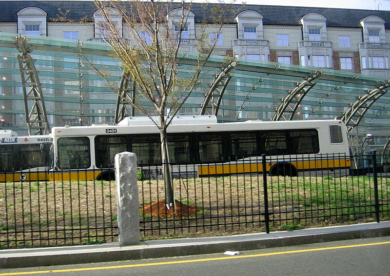
The West End, demolished, by September 1960 (source)

The introduction also covers the sources of various influences in city planning, from the Garden City visions of Ebenezer Howard to the Radiant City Utopian monstrosity of Le Corbusier. Reading her descriptions of their ideas, I began to realize just how far they had penetrated into our society.  Cities designed to look pretty from an airplane. Massive highway projects cutting through neighborhoods. High-rise residential towers with humongous parking lots. A fanatical devotion to the notion of "open space" at all costs, and grass everywhere. Separation of uses: residential here, commercial over there. Free parking as a birthright. You can trace much of this kind of thinking back to some authors from the 19th and early 20th century. A reaction against the problems of cities, especially back then, when health and sanitation were minimal. Their solutions were designed, regardless of intention, to destroy cities. To fix the problems of cities by ripping them apart and re-creating them according to some kind of orderly and sterile vision. That these ideas became the foundation of the field of city planning is a scandalous shame.

Jacobs introduced this background to contrast their approach with hers. She was not interested in an ideology which dictated the right answers. She wanted to learn the principles behind successful cities, and the failures of others, through observation and investigation of the reality of cities. As she wrote:
I hope any reader of this book will constantly and skeptically test what I say against his own knowledge of cities and their behavior. If I have been inaccurate in observations or mistaken in inferences and conclusions, I hope these faults will be quickly corrected.
Skyscrapers, open space, and highways (source)
In the fifty years since she originally published this book, it remains timely and telling that her observations and inferences continue to be remarkably accurate and even prescient. There are many points when reading this book that I sat back and wondered: if I took this passage and quoted it out of context, would anyone know what year it had been written? Would they have guessed 1960? 1980? Or possibly 2000? Or even later? Some things simply have not changed. In a way, that's an unfortunate fact. Although she became somewhat of a folk hero for being part of the backlash against Robert Moses and the highway builders of New York City, the rest of the nation continued to pave over cities for decades to come. In Boston, it was not until the mid-70s that we finally got a moratorium against highways, and by then it was almost too late. Despite that moratorium, we still managed to sink $22 billion into the Big Dig. You can walk down Market Street in San Francisco and discover that Civic Center is still suffering in quite nearly exactly the same way as she described it all those years ago. Downtown Pittsburgh was and still is drained of vitality, cut off from diversity of use by well-meaning but witless planners. It is the only place I have ever seen a major bookstore that closes at 5pm sharp on a weekday.

Many people do not want to have to think about issues of urban planning. They just want to get on with their lives and leave planning to the experts. But Jane Jacobs exposes the so-called experts as charlatans, with little useful knowledge, and a hideous history of malpractice behind them. Instead she implores readers to look for themselves, and "also listen, linger and think about what you see." As people, we live in cities, and are economically dependent upon cities. We cannot escape their importance, and so it behooves us to pay attention to their vitality.