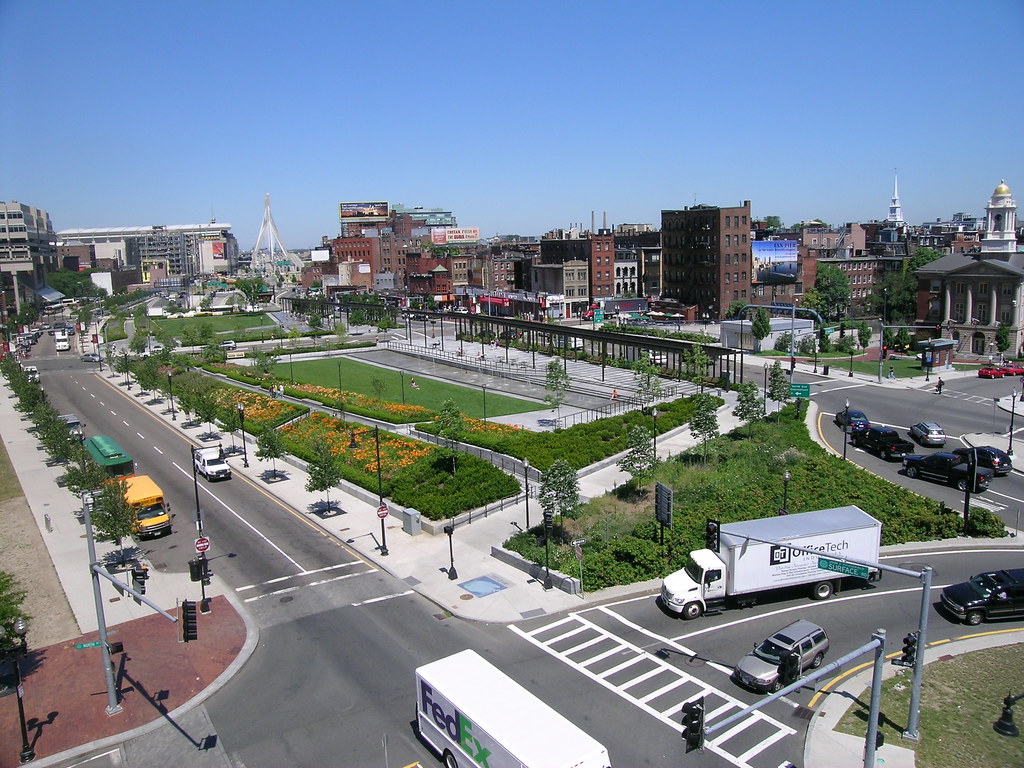
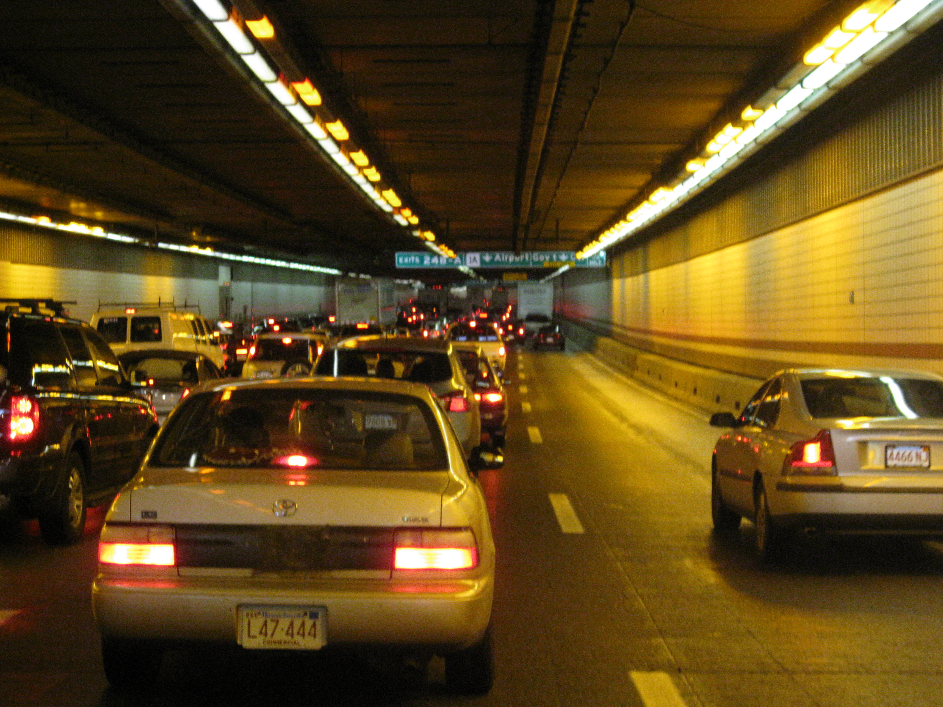
Pages

Showing posts with label big dig. Show all posts

Thursday, January 24, 2013

Induced demand in the 1930s

Let's take another look through the many-faceted opus, The Power Broker.

Anytime someone makes the excuse that "we need to widen the roads and build more parking lots to accommodate all the cars using it" just remind them that building more infrastructure for cars causes more traffic. This effect was noticed as early as the 1930s. Robert Caro vividly describes the effect of the earliest fully-grade-separated highways on New York:
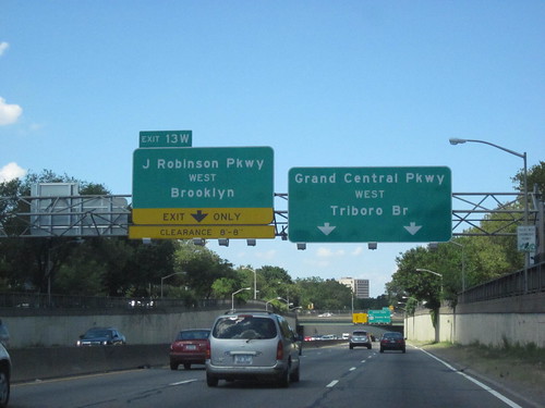
Grand Central Parkway on a nice day (source)
The Grand Central, Interborough, and Laurelton parkways opened early in the summer of 1936 [...] One editorial opined that the new parkways would, by relieving the traffic load on the Southern and Northern State parkways, solve the problem of access to Moses' Long Island parks "for generations." 
The new parkways solved the problem for about three weeks. "It wasn't more than three weeks after they opened that I decided to go out to Jones Beach on a Sunday," Paul Windels recalls. "I got on the Interborough and by God it was as jammed as the Southern State ever was." Moses announced that he had the solution: build forty-five miles of new parkways [...] 
Some city planners noticed that the traffic pattern on Long Island had fallen into a set pattern: every time a new parkway was built, it quickly became jammed with traffic, but the load on the old parkways was not significantly relieved. If this had been the pattern for the first hundred miles of parkways, they wondered, might it not be the pattern for the next forty-five as well? [p. 515]
But when they suggested improved mass transit ideas that groups such as the Regional Plan Association had been proposing, they were ignored.
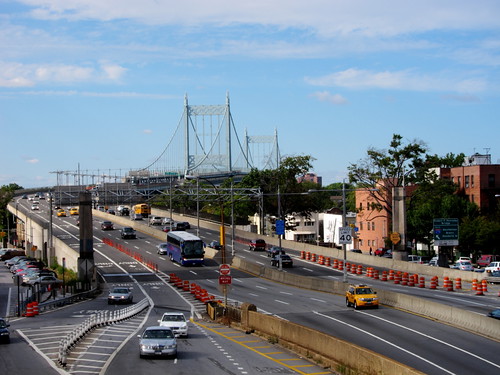
The approach to one span of the Triborough (aka RFK) Bridge (source)
The Triborough Bridge opened on July 11, 1936. [...]
On August 17, 1936, a little more than a month after the Triborough Bridge opened, Long Island's parkways were the scene of what some observers called the greatest traffic tie-up in the history of the metropolitan area. 
Referring to it as a "cross-country traffic jam," the Herald Tribune was forced to conclude that the bridge had, at least indirectly, caused it. [...]
Despite the heavy volume on the Triborough Bridge, Othmar Ammann [the chief engineer] said, "the relief of the traffic load on the Queensborough Bridge has not been as great as expected." But the Times editors evidently did not consider this fact particularly noteworthy. [...]
Traffic between Long Island and New York had, before Triborough's opening, flooded the twenty-two lanes available on the four old bridges; suddenly the traffic between Long Island and New York had become so heavy that it was also flooding eight new lanes, the new lanes of the Triborough Bridge---and it was hardly any lighter than before on the old bridges. [p. 518]
Again, Moses called for more parkways and what would become the Long Island Expressway. And again, the press went along with it.
The Wantagh State Parkway Extension was opened on December 17, 1938, three months ahead of schedule. [...] 
[It] did not receive its first real test of traffic-easing capacity until the first warm weekend morning of 1939. On that morning, it was jammed bumper to bumper for more than three miles. Traffic experts could not understand where those cars had come from. The other Long Island parkways, after all, were just as jammed as ever. [p. 517]
Having observed the problems, the RPA attempted to get provisions for a railroad link included on the proposed Bronx-Whitestone bridge. Moses refused to consider it.
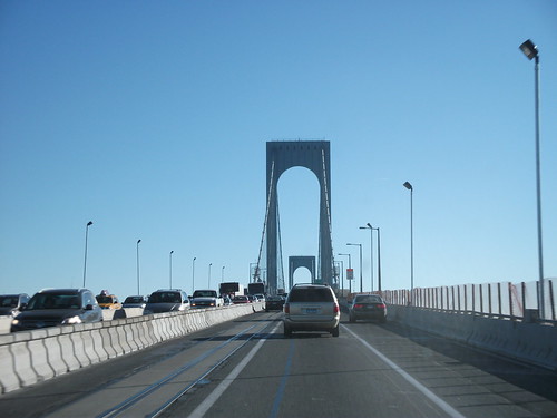
The Bronx-Whitestone Bridge (source)
During 1940, the first full year of operation, 6,317,489 vehicles passed through the Bronx-Whitestone's toll booths, cramming its four lanes to capacity and causing massive tie-ups on it. Traffic on the Triborough was reduced by 122,519 vehicles. Traffic on the other four East River bridges was reduced not at all. In fact, it rose slightly. Somehow the new bridge had generated, in a single year, more than 6,000,000 new on-and-off-Island motor trips. [...]
Shortly after the bridge opened, Moses completed the road linking the bridge with Westchester County, the Hutchinson River Parkway. Soon, that was jammed too. [p.519]
At this point the book turns to the Gowanus Parkway, an elevated highway which ripped through the thriving Brooklyn neighborhood of Sunset Park, and destroyed the heart of it on Third Avenue. It replaced the elevated train line of Third Avenue which was supposed to be taken down in favor of the newly constructed Fourth Avenue subway. Instead it was replaced by a massive concrete elevated highway and the four lane avenue beneath was widened into a 10-lane road to carry the trucks which Moses would not allow on his "parkway."


Below the Gowanus Expressway (formerly Parkway) (source)

The construction of the Gowanus Parkway, laying a concrete slab on top of lively, bustling Third Avenue, buried the avenue in shadow, and when the parkway was completed, the avenue was cast forever in darkness and gloom, and its bustle and life were forever gone. [...] Stores, restaurants and theaters had brought people to Third Avenue. Now half the stores, restaurants and theaters were gone.
The El had brought people through Third Avenue on their way to and from its stations. The parkway did not. Moreover, although the El had been a huge, gloomy structure, it was, as Cathy Wylde puts it, "one that people from the neighborhood relate to; they traveled on it, they were familiar with it." [...] "The highway was something different," Miss Wylde says. "It was noise, dirt, accidents, not lighted, a garbage dump, drag races along it in the night, wild kids, something totally negative. It was a tremendous psychological barrier. In a way you could say the people feared the highway." [...] Once the avenue had been a place for people; Robert Moses had made it into a place for cars. And as the avenue's roadway became more crowded, its sidewalks began to empty. [p. 523]
No sooner would Moses open the Brooklyn-Battery Tunnel at one end of the Gowanus Parkway and the Belt Parkway at the other than the Gowanus would be jammed solid with traffic. At rush hours, the traffic trying to get up onto it would be backed up solid, spilling off the ramps and back into the neighborhood for blocks. [p. 525]


Merging into the Henry Hudson Parkway from the George Washington Bridge (source)


But quite possibly the largest project of this time period was the so-called West Side Improvement: the Henry Hudson bridge at the northernmost tip of Manhattan and the parkway connecting to the West Side Elevated Highway at 72nd Street. Moses claimed it only cost $24 million at the time, a figure wildly out of line with reality. Robert Caro estimates that the true cost was between $180 and $218 million in 1937, which would probably fall somewhere between $3,000 and $4,000 million in 2012 dollars. Besides the highway he did create a linear park, although much of it was blocked from the riverside by the highway. And the park suddenly vanishes when it reaches the part of Manhattan with the highest minority population at the time (Moses' racism is a whole topic unto itself). But we are on the topic of induced demand, so what happened with the West Side Improvement? No surprise to us:
Motorists pulling up to pay their tolls found themselves at the end of lines that seemed little, if any, shorter than the lines had been at the old Broadway bridge, whose congestion New York had considered intolerable. And there was another puzzling fact. Although the new bridge had been built to relieve the congestion on the old bridge, congestion on the old bridge had not been noticeably relieved. The lines of cars waiting to cross it were, in fact, almost as long as ever. [...]
The rush-hour jams were just as bad as the rush-hour jams had been on Riverside Drive before the West Side Improvement was built; reporters escorted over the West Side Improvement before it opened had found it reduced the time required for the nine-mile trip from sixty-eight minutes to twenty-six; now one of those reporters made the trip over the West Side Improvement at two rush hours---admittedly very bad ones---and found that on one trip it took fifty-eight minutes, on the other seventy-three. And looking at the situation that way, the total effect on traffic congestion of the West Side Improvement had been to move the congestion one block west---and yet there was still congestion on Riverside Drive, congestion that had been eased only slightly by the construction of a parallel route. [p. 563]
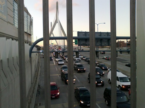
The Zakim Bridge leading into the Central Artery/Tunnel

Did we learn our lesson from this exercise in wasteful spending for little benefit and heavy cost to quality of life? Of course not. The Big Dig cost $15 billion before interest, and this is what the Boston Globe had to say about induced demand when they did some investigation:
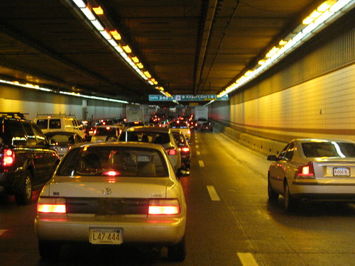
Ultimately, many motorists going to and from the suburbs at peak rush hours are spending more time stuck in traffic, not less. The phenomenon is a result of a surge in drivers crowding onto highways - an ironic byproduct of the Big Dig's success in clearing away downtown traffic jams.

The Greenway boulevard atop the Central Artery/Tunnel

But hey, at least downtown's not covered by the Green Monster anymore, right? That's got to be worth something. Not $15 billion though. And not for a highway which should not have been built in the first place. The correct answer would have been to take it down and---at a fraction of the cost---replace it with a more appropriate boulevard having its congestion managed through pricing. Well, now the money's been spent, and in fact, we got the worst of both options: the above-ground boulevard stinks up the Greenway and the tunnel funnels cars into new chokepoints around the city. Oops.

Back in New York State, Governor Cuomo is attempting to force through a new Tappan Zee bridge that---like the Bronx-Whitestone---lacks bus lanes or railroad provisions. He even compared himself to Robert Moses at one point. The opposition is stronger this time, but it's an open question who will prevail.

Part of the Bowker Overpass

Much of the 1950s automobile infrastructure in Metro Boston is decaying and coming to end-of-life. It could easily cost hundreds of millions, or even billions, of dollars to repair deteriorating tunnels and bridges. With the issue of transportation funding in the air, the fact shouldn't be lost that it is not worthwhile to restore these facilities to their 1950 state. We should not be held hostage to "traffic projections" when history so clearly shows that traffic is induced by the existence of these facilities in the first place. The roads have to be fixed in some way, as in many cases they are beyond repair. We could save a whole lot of money by choosing more appropriate, scaled-down designs which integrate with the city and improve quality of life for residents as well as visitors.

As for The Power Broker, there's tons more great material to sort through, I had to pare down quite a lot of excellent prose to keep the length of this post from becoming overwhelming. So I recommend checking it out yourself. Most of the quotes are from the first chapters of Part V, The Love of Power.

Friday, June 29, 2012

The Big Dig, part 4

The Big Dig (source)
I've taken a break from this series of blog posts on the Big Dig, but I want to return to it briefly to discuss costs and benefits of the project. Last time, I wrote about what I learned from the Inspector General's report: that the original cost estimates for the Big Dig, provided by consultants, were remarkably accurate in hindsight. Those cost estimates were manipulated by politicians in order to sell the project to the public.

Fast-forward to 2006: a study was commissioned for the Massachusetts Turnpike, reporting on the economic benefits of the Turnpike and the Big Dig. The work was performed by the Economic Development Research Group from Boston, and was touted as good news for proponents of the Big Dig. From the report, the headline number for the Central Artery/Tunnel and the Ted Williams Tunnel projects is that they contribute to $168 million/year of estimated economic benefits:
These improvements are now providing approximately $168 million annually in time and cost savings for travelers.  This includes $25 million of savings in vehicle operating cost plus a value of $143 million of time savings. Slightly over half of that time savings value ($73 million) is for work-related trips, and can be viewed as a reduction in the costs of doing business in Boston. 
They do not mention if this takes into account the congestion being generated at the new, outer bottlenecks. The report also provides several charts with traffic counts. For example, at the time of the measurements, the average volume per day on the Central Artery/Tunnel was 154,009 vehicles, and in the Ted Williams Tunnel it was 53,927 for a combined total close to 210,000 (but some of those may be double-counted).

Let's put those numbers in context. Suppose we take the overall cost of the Big Dig, at $22 billion:
In all, the project will cost an additional $7 billion in interest, bringing the total to a staggering $22 billion, according to a Globe review of hundreds of pages of state documents. It will not be paid off until 2038.
The cost works out to $105,000 per daily vehicle. By comparison, Phase I of the Second Avenue Subway is projected at $19,000 per daily rider and the Green Line extension is expected to be $18,400 per daily rider. In addition, at the rate of the supposed economic benefits of the Big Dig, $168 million per year, it will take 131 years to reach a total of $22 billion in benefits. That's without factoring in maintenance over time. And don't forget, we're still paying for the original project:
The authority's annual payments on its Big Dig debt are $115 million now. Those payments will level off at $145 million annually by 2020 and continue for another 18 years.
For example, the draft STIP for next year includes $150 million programmed for repayment of Grant Anticipatory Notes -- a form of debt employed by the Big Dig financing.

The surface artery

The other economic effects of the Big Dig are much harder to quantify, although EDR Group does make an attempt to describe some of them. Unfortunately, they also focus too much on past work such as the Prudential Center, which really holds no relevance to this question. Certainly, removing the horrible "Green Monster" from downtown Boston is a good thing. But the question that seems to have never been considered is: could this have been done without constructing a tunnel? A surface artery, similar to the 6-lane highway that now exists, could have provided many of the same benefits. You could even add the Ted Williams Tunnel back, to help untangle traffic going from I-90 to the airport. For commuting purposes, a vastly improved public transportation system could have been much more cost-effective and land-efficient -- not requiring enormous parking garages to be constructed downtown.

In any case, what's done is done. The Big Dig is here to stay for the next few decades, at least until more concrete blocks start falling down again. But let's not be fooled into thinking that it was a good value. The Greenway has many problems, and although it is better than an elevated highway, that is not saying much. There is no way it was worth $22 billion to get what is basically a glorified median strip. And the touted economic benefits of the highway are paltry in comparison to the overall cost. It is hard to imagine that the Big Dig would ever have been approved if all this was known upfront.

Update: The estimated overall cost was revised upwards yesterday, again! $24 billion.

See also: The Big Dig, part 3.

Friday, February 17, 2012

The Prado and the Greenway


I was walking in the North End this afternoon and I passed through the Paul Revere Mall (a.k.a. the Prado). There was a scattering of people: a family, a couple chatting on a bench, a dog walker, a man playing catch with his son. They were mostly clustered or sitting around the central fountain -- dry now. That brought to mind a similar scene in chapter 5 of Death and Life.

The fountain basin in New York's Washington Square is used inventively and exuberantly. Once, beyond memory, the basin possessed an ornamental iron centerpiece with a fountain. What remains is the sunken concrete circular basin, dry most of the year, bordered with four steps ascending to a stone coping that forms an outer rim a few feet above ground level. In effect, this is a circular arena, a theater in the round, and that is how it is used, with complete confusion as to who are spectators and who are the show.

On my way back, I passed through the relatively new Rose Kennedy Greenway. The part next to Hanover Street is one of the nicer sections. There's a lounging area, a bushy area with paths, some exhibits to peruse. When the weather is really nice, I've seen people sunbathing on the lawn. Today was not that kind of day -- it was warm only in comparison to the usual February weather. Still, there was quite a bit of foot traffic hurrying back and forth between the North End and downtown. But the park itself was otherwise mostly empty.


I decided to walk the long way around to see if I could find anyone enjoying the Greenway in a fashion similar to the Prado. After all, we've committed $22 billion to put the highway underground.


Some open space. It's required by law, in fact. Lots of green grass. Nobody here, though.


Not here either.


Wait, I thought the highway was supposed to be underground.


I finally found a couple of people actually inside of the park. It turned out that they were reading the names on the paving stones.


A jogger. Nearby, there were also some skate-boarders that found a use for all this open space.


Good thing we kicked Occupy Boston out of here. After all, they were preventing all of these people from using this space. Also: what are those things on the ground?


We spent $22 billion dollars for this?


I started to choke from the fumes of the waiting cars. Time to get out of here.


I'm told the Greenway is popular among the officer worker lunchtime crowd. No word on whether the perverts have moved in yet.

Thursday, January 5, 2012

Open Public Comment Letter

Regarding the plan to raise fares and cut services on the MBTA:

The public transportation services provided by the MBTA are crucial to the region's economic success and quality of life. Yet, the Commonwealth's plan for handling the funding of this agency has failed. In 2000, the legislature attempted to put the agency on its own financial footing through the passage of "forward funding." This plan was to provide 20% of state sales tax revenue to the agency, and in return, the agency would henceforth manage and discharge its own debt. The newly reborn agency was handed the responsibility for its existing debt -- but was also forced to takeover $1.8 billion in Central Artery/Tunnel commitments.

Since 2000, the predictions that "forward funding" was based upon have turned out to be wrong. Sales tax growth was conservatively estimated at 3% a year. In fact, it has been approximately 1% a year. Energy costs to run the system have sky-rocketed, as well as health care costs for employees. The legislation that was supposed to make the agency independent has instead hamstrung it with an unsustainable debt load.

In 2007, the Transportation Finance Commission issued this following recommendation:
The MBTA has over $5.2 billion in outstanding principal debt and paid $351 million or 27 percent of its operating budget on debt service in FY 2006 – more than the total of all fare revenue collected. About 35 percent of the principal amount of the outstanding debt ($1.8 billion) is directly attributable to carrying out Central Artery/Tunnel commitments. That debt is rightly the responsibility of the Commonwealth, not the MBTA. Level-funded over a 20-year period, this would shift about $117 million in debt payments from the MBTA to the Commonwealth. It should be emphasized that this debt must still be paid. The substance of this recommendation would transfer this obligation from the MBTA to the state budget.
This $1.8 billion in Central Artery/Tunnel debt was incurred by court-mandated projects that the Commonwealth was required to fund, in order to receive approval for the Central Artery/Tunnel in the first place. It is time to enact the recommendation of the Transportation Finance Commission, and put the Big Dig debt on the Commonwealth budget where it belongs. This action alone would go a long way to closing the budget gap for the next fiscal year.


(mailed to the public comment address found in the MBTA news article)

Wednesday, January 4, 2012

Fix Forward Funding First!

The MBTA has over $5.2 billion in outstanding principal debt and paid $351 million or 27 percent of its operating budget on debt service in FY 2006 – more than the total of all fare revenue collected. About 35 percent of the principal amount of the outstanding debt ($1.8 billion) is directly attributable to carrying out Central Artery/Tunnel [Big Dig] commitments. That debt is rightly the responsibility of the Commonwealth, not the MBTA. Level-funded over a 20-year period, this would shift about $117 million in debt payments from the MBTA to the Commonwealth. It should be emphasized that this debt must still be paid. The substance of this recommendation would transfer this obligation from the MBTA to the state budget.

It's abundantly clear from many sources that the Forward Funding legislation of 2000 has been a failure and needs to be revisited before considering fare hikes and service cuts. In 2009, the MBTA Advisory Board published a review of the MBTA. This report explained, with excellent charts, how the Forward Funding failed to live up to expectations. In short,

  • Sales tax revenue was far more anemic than ever imagined in the 1990s.
  • Energy costs have increased dramatically more than expected.
  • The Finance Plan inexplicably did not predict any increase in health care costs.
  • Paratransit expenses increased due to growth, increased vendor fees, and fuel costs.

The granted portion of state sales tax revenue was supposed to make up for the debt obligations that were shoveled onto the agency. As the debt was paid down, the MBTA could manage its own finances "forward" from there, independently from any further state support. Instead, the plan backfired on all parties, and the MBTA began digging itself into a hole just to pay for maintenance and operations on top of the existing debt service. More from the review:
The only major long-term operational success of Forward Funding is the fact that the riding public paid three fare increases in the last eight years. That resulted in a cumulative $95M gain. Asking that same public in 2010 for yet another fare increase because Forward Funding did not work defies credibility. The riding public deserves to have tangible evidence that the MBTA is improving safety and service—not deteriorating further.
It is now 2012, and the MBTA is formally proposing a fare increase as well as service cuts, to cover a $163 million deficit. It is time to follow the Transportation Finance Commission's recommendations and fix forward funding first, by moving the Big Dig debt commitments back to the state budget where they belong. This could cover approximately $117 million of the projected deficit, leaving a much more manageable $46 million shortfall to be addressed.

Tuesday, January 3, 2012

The Big Dig, part 3


Were the Big Dig cost overruns unpredictable, due to the tricky nature of tunneling through the heart of a city? Or was it something else? From A History of Central Artery/Tunnel Project Finances 1994 - 2001:
Records and interviews reveal a Big Dig cost history at odds with publicly disclosed information. Most significantly, records show that B/PB presented Big Dig officials with an excruciatingly detailed total cost forecast of $13.79 billion in November 1994, a figure close to the $13.8 billion revised estimate announced by Big Dig officials in October 2000. [...]
Anxious to avoid the sticker shock effect of B/PB's estimate, Big Dig officials undertook a nine-month initiative between June 1994 and March 1995 to decrease B/PB's total cost estimate from $13.8 billion to $8 billion. At this time, the Secretary of Transportation and Construction publicly announced that the on-time and on-budget figure would not exceed $8 billion. Documents cite a directive from Big Dig officials telling B/PB to "hit the target" of $7.98 billion. [...]
B/PB managers insisted that local FHWA officials be told about all deductions, assumptions and exclusions that had been used to reduce B/PB's cost projection. Records show that B/PB and Big Dig officials did so. [...]
Once local FHWA officials learned of, modified, and sanctioned the use of these multi-billion dollar accounting assumptions during the 1994-1995 CSU-Rev.6 budget review process, the accounting assumptions became a permanent, tacit feature of the budget. [...] 
Put another way, once local FHWA officials gave their approval to the use of these accounting assumptions in 1995, they became part of the "semantic" definition of the Big Dig's total cost. The accounting assumptions became a multi-billion dollar minimizing factor for every cost estimate that followed.
Starting in 2000, the Massachusetts Office of the Inspector General began investigating the cost cover-ups behind the Big Dig, and they published their findings in a March 2001 report. They found that state officials ordered Bechtel/Parsons-Brinckerhoff to arbitrarily cut $6 billion from the estimated cost, in order to meet a political goal.
Page 44 of the OIG report

The report concludes that since the FHWA was made fully aware of the reductions and their nature, it is responsible for accepting the bogus $8 billion number and giving respectability to it. Therefore, the Federal funding cap should be raised, since it was based on information the FHWA knew to be unrealistic, and that when the Massachusetts Legislature provided state funds, it did so "in the absence of critical information." (p. 16)

Frankly, although the Mass OIG report is revealing, I think it is somewhat self-serving by implicating the FHWA so heavily. Was the FHWA complicit in hiding the true costs of the project? Yes, it appears. But the duplicity was the direct result of orders from Big Dig officials. Shouldn't they be the ones held responsible for manipulating numbers for political reasons? As for B/PB, they did do the shady accounting they were ordered to do, they also provided all the information about it to the FHWA and investigators. Anyway, there is a whole sordid list of errors to charge B/PB with aside from this.

The OIG report was published over ten years ago. What happened? According to this report (pp.15-18), the Attorney General determined that the report was not sufficient to make a criminal case, and it appears that the remaining cost recovery effort was rolled into a larger lawsuit over a collapse in the I-90 connector. But at least we know that the cost overruns were largely just a return to B/PB's original prediction, which turned out to be pretty accurate.

See also: The Big Dig, part 2, part 4.

Thursday, December 29, 2011

Madrid Rio: Highway Tunnel Project

I was lying flat on my back, sprawled across a marble platform, looking at the high ceilings above. I had just stepped off the escalator to the Metro terminal at the brand new (ridiculously large) Madrid Barajas airport,  when I slipped and fell. I was in a hurry: I could see that the next train was about to depart, but at this point I wouldn't make it in time. A custodian was mopping nearby, he came over, helped me back up, and asked me in Spanish if I was OK. I summoned up the little language training I had and asked "¿Cuando proximo tren?" He pointed wordlessly at the other track, where the doors were open on yet another train. I sheepishly schlepped my bags there, and within a few minutes, we were moving.

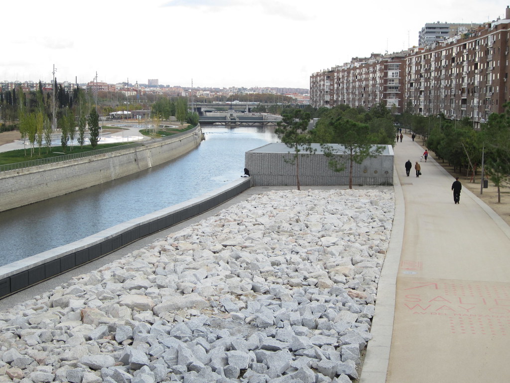
Riverside promenade, Madrid (source)

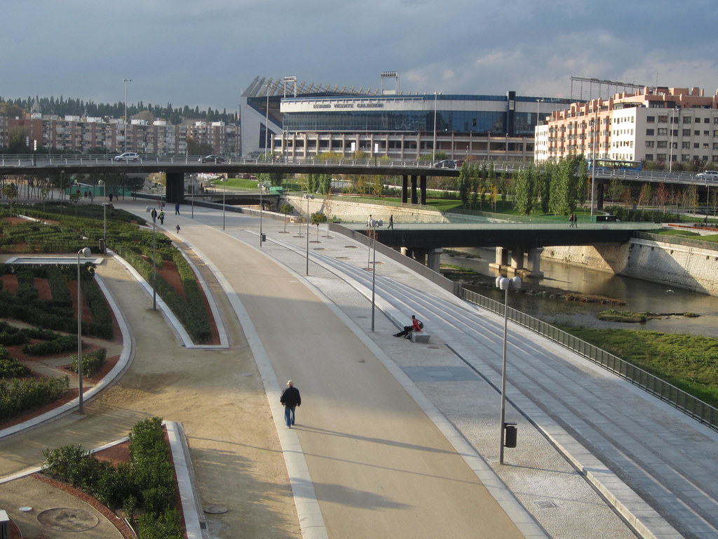
That was my introduction to the city of Madrid, in 2010. This past year, they completed their own version of the "Big Dig", putting the M-30 beltway underground, and restoring the Manzanares River. The project is called "Madrid Rio" and tunneling was started in 2003 as an effort to reclaim the riverfront land and improve the busy M-30 at the same time.

When I visited for a conference in 2010, I got to spend my free time exploring. I remember there being a river on the maps, and I did visit points on both sides of it, but I do not remember ever seeing the river itself. Apparently, I'm not the only person with this experience. Up until recently, the river was treated as a neglected median for the M-30. The park is so new that Google's satellite imagery still shows it under construction (as of this writing).
A highway runs beneath (source)
Already, comparisons have been made between this project and others around the world. Let's start with the basics.

Madrid Rio
Ten kilometers of tunneling, seven years of construction, 300 acres of new parks, €400 million (~$550 million) to build the park, out of approximately €4 billion (~$5 billion) for the entire project.

The Big Dig (Central Artery/Tunnel)
Over eight kilometers of tunneling, 10-20 years of construction (depends what you count), 26 acres of reclaimed space, $15 billion (or $22 billion with interest). This was really two mega-projects rolled into one, so it is difficult to compare directly. This site attributes $6.5 billion to the I-90 extension, leaving about $8.5 billion for the 5-km Central Artery.


Spain, it seems, is really good at building infrastructure cheaply. But to be fair, the project in Boston was a lot more complicated. The M-30 ran alongside the Manzanares River, which had never been an important part of the modern city of Madrid. The Big Dig took place in the heart of downtown Boston. It appears that the tunneling for the M-30 was relatively simple: not much to worry about except for some subway tunnels underneath. The Big Dig required the relocation of underground utilities, it had to thread below South Station, around both the Red Line and the Blue Line, all while supporting the weight of the Central Artery above. Madrid was willing to screw over residents during construction, in ways that would be unacceptable here in the States. I do not know to what extent this made it easier for them.

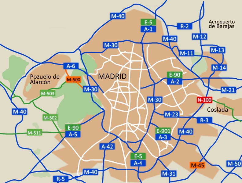
Madrid highway network (source)
The most effective way Madrid saved money, however, is by never building a city-dividing highway in the first place. The M-30 is the inner belt, and the highways that lead into the city end there. It may be hard to tell from this map, but the region within the M-30 beltway is quite large. It includes the heart of the city, and many of the inner neighborhoods. However, the outer barrios are crisscrossed by highways, and I have heard that traffic on them is quite heavy.

To counter this, Spain has been pro-active about building and maintaining public transportation. The Madrid Metro is currently sixth in the world in terms of length. I can attest that, when I visited, the system was largely clean and modern (having undergone renovation in the last ten years) and very extensive for a city of that size. This is complemented by buses as well as commuter, intercity and high-speed railroad operations.

I don't know if Madrid Rio will be successful. The alleged benefits are the creation of a new river park, the revitalization of many properties abutting it, and new development to go alongside. Will Madrileños still stroll the riverside when the novelty has worn off? Perhaps: the park includes many new bridges and connections to Casa de Campo, which was cut off from the city previously. Even so, it may not be worth the cost -- which was fairly high by Spanish standards.

Friday, December 23, 2011

The Big Dig, part 2


The Greenway
A prescient Boston Globe article:
The year is 2010, and tourists are scurrying across the surface of the submerged Central Artery, avoiding cars and checking maps to get from Faneuil Hall to the Aquarium. Mothers with strollers are leaning into a gusty wind, passing through a barren park where no one lingers.
I have made one small change to the quote. The authors felt they were exaggerating when they wrote those words in 1999. However, a mere ten years later, the Rose Kennedy Greenway has already become the barren park that they had envisioned.

But you don't have to take my word for it. In late 2011, a political movement known as Occupy Boston took over the open space near South Station called Dewey Square -- part of the southernmost portion of the Greenway. Eventually a Suffolk Superior Court ruled that the city could evict them. As part of that ruling, the judge provided a description of the space:
Developed as parkland, the locus in quo is a hundred-foot wide median strip, which covers an interstate highway tunnel and is bounded by an exit ramp and heavily trafficked streets. It is operated by the Rose Fitzgerald Kennedy Greenway Conservancy, Inc. and is known as Dewey Square.
Many decades and dozens of billions of taxpayer dollars were spent on designing and constructing the Big Dig. It was supposed to open up nearly 30 acres of prime downtown real-estate, and reunite the city. But when former environmental secretary John DeVillars approved the plan, he inserted an arbitrary stipulation that 75% of the land be used for "open space." Also: as it is constructed, the tunnel underneath will not support any building taller than a few stories. As a result, nearly all proposals for the land focused on different ways to turn it into a park, or worse, a parking lot. And in the end, what have we got for all of the effort? A six lane divided highway, at-grade, with "open space" in the middle. See for yourself:


$15 billion buys you a tunnel, a new at-grade highway and a glorified median strip (source)

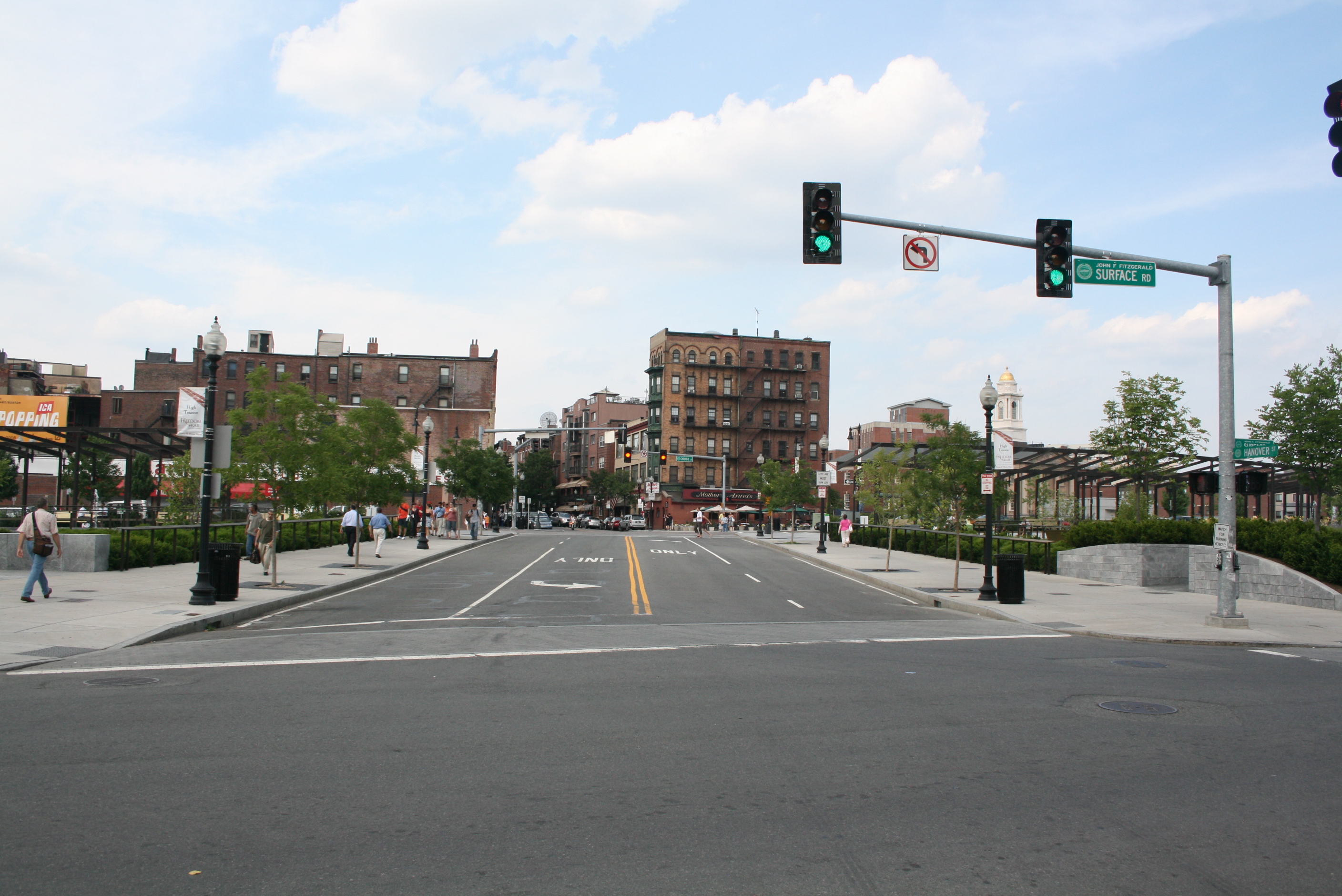
"Pedestrian friendly" connection to the North End (source)


Northernmost section - perhaps the nicest part but still very highway-like (source)
We didn't get redevelopment of the urban fabric to replace what was demolished fifty years ago. And we didn't get much of a park either. Just a barren "open space." Or as Charlie Gardner put it: they made a desert and called it a park.

He also asks: did anyone consider the option of removing the Central Artery, and not replacing it? After all, the 1989 Loma Prieta earthquake forced San Francisco to do that to the Embarcadero Freeway, and the result has been overwhelmingly positive for them. While people have made comparisons between that highway and Boston's Central Artery, nobody seems to consider if what worked for them might have worked for us as well.

Consider this segment from a fascinating interview with Fred Salvucci, where he explains how the idea for the Big Dig came about:
Initially Bill Reynolds, who was a highway builder and the head New England Road Builders, came up to me and said that, "This big ugly elevated road is like a neon sign flashing, 'Roads are bad.' And it's just a bad advertisement for our industry and I'm convinced that the only way we'll fix this anti-highway attitude is by correcting the mistake and putting it underground." And my first reaction was, "This is crazy. You know, how are we going to shut the city down for ten years while we build a new road?"
Two things: perversely, the Big Dig project grew out of the anti-highway movement (the interview discusses this at length), and Salvucci felt that shutting down the Central Artery was tantamount to shutting down the city. As far as I can tell from my research, that presumption -- spoken or not -- is never questioned.

See also: The Big Dig, part 1 and part 3.

Saturday, December 10, 2011

The Big Dig, part 1


The Big Dig (source)
The most expensive highway project in the United States was built here in Boston. It was nicknamed "The Big Dig", a name that became notorious and synonymous with massive cost overruns and delays.

So when the highway segments were finally completed, many people were eager to put the whole mess behind. The cost was high, but at least we had some shiny new bridges and tunnels to use. Also, the space formerly occupied by the Central Artery had become open land, with grass and marginal roads.

However, the Big Dig did not live up to its promise, and may have made some traffic patterns worse. The Boston Globe conducted an investigation and published an article in November 2008:
Ultimately, many motorists going to and from the suburbs at peak rush hours are spending more time stuck in traffic, not less. The phenomenon is a result of a surge in drivers crowding onto highways - an ironic byproduct of the Big Dig's success in clearing away downtown traffic jams.
The State of Massachusetts has spent $15 billion on a fight against "The Fundamental Law of Highway Congestion," and the Law won. The original paper was published in 1962. There has been plenty of research over the years on this subject, and there was no excuse to be unaware of the dilemma by the early 90s when the Big Dig planning was underway.
Proposed Green Line extension

The trouble does not end there. The State agreed to mitigate the pollution from the additional vehicle traffic induced by the Big Dig. To this end they made legally binding promises to build several public transportation projects, including: Green Line extension to Medford, Arborway trolley restoration, and Red-Blue subway connection. However, the MBTA has weaseled out of Arborway by substituting improvements to the 39 bus, and has moved on the other projects only when threatened by lawsuits. The Green Line extension was recently pushed back, yet again, causing widespread anger among residents and elected officials. The State government apparently thinks that, with the completion of the highway segments, it can brush off any further obligations to the citizens.

In 2000, in an attempt to fix the finances of the MBTA, legislation called "Forward Funding" was passed. This law dedicated 20% of sales tax revenue to the MBTA, and in exchange, charged the agency with issuing and paying its own debt. People were assured that this would be sufficient to run operations. However, the legislature also did something sneaky: they moved $3.3 billion of debt from the State onto the books of the MBTA. Part of that debt was from the Big Dig. The reformed agency was "[Re-]Born Broke:"
Legal obligations debt ($1.688 billion) corresponds to state implementation plan (SIP) commitment projects.  These were public transportation projects the state agreed to build as part of the Big Dig.  [...] The State also transferred the responsibility to finish many SIP commitment projects, and the T borrowed to do so.  In 2007 the State agreed to re-assume responsibility for outstanding SIP projects, but not the debt for such projects borrowed before 2007.
In other words, the State of Massachusetts had made a binding agreement with the citizens that, among other things, it would improve the public transit systems managed by the MBTA in exchange for constructing the Big Dig. But less than ten years later, Beacon Hill was able to completely twist the logic of this agreement around. Now the MBTA alone is being forced to bear the debt burden that the State was supposed to pay  in the first place. And the revenues from sales tax never met the original expectations. The result is a system that is breaking down and cannot pay for desperately needed repairs. We are looking at possible fare increases, up to an outrageous $3.25 per ride using CharlieTicket, and severe service cuts. This plan could demolish ridership on the system, leading to a spiral of further deficits. And if that happened, it would not only hobble mass transit, but also the entire economy in the Metro Boston region which depends on the T.

See also: The Big Dig, part 2