Pages

Showing posts with label history. Show all posts

Tuesday, July 28, 2015

The subversion of fair housing law by pernicious zoning ordinances, part 2

[continued from part 1]

Massachusetts has, in the past, attempted to address the problem of snobbish, exclusionary zoning. The section of law known as Chapter 40B was passed in 1969:
This law was seen as one of the earliest recognitions of the racial and economic segregation often imposed by exclusionary zoning practices such as minimum lot sizes and bans on multi-family housing. The purpose of the law is to “address the shortage of low and moderate income housing in Massachusetts and to reduce regulatory barriers that impede the development of such housing.” 
Often referred to as the “Anti-Snob Zoning Law,” the “Comprehensive Permit Law” and the “Massachusetts Affordable Housing Law,” Chapter 40B is seen as a “one-stop” permitting process for developers proposing low and moderate-income housing projects. Rather than applying to many local boards, the developer applies for a “comprehensive permit” to one local authority—the Zoning Board of Appeals (ZBA). 
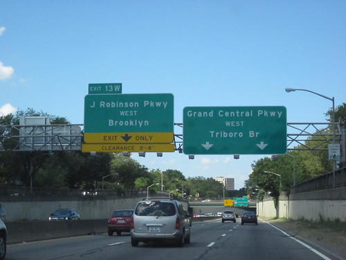
Chapter 40B is significant in that it was one of the first instances in which a state exerted authority over local control in land use zoning.4 Therein also lays its controversy. Under 40B, a developer has the right to appeal to the state Housing Appeals Committee (HAC) if it is denied a comprehensive permit for a qualified project, or if it is granted one with conditions making the project uneconomic. Under 40B, ZBAs are able to approve projects with higher density than current zoning allows, making it more economically feasible to develop affordable housing.
Chapter 40B only applies to municipalities that have less than 10% of their housing stock designated as 'affordable', and it does not apply to Boston at all (due to the Boston Redevelopment Authority). It's success has been limited: 48,000 units were created from 1969 through 2008, of which 26,000 were designated as affordable. That's an average of 1,230 units per year, or 666 affordable per year -- far lower than the demand. And only 55 municipalities (of 350) had met the 10% requirement after nearly 40 years of the law.

The law happened to go into effect not long prior to Boston's school busing crisis, an era that exacerbated the divide between city and suburb, as 'white flight' brought many new residents to the suburban towns, eager to shut the door behind them as they arrived. From Common Ground:
Indeed, barely a month after Garrity’s ruling on the constitutional violation, the Supreme Court effectively cut off one possible avenue of remedy. In Milliken v. Bradley, it over-ruled a district court which had required cross-busing between Detroit and its surrounding suburbs. Since the lower court had found de jure segregation only within the city and not in the suburbs, the Supreme Court held that a metropolitan-wide order “would impose on the outlying districts, not shown to have committed any constitutional violation, a wholly impermissible remedy.” Milliken marked an important turning point in the Court’s approach to school segregation. Albeit by the narrowest margin (5–4) in any major school case yet, the Court halted the advance of school desegregation at the city line. Although many students of the matter believed a clear pattern of “state action” could be detected in the suburbs—notably in government housing loans and highway construction policies which operated to keep them predominantly white—the increasingly conservative Court majority declined to push its broadened doctrine of de jure segregation that far.
The anti-busing protesters could no longer maintain segregated schools in the city; instead, they moved to the surrounding towns where they could promote segregation through the use of regulatory tools such as zoning codes. The borders of municipalities acted as effectively as segregated neighborhood boundaries had before. Since then, a common complaint of town NIMBYs opposed to residential development is that it might bring 'too many' students to the public school system, thereby 'overwhelming' it. Such 'pseudo-engineering' of the school system by laypeople -- as if they were engineers designing a waterworks -- is more likely to be a cover story for their true motivation: the exclusion of people unlike themselves. And this effect may partially explain why the Chapter 40B requirements have not been met by the majority of towns in the Commonwealth, even after nearly half a century has passed.

Thursday, July 23, 2015

The subversion of fair housing law by pernicious zoning ordinances, part 1

I'm not a religious person but I think there is genuine evil in this world. And one of those evils is the persistence of segregation fifty years after the Civil Rights movement of the 1960s.

2010 Census Block Data showing distribution of population by race in Boston (source)
One of the more important Supreme Court decisions of the year was handed down last month. Texas Department of Housing and Community Affairs v. The Inclusive Communities Project, Inc. ruled that 'disparate-impact' claims are valid under the Fair Housing Act of 1968. This ruling ensures that an important tool in the fair housing toolbox continues to be usable: the notion of 'disparate-impact', or that government policies can have an unstated yet implicit racially-biased effect.
The Inclusive Communities Project brought suit over how the Texas Department of Housing and Community Affairs distributes tax credits for low-income housing. The Department’s policy, the group claimed, causes almost all affordable units to be built in racially segregated low-income areas, providing minorities with few opportunities to move to integrated or wealthier areas. Though the creators of the tax credit policy had no racial intent, according to the Inclusive Communities Project the results of the policy confined minorities to segregated areas.
From the opinion:
Recognition of disparate-impact claims is consistent with the FHA’s central purpose. See Smith, supra, at 235 (plurality opinion); Griggs, 401 U. S., at 432. The FHA, like Title VII and the ADEA, was enacted to eradicate discriminatory practices within a sector of our Nation’s economy. See 42 U. S.  C. §3601 (“It is the policy of the United States to provide, within constitutional limitations, for fair housing throughout the United States”); H.  R.  Rep., at 15 (explaining the FHA “provides a clear national policy against discrimination in housing”).  These unlawful practices include zoning laws and other housing restrictions that function unfairly to exclude minorities from certain neighborhoods without any sufficient justification. Suits targeting such practices reside at the heartland of disparate-impact liability. See, e.g., Huntington, 488 U. S., at 16–18 (invalidating zoning law preventing construction of multifamily rental units); Black Jack, 508 F. 2d, at 1182–1188 (invalidating ordinance prohibiting construction of new multifamily dwellings); Greater New Orleans Fair Housing Action Center v. St.  Bernard Parish, 641 F.  Supp. 2d 563, 569, 577–578 (ED La. 2009) (invalidating post-Hurricane Katrina ordinance restricting the rental of housing units to only “‘blood relative[s]’” in an area of the city that was 88.3% white and 7.6% black); see also Tr. of Oral Arg. 52–53 (discussing these cases). The availability of disparate-impact liability, furthermore, has allowed private developers to vindicate the FHA’s objectives and to protect their property rights by stopping municipalities from enforcing arbitrary and, in practice, discriminatory ordinances barring the construction of certain types of housing units. See, e.g., Huntington, supra, at 18. Recognition of disparate impact liability under the FHA also plays a role in uncovering discriminatory intent: It permits plaintiffs to counteract unconscious prejudices and disguised animus that escape easy classification as disparate treatment. In this way disparate-impact liability may prevent segregated housing patterns that might otherwise result from covert and illicit stereotyping.
This is an important ruling if and only if the Federal government backs it up by strengthening and enforcing the regulations based on the Fair Housing Act. Unfortunately, over the past four decades, successive administrations including the current one have largely done nothing or acted to undercut the law. That might change now, with the Supreme Court's fresh ruling.

This is significant if it is used to reverse some of the most pernicious and widespread zoning code techniques that effectively cause economic and racial segregation through disparate-impact. Zoning has long been about exclusion, even continuing after explicitly racial zoning was struck down by the courts. From Dead End, a book about the history and effect of sprawl, by Benjamin Ross:
[Euclid v Ambler, 1926] moved quickly beyond the specifics of Ambler’s property; from the beginning, the principle of zoning was at stake. And the main principle was the exclusion of people, the people who lived in apartment houses. “In the last analysis,” Judge Westenhaver wrote perceptively in his opinion, “the result to be accomplished is to classify the population and to segregate them according to their income or situation in life.” The Supreme Court saw the issue similarly. The village’s power to keep out factories was not really in doubt, it observed: “The serious question in the case arises over the provisions of the ordinance excluding from residential districts apartment houses, business houses, retail stores and shops, and other like establishments.”
And The Racial Origins of Zoning in American Cities:
"What began as a means of improving the blighted physical environment in which people lived and worked," writes Yale Rabin, became "a mechanism for protecting property values and excluding the undesirables." The two interest groups that were regarded as the undesirables were immigrants and African Americans.
While instances of explicit racial exclusion through zoning and restrictive covenants are generally overturned by the courts, that has not been the primary mechanism through which segregation is created and maintained. Instead, the racially biased effect is engineered through neutral-seeming zoning codes that provide an aura of plausible deniability. For example, a zoning code might mandate a minimum lot size, such as a quarter-acre, for construction of housing, while forbidding anything larger than a single-family home to be built. None of the language used has any explicit mention of race or class, but the net effect is to restrict residency on that property for only a single family capable of affording a quarter-acre of land. In any reasonably attractive neighborhood, the price of that 10,860 square feet of land is beyond the reach of low- or middle-income families, thus effectively excluding all but the wealthy.

That is not the only type of regulation that is used to make land and housing unaffordable. For example, onerous requirements for front yard, back yard, and side yard ensure that only those people wealthy enough to afford 'conspicuous waste' can live there. Minimum parking quotas force residents to pay for parking spaces whether they use them or not. And, most infamously, the prohibition against apartments or multi-family housing in many zones makes it impossible to divide the cost among several families. Generally, the net effect of these regulations is either implicitly or explicitly intended to lower density. One glance at the population distribution map above should confirm that there is more than a passing correlation between 'low density' and 'overwhelmingly white'. That is disparate-impact at work: it is subtle in the wording of zoning codes, but the net effect over time is clear. The question now is: will the government begin to tackle the inequities created by local zoning codes? And how?

[continued in part 2]

Tuesday, May 26, 2015

Happy 115th birthday to the Green Line "B" branch, and thoughts on the future

Commonwealth Ave when it was provisionally named 'Massachusetts Ave' in 1885 (source)
The section of Commonwealth Avenue between Packard's Corner and Chestnut Hill Avenue was largely built in the 1890s. Trolley service along this relatively new stretch of Comm Ave began May 26th, 1900. Prior to that, service to Lake Street typically ran via Beacon Street and Chestnut Hill Avenue.

Construction of Comm Ave near Lake Street (source)

Trolley service near Wallingford Road, in the early years (source)

A description of a journey that was published in 1904:
From the Newton line, by taking a Commonwealth Avenue car, another attractive ride is afforded for the return journey. The car turns off to the left and runs through a delightful combination of city and country until it reaches the Brighton junction, off to the left being the links of the Kenilworth Golf Club. At Pleasant Street, on the left, may be seen the links of the Allston Golf Club, and one of the most picturesque county clubhouses in the country is visible across a little pond. The car comes back into Beacon Street again after passing Cottage Farm station

Yes, it existed: the Allston Golf Club house (source)
Tudor Manor, 1930 (source)
The electric streetcar service would eventually attract the transit-oriented development of the avenue that we see today, with large, graceful apartment buildings of various styles from the early to mid-twentieth century. Sadly, the current zoning code (from 1990) has chosen for aesthetic reasons to retroactively ban these kind of apartment buildings, and so none of them could be built today without many variances. That's a strange policy to maintain in a city that is ostensibly trying to generate housing units that are attainable to people of middle-class means.

Comm Ave near Allston Street, present day

1958 view from near Washington Street, during road-widening construction (source)

Snow didn't stop them in 1938, near Warren Street (source)
I was fortunate enough to view a presentation on the history of Comm Ave last year but it was not until recently that the slides and pictures were made available on-line. For more of these pictures and history, please visit the website.

What we now call the Green Line "B" branch has gone through many changes over the years. Obviously when the MBTA was formed, the rebranding changed it from merely having a streetcar number into being integrated as part of the color-coded 'rapid transit' map (sadly, while not really improving service). The reservation has been shifted towards the center as part of road-widening efforts in the 1950s and the 1970s, resulting in the awkward intersection at Warren Street, where work ceased. The trolleys gave way to big 'light rail vehicles' that now carry approximately 30,000 passengers a day, averaging a snail-like 6-10 mph due to overcrowding and degrading infrastructure. The stations have not seen much in the way of upgrades, either, largely remaining as tiny asphalt strips with the occasional concrete barrier or plastic shelter added.


Chestnut Hill Avenue station platform (for thin people only)

Looking down the hill

At times, many stops were eliminated or consolidated, most recently about ten years ago, when Mt Hood Rd, Summit Ave, Greycliff Rd, and Fordham Rd were permanently retired to help improve spacing. We're looking forward to having another four closely-spaced stations be consolidated into two appropriately-spaced, fully accessible stations. The T has promised us signal priority for years, and claims to be experimenting with it. We're still waiting for the use of all doors on the surface to help speed up boarding and alighting, as well as full accessibility for everyone.

As the twentieth century progressed, Comm Ave was turned more and more into an asphalt wasteland: big sections carved out for angled parking, with a few sickly looking trees inhabiting the neglected median islands that were left. The Green Line and its riders were largely disregarded, probably considered relics of the past that would be replaced by mass car ownership and buses. But the Green Line is a survivor. Despite how poorly it has been treated by the city and the MBTA, the "B" remains the busiest branch of the Green Line, and the surroundings remain highly transit-oriented, with some of the lowest car ownership rates outside of Boston proper.

We have an opportunity to change the future. The city is brewing up a design for what they call Comm Ave Phases 3 and 4. That covers the section of Comm Ave from Packard's Corner up to Warren and Kelton Streets. This is part of the section that was constructed in the 1890s, and it's 200 feet wide, a lot of space. Despite that, daily vehicle volumes are very low, about 12,000 ADT, a figure which is low enough that it could easily be handled even on a street with merely a single lane in each direction. Clearly, this should be a street designed for people. The city has claimed that they are going to do something to make the avenue much more friendly for walking, biking, and riding the Green Line. They claim that they will do something about the fact that there are extremely long intervals between crosswalks (and then those are also inaccessible to the disabled), with a fence blocking off part of Allston/Brighton from another. They claim that they can restore the idea of a Comm Ave 'greenway', an echo of its original conception, a park that connects from the Charles River to the Chestnut Hill Reservoir. The 21st century version of Comm Ave could be a lot friendlier to the community. But only if we remember to show up and hold them to it.

Tuesday, March 10, 2015

The scourge of single-story retail

A curious pattern exists in Boston (I've also noticed it in other American cities). Neighborhoods that were primarily developed between 1890 and 1960 tend to have a lot of single-story retail. Oftentimes those retail shops are adjacent to multistory residential or office buildings, but the retail buildings themselves are single-story. Many of them are cheap boxes that look awful, while some of them do have decent architectural features that seem strangely out-of-place.

I'm sifting through some of my pre-snowpocalypse photographs for this post, so we can remember Boston as it once was.

The Fenway is a densely populated vibrant neighborhood with a strange dichotomy between retail buildings and residential buildings, like many other streetcar suburbs built around the same time.

Another example from the Fenway.

Double-whammy of bad 20th century planning: surface parking and single-story retail immediately adjacent to major Green Line station in Brighton.

Same place, across the street. Typical of Comm Ave, there's a strip of single-story retail adjacent to 5-story or more apartment buildings. Some parts of Comm Ave do have ground-floor retail below residential, but it's the exception, not the rule.

Union Square, Allston, with lots of great little shops and restaurants. But almost all of them are in single-story retail buildings. The tall building behind is from the 1980s, and does have a little bit of ground floor retail included, but is separate from most of the shops you see.

Single story retail from the early 20th century. But as you can see, it used to be a whole lot better. Nowadays the building is used for storage of automotive supplies, and the intersection is a motor vehicle-dominated nightmare. In 1889, the first electric trolley line in Boston departed from the Allston depot along those tracks. Now, the Allston depot is a pizzeria with a giant surface parking lot.
In the mid-1960s this theater was torn down to be replaced by a nearly featureless single-story retail building with surface parking out front. As the zoning regulations of the time would dictate.

Single-story retail in the center of Hyde Park's business district.
Single-story retail in triple-decker Dorchester, along Blue Hill Ave, where trolleys once roamed, and where frequent buses ply today.
Single-story retail and massive surface parking near Forest Hills, a major MBTA subway, bus and commuter rail station.
Single-story retail on Comm Ave next to a Green Line station.
Tall residential, short retail, MBTA station: Brookline is no exception.

In a city with an acute housing shortage, where space is at a premium, why do we allow so much waste to take place? It seems like there are hundreds of thousands of people who would like to be able to live in these neighborhoods with decent local shops, and in some cases, places that are only steps away from frequent MBTA service. Multistory buildings with ground floor shops and upstairs residences are not new in Boston -- they were quite commonly built in the 18th and most of the 19th centuries. The oldest neighborhoods in Boston: Beacon Hill, the North End, even the Back Bay, all have streets lined with buildings that have ground floor retail and homes above. Yet, starting around 1890 or so, it seems, some kind of insanity gripped America: suddenly, neighborhoods started being developed with apartment buildings on one block and single-story retail on another. Sometimes even on the same block.

I don't have a definitive answer, but there are several pieces in play:
  • The criminally incompetent, so-called "City Planning" movement started around the turn of the 20th century, and these new planners were notoriously blind to the actual sources of city vitality and diversity. In some cases, they were opposed to city life, and actively sought to destroy it. Records from the City Planning Board of Boston show that many early discussions focused around choosing which buildings to destroy in order to widen roads. No doubt, they probably saw mixed uses as being "messy" and falsely perceived them as a source of traffic congestion.
  • Property tax laws in this country can be counterproductive: they effectively penalize landowners who invest in their properties. In some cases, building owners may have chosen to cut down floors off their own buildings to save on tax expenses. In a sane world, such crazy outcomes would result in legislative self-examination and reform of the tax laws: for example, by repealing property taxes and replacing them with something less harmful like a land-value tax. In this world, well... no.
  • In New England (and NY) it was common to quickly erect buildings that became known as "taxpayers" in order to generate some value quickly for the land without much effort. These taxpayer buildings were just enough to house some retail and then got locked into place when zoning came into effect around the mid-1950s. Many of the featureless boxes plaguing our landscape seem to fall into this category, but there are also plenty of examples of single-story retail with the kind of fine architectural detailing that seems out-of-place on a taxpayer.
  • The economics of redevelopment seem to require a significant density boost in order to replace a revenue-generating property with a new one. If floors cannot simply be added to the top of the single-story building, and if the construction requires a shutdown of the business operating within, then the end result of construction has to be much taller than what previously existed. In the case of single-story successful retail, that probably means going up to 4-6 levels.
  • And this discussion wouldn't be complete without mentioning the nefarious effect of mid-20th century zoning regulations. It is quite possible that many single-story retail buildings were intended to be temporary. But once zoning kicked in, redevelopment -- already difficult -- became near impossible. The density boost required to make redevelopment financially palatable was now illegal or required expensive variance hearings. In many cases, even the existing property was made illegal by unreasonable zoning requirements that demanded excessive amounts of parking that simply could not be provided in a space-constrained city neighborhood.
So, as a result, we have a bunch of neighborhoods where, if you somehow transported some people from 1915 one hundred years into the future to 2015, they might ask: "Why do you still have all these same crummy, single-story buildings that existed in my time?" ... After, of course, catching up on the past hundred years of history.

If we are serious about tackling the problem of rising housing costs and creating a better, more vibrant city that is accessible to all, then we will need to find a way to deal with these squat, inefficient, single-story structures. I often hear people complain that Boston is space-constrained, that we don't have room for development. That's not really true, as there are too many vacant parcels. But there are also many underutilized parcels in locations that can easily support much more. The replacement of single-story buildings that are located adjacent to frequent transit ought to be a high priority for all of the cities and towns in the region.

Saturday, March 22, 2014

The Friends of Government Center

In honor of the shutdown of Government Center, I present you a side-by-side comparison of scenes from "The Friends of Eddie Coyle" (1973) and the same scenes, as close as I could get, in 2014.


Although it's neat to see the similarities after 40 years, it's in the sense that: "I cannot believe they left it like this for so long." I won't miss the old brick pimple, the tiny escalators, the cramped fare gate area, or the dirty walls. Government Center is a relic of an era when architects openly longed for the aesthetic of the Soviet Union. A time when it was desired to have design that intentionally repelled life, in order to crush people's spirits, and send them fleeing from the city. Good riddance to all that. Now: what to do about the oversized, desolate plaza and the concrete monstrosity next door...


(film scenes source: DVD of "The Friends of Eddie Coyle", Paramount Pictures)

Friday, May 31, 2013

Should we disband the Boston Redevelopment Authority?

Rachel Slade has a new article in Boston Magazine entitled "The Authority" in which she calls for the Boston Redevelopment Authority to be disbanded, and its functions of planning, zoning and development to be separated. The agency is an anachronism, a relic of the era of "urban renewal", and has too much power and too little accountability.

The West End wiped out (source)
I can't say I totally disagree with this assessment. All it takes is a trip downtown to remind oneself of the hubris and arrogance of the BRA. A stroll through Government Center does the trick. How could they be so stupid? What were they thinking? What we lost was irreplaceable. Scollay Square, the West End, Barry's Corner, large sections of Roxbury, Jamaica Plain, all wiped out for not conforming to the sterile vision of a few self-selected planners; or for being in the way of the new highway lifestyle that was to conquer all. To the planners of those days, the city was a merely a tool for the wealthy suburban residents. Anything that got in the way of that had to go.

However, that was a long time ago. We can't fix the past. The BRA of then is gone, and the BRA of recent years is different. The BRA of today holds community meetings. They do promote, or at least claim to promote, actual urban development instead of faux-suburbia. For example, the BRA nowadays requires commercial development to form a street wall, with little or no setback, and to put parking behind, out of sight. This is in contrast to several mid-century examples which were built as mini-strip malls in the middle of urban areas. The BRA of today is willing to approve projects with low or no parking requirements.
Transit-oriented vacant land, not so smart

Does that make the agency good or worth preserving? Not really. They have more than their fair share of failures; Slade lists many, and I would also add to that: the disgrace of having long term vacancy of so many transit-adjacent parcels in the city. Besides, the concentration of power in one Authority is too tempting and probably too dangerous. There might be some good people there now, but they may not always be there. It's telling that redevelopment authorities have been disbanded around the country. But, on the other hand, to do so is not always a success.

Slade's article cites San Francisco as a positive example of planning. But, it seems to me, that comparison casts the BRA in a very good light. San Francisco is a beautiful city but by urban development measures it's a sad failure. In 2011, SF added only 269 net units of housing (this past year has been better). This, despite being one of the most desirable locations in the entire country. Rents have sky-rocketed there, much more so than here. San Francisco is infamous for possessing some of the most vocally anti-growth residents on the planet. And Boston is full of its fair share of such folks too, who oppose change no matter what, or who have ulterior motives.

On the one hand, you can hardly blame them: people still remember the bad old days of the 60s and 70s. The popular movements which arose and stopped the highway devastation from progressing further were heroic. And there continues to be community members who make thoughtful comments, provide positive feedback, and help bring about broadly beneficial outcomes. That's how planning ought to work. But the same mechanisms are also used by selfish individuals to do things like effectively grant themselves free parking privileges on publicly-owned land. Others fight against badly needed housing development because of some unsubstantiated fear of buildings. Bus lanes are blocked because someone yells "Gridlock!" I even heard one woman complain of not having enough open space for a development that happens to be next to one of the largest parks in Boston.

It's absurd. And who's going to stand up to that? Who will separate the sensible concerns from the ridiculous demands? That's what I want to know. Let's disband the BRA and replace it with a separate city planning department, a zoning department, and a development office. But let's also put in place a mechanism to prevent the various neighborhood NIMBY groups from dividing and conquering the new offices. We can't have a system where politically savvy groups get to squelch growth. All neighborhoods have to participate. Nobody is special. We could start with the idea of a Zoning Budget: "All deviations downward from planned growth in housing supply expressed in the [zoning] budget should have to be offset by corresponding increases elsewhere in buildable as-of-right land." Or a city department which promotes economic growth as a counterbalance to the stasis status quo. Or zoning which sets broad goals but does not micromanage how to get them.

Another thing: a city planning office sounds nice in theory. But I have reservations about it. For one thing, "planning" in this city (and this country) has a long record of failure. "Urban renewal" in the 50s and 60s was part of that. Zoning is another part. When you examine that zoning plans that were derived from community input, you will find that the limitations are laughably low. Much of Boston that we know could not be built under today's zoning code. That's a travesty, a complete failure of planning. How can you claim to "plan for the future" when your plans don't even accommodate for today?

The problem is that when most people think about zoning they think "oh, it keeps the polluting factory separate from the school." And that's where they stop. And since protection from pollution is a good thing, people have a generally good feeling about zoning, they don't question it. Unfortunately, zoning was taken much much further over the past 60 or so years that it has been in effect. It's been a way for bureaucrats and snobs to dictate details of buildings down to the inch. Your front yard is only 19 feet? Too bad! People who can't afford a single family detached home are treated like they were toxic waste and are told to live in a "multifamily district." You want to open a dentist office where a barber worked before? Incompatible! As-of-right development is curtailed all the way down to almost nothing, and some NIMBYs still think that's too much. We've come a long way from a country where buying your own land meant you had the freedom to build what you desired on it -- even if your choices are entirely safe.
Destroying buildings to widen Cambridge Street c.1920 (source)

The failure of planning dates back even further, before the Great Depression. A planning craze, that bubbled up from the late nineteenth century, swept the nation about a hundred years ago (see also this for a laugh) and a planning board was set up in Boston, like other cities. Reading through their old journals is interesting and yet hair-pullingly frustrating. It seems that every other proposal they came up with was to do street widening. The mass-produced automobile was not even a decade old, most people didn't have one, but these planners couldn't wait to start bulldozing blocks and widening streets. A lot of it may have been rooted in racial politics of the early 20th century; the elites wanting to sweep out the undesirables. Some of it may have come from genuine concern for the conditions (after all, we've come a long way in sanitation) with little understanding of the dangers posed by motor vehicles, nor any comprehension of the value of the small streets to city life.

The point is that the central planners of those days didn't understand what they were dealing with and didn't know what the future would bring either. Olmsted was, at least, honest about this:
Speaking at the second national conference on city planning at Rochester, NY, in May, 1910, Olmsted, for one was almost overwhelmed by "the complex unity, the appalling breadth and ramification, of real city planning." He realized, not for the first time, that he and his fellow practitioners were "dealing ... with the play of enormously complex forces which no one clearly understands and few pretend to." He humbly acknowledged that "our efforts to control [these forces] so often lead to unexpected or deplorable results that sober-minded people are often tempted to give up trying to exercise a larger control [...]"
Why do we think we're any different? Maybe we absolutely cannot get by without city planning, but that doesn't mean a city planning department is going to get it right. How can they? A city is a complex system, not necessarily amenable to central planning. You can point to the Back Bay as an example of a planned area that worked out pretty well. But that was completed before the heyday of "city planning." And we haven't been able to replicate that kind of success in modern times, ever since planning became an established profession. We can't even figure out how to build anything decent anymore. Whether it's due to architects more intent on stroking their own egos than building nice places, or NIMBYs clamoring for more free parking, or just a quality that we cannot seem to grasp, we just don't seem to know how to make successful urban districts. Instead, we take existing ones, pump money into them, and pray.

So, disband the Boston Redevelopment Authority. But don't expect separated planning, zoning and development departments to lead to nirvana. Planning is just a tool; it can easily be used to create boring, sterile districts, and often has. Most of suburban sprawl was planned to be that way, and then laced into a zoning straitjacket to prevent any spark of life from ever arising. Without making some fundamental changes to the way planning is done -- such as the Zoning Budget -- you're just shuffling offices around and creating more bureaucracy, but not making any positive changes.

Monday, March 4, 2013

Against the proposed widening of Melnea Cass Boulevard

The Friends and Neighbors of Melnea Cass Boulevard have put out an excellent op-ed piece: Widening Melnea Cass a bad idea.
As concerned members of Friends and Neighbors of Melnea Cass Boulevard, we write to highlight an urgent situation that many Roxbury residents may not be aware of. On Wednesday March 6, 2013 [at the Boston Water & Sewer Headquarters] an important public meeting will be held by the Boston Transportation Department to discuss its plan to widen Melnea Cass Boulevard (MCB), an ill-conceived project that will be detrimental to Lower Roxbury. The project would widen MCB by about 40 feet to add bus lanes, providing little public benefit because there are currently no plans to augment existing MBTA bus routes. The proposed project is at best a knee-jerk response to the availability of federal monies designated for such planning, which might be withdrawn if not used in the near future.
A little history: the land through which MCB now runs was once a neighborhood, but it was bulldozed and cleared as part of "urban renewal" and in preparation for the never-built Inner Belt expressway.

Comparison of the urban fabric in 1955 and the desolation found in 1995 (thanks to HistoricAerials)
The Inner Belt was stopped, but not in time to save this portion of Roxbury. Since then, for whatever reason, the land has lain underused. You can see in the pictures that a crosstown boulevard was established where none was before. The land around this boulevard is largely vacant or some sort of truck or car parking lot. For an area which is just over 2 miles away from downtown Boston, this seems strange and unnatural. The nearby Dudley Square has also suffered since the Orange Line was relocated to the Southwest Corridor about half a mile west. The question weighing on everyone is: what can be done about this situation?

Here are BTD's primary talking points for this project:
Transportation should work well for all modes:
  • Safe, efficient, calmed traffic
  • Lower speeds
  • Good bicycle and pedestrian connections
  • Effective transit
And one of the proposed cross-sectional designs:
And here's a sample of a proposed intersection:
I'm having a great deal of trouble reconciling these pictures with the notion of "safe, efficient, calmed traffic", "lower speeds" and "good pedestrian connections."

You're looking at 7 lanes of traffic just to get across the street. That's on the order of 80 feet of pavement. If you want to know how that will feel, just go to the corner of Melnea Cass Boulevard and Tremont Street currently. MCB widens out to about 77 feet at this point, and to make matters worse, Tremont is also really wide. It's not pleasant to be a pedestrian there. This plan looks a lot like Commonwealth Avenue just east of the Mass Pike bridge. That was rebuilt not too long ago. It used to be even more dangerous. It's been improved, but it's still pretty nasty. And that's with a much wider transit reservation.

Also, just in case you didn't have enough pavement, there's actually 9 lanes with parking. Those sidewalks are looking awfully tiny. Unfortunately, tiny sidewalks are a widespread problem in Boston, but why perpetuate that on what is supposed to be a "Complete Streets" design?

Where did those tall buildings come from in the rendering? Always fun to see what the artists imagine. But let's think about it. Suppose that kind of investment was attracted and allowed to flourish along MCB? What are the possibilities?

  1. Large parking lots are built under, around or behind those buildings; as current zoning dictates. The street environment stays car-oriented. Therefore everyone drives, all lanes of traffic are jammed, and the bus ridership is anemic. Nobody is happy, but drivers stare hungrily at those bus lanes and commence the "empty lanes attack" through political channels. Eventually, the bus lanes get turned over to general traffic, just like so many trolley lanes before them. The greenspaces become neglected and dangerous.
  2. A thriving transit-oriented development corridor is created. The bus lines function smoothly and efficiently so people use them and don't feel the need to use their car for every trip. Heck, suppose it even gets used for the Urban Ring! But still plenty of traffic is attracted to those lanes. Either they're uncongested and traffic flows at dangerously high speeds, or enough through-traffic is induced to jam them anyway. Either way, the majority of people making use of the corridor are on foot and yet they are squeezed into a small amount of the space, and put at risk.
BTD's plan is to take the existing 120' right-of-way and re-arrange it in such a way that it adds an extra 24' of pavement in the center for the bus lanes. This implies shifting the north side of the road further north onto the current bike path and line of trees. If they intend to keep MCB as a car-oriented corridor while adding a set of dedicated bus lanes, this is probably the best way to go about it, although it does sacrifice a lot of trees.

Is there a better way? I think so. If the neighborhood wants to become more walkable, more bike-friendly, and more transit-friendly, then I think the best solution is not to widen the pavement at all. Instead, if BTD really wants to show its dedication to "Complete Streets" then they will take two of the existing travel lanes, and convert them into dedicated bus lanes.

Some might argue the old trope that this will cause "gridlock" and traffic jams as drivers senselessly pile into one another without thought. That's nonsense. If the corridor is going to be reimagined and reinvented, then it will also change the way people travel along the corridor just as radically. People respond to their environment. If you want to have a highway, then by all means, keep the road wide. But if you want it to be a walkable place to build a neighborhood around, then you'll want to keep the lane count down.

My plan also saves the trees and costs a whole lot less money. It can be implemented with paint. Then, the city needs to allow the development of the vacant lots and the parking lots. Lower or outright remove any minimum parking requirements in the zoning code to help ease traffic. This area has been neglected by the city for far too long. It's time to clean up the mistakes of the 1960s, not repeat them.

Thursday, January 24, 2013

Induced demand in the 1930s

Let's take another look through the many-faceted opus, The Power Broker.

Anytime someone makes the excuse that "we need to widen the roads and build more parking lots to accommodate all the cars using it" just remind them that building more infrastructure for cars causes more traffic. This effect was noticed as early as the 1930s. Robert Caro vividly describes the effect of the earliest fully-grade-separated highways on New York:

Grand Central Parkway on a nice day (source)
The Grand Central, Interborough, and Laurelton parkways opened early in the summer of 1936 [...] One editorial opined that the new parkways would, by relieving the traffic load on the Southern and Northern State parkways, solve the problem of access to Moses' Long Island parks "for generations." 
The new parkways solved the problem for about three weeks. "It wasn't more than three weeks after they opened that I decided to go out to Jones Beach on a Sunday," Paul Windels recalls. "I got on the Interborough and by God it was as jammed as the Southern State ever was." Moses announced that he had the solution: build forty-five miles of new parkways [...] 
Some city planners noticed that the traffic pattern on Long Island had fallen into a set pattern: every time a new parkway was built, it quickly became jammed with traffic, but the load on the old parkways was not significantly relieved. If this had been the pattern for the first hundred miles of parkways, they wondered, might it not be the pattern for the next forty-five as well? [p. 515]
But when they suggested improved mass transit ideas that groups such as the Regional Plan Association had been proposing, they were ignored.

The approach to one span of the Triborough (aka RFK) Bridge (source)
The Triborough Bridge opened on July 11, 1936. [...]
On August 17, 1936, a little more than a month after the Triborough Bridge opened, Long Island's parkways were the scene of what some observers called the greatest traffic tie-up in the history of the metropolitan area. 
Referring to it as a "cross-country traffic jam," the Herald Tribune was forced to conclude that the bridge had, at least indirectly, caused it. [...]
Despite the heavy volume on the Triborough Bridge, Othmar Ammann [the chief engineer] said, "the relief of the traffic load on the Queensborough Bridge has not been as great as expected." But the Times editors evidently did not consider this fact particularly noteworthy. [...]
Traffic between Long Island and New York had, before Triborough's opening, flooded the twenty-two lanes available on the four old bridges; suddenly the traffic between Long Island and New York had become so heavy that it was also flooding eight new lanes, the new lanes of the Triborough Bridge---and it was hardly any lighter than before on the old bridges. [p. 518]
Again, Moses called for more parkways and what would become the Long Island Expressway. And again, the press went along with it.
The Wantagh State Parkway Extension was opened on December 17, 1938, three months ahead of schedule. [...] 
[It] did not receive its first real test of traffic-easing capacity until the first warm weekend morning of 1939. On that morning, it was jammed bumper to bumper for more than three miles. Traffic experts could not understand where those cars had come from. The other Long Island parkways, after all, were just as jammed as ever. [p. 517]
Having observed the problems, the RPA attempted to get provisions for a railroad link included on the proposed Bronx-Whitestone bridge. Moses refused to consider it.

The Bronx-Whitestone Bridge (source)
During 1940, the first full year of operation, 6,317,489 vehicles passed through the Bronx-Whitestone's toll booths, cramming its four lanes to capacity and causing massive tie-ups on it. Traffic on the Triborough was reduced by 122,519 vehicles. Traffic on the other four East River bridges was reduced not at all. In fact, it rose slightly. Somehow the new bridge had generated, in a single year, more than 6,000,000 new on-and-off-Island motor trips. [...]
Shortly after the bridge opened, Moses completed the road linking the bridge with Westchester County, the Hutchinson River Parkway. Soon, that was jammed too. [p.519]
At this point the book turns to the Gowanus Parkway, an elevated highway which ripped through the thriving Brooklyn neighborhood of Sunset Park, and destroyed the heart of it on Third Avenue. It replaced the elevated train line of Third Avenue which was supposed to be taken down in favor of the newly constructed Fourth Avenue subway. Instead it was replaced by a massive concrete elevated highway and the four lane avenue beneath was widened into a 10-lane road to carry the trucks which Moses would not allow on his "parkway."


Below the Gowanus Expressway (formerly Parkway) (source)

The construction of the Gowanus Parkway, laying a concrete slab on top of lively, bustling Third Avenue, buried the avenue in shadow, and when the parkway was completed, the avenue was cast forever in darkness and gloom, and its bustle and life were forever gone. [...] Stores, restaurants and theaters had brought people to Third Avenue. Now half the stores, restaurants and theaters were gone.
The El had brought people through Third Avenue on their way to and from its stations. The parkway did not. Moreover, although the El had been a huge, gloomy structure, it was, as Cathy Wylde puts it, "one that people from the neighborhood relate to; they traveled on it, they were familiar with it." [...] "The highway was something different," Miss Wylde says. "It was noise, dirt, accidents, not lighted, a garbage dump, drag races along it in the night, wild kids, something totally negative. It was a tremendous psychological barrier. In a way you could say the people feared the highway." [...] Once the avenue had been a place for people; Robert Moses had made it into a place for cars. And as the avenue's roadway became more crowded, its sidewalks began to empty. [p. 523]
No sooner would Moses open the Brooklyn-Battery Tunnel at one end of the Gowanus Parkway and the Belt Parkway at the other than the Gowanus would be jammed solid with traffic. At rush hours, the traffic trying to get up onto it would be backed up solid, spilling off the ramps and back into the neighborhood for blocks. [p. 525]


Merging into the Henry Hudson Parkway from the George Washington Bridge (source)


But quite possibly the largest project of this time period was the so-called West Side Improvement: the Henry Hudson bridge at the northernmost tip of Manhattan and the parkway connecting to the West Side Elevated Highway at 72nd Street. Moses claimed it only cost $24 million at the time, a figure wildly out of line with reality. Robert Caro estimates that the true cost was between $180 and $218 million in 1937, which would probably fall somewhere between $3,000 and $4,000 million in 2012 dollars. Besides the highway he did create a linear park, although much of it was blocked from the riverside by the highway. And the park suddenly vanishes when it reaches the part of Manhattan with the highest minority population at the time (Moses' racism is a whole topic unto itself). But we are on the topic of induced demand, so what happened with the West Side Improvement? No surprise to us:
Motorists pulling up to pay their tolls found themselves at the end of lines that seemed little, if any, shorter than the lines had been at the old Broadway bridge, whose congestion New York had considered intolerable. And there was another puzzling fact. Although the new bridge had been built to relieve the congestion on the old bridge, congestion on the old bridge had not been noticeably relieved. The lines of cars waiting to cross it were, in fact, almost as long as ever. [...]
The rush-hour jams were just as bad as the rush-hour jams had been on Riverside Drive before the West Side Improvement was built; reporters escorted over the West Side Improvement before it opened had found it reduced the time required for the nine-mile trip from sixty-eight minutes to twenty-six; now one of those reporters made the trip over the West Side Improvement at two rush hours---admittedly very bad ones---and found that on one trip it took fifty-eight minutes, on the other seventy-three. And looking at the situation that way, the total effect on traffic congestion of the West Side Improvement had been to move the congestion one block west---and yet there was still congestion on Riverside Drive, congestion that had been eased only slightly by the construction of a parallel route. [p. 563]

The Zakim Bridge leading into the Central Artery/Tunnel

Did we learn our lesson from this exercise in wasteful spending for little benefit and heavy cost to quality of life? Of course not. The Big Dig cost $15 billion before interest, and this is what the Boston Globe had to say about induced demand when they did some investigation:
Ultimately, many motorists going to and from the suburbs at peak rush hours are spending more time stuck in traffic, not less. The phenomenon is a result of a surge in drivers crowding onto highways - an ironic byproduct of the Big Dig's success in clearing away downtown traffic jams.

The Greenway boulevard atop the Central Artery/Tunnel

But hey, at least downtown's not covered by the Green Monster anymore, right? That's got to be worth something. Not $15 billion though. And not for a highway which should not have been built in the first place. The correct answer would have been to take it down and---at a fraction of the cost---replace it with a more appropriate boulevard having its congestion managed through pricing. Well, now the money's been spent, and in fact, we got the worst of both options: the above-ground boulevard stinks up the Greenway and the tunnel funnels cars into new chokepoints around the city. Oops.

Back in New York State, Governor Cuomo is attempting to force through a new Tappan Zee bridge that---like the Bronx-Whitestone---lacks bus lanes or railroad provisions. He even compared himself to Robert Moses at one point. The opposition is stronger this time, but it's an open question who will prevail.

Part of the Bowker Overpass

Much of the 1950s automobile infrastructure in Metro Boston is decaying and coming to end-of-life. It could easily cost hundreds of millions, or even billions, of dollars to repair deteriorating tunnels and bridges. With the issue of transportation funding in the air, the fact shouldn't be lost that it is not worthwhile to restore these facilities to their 1950 state. We should not be held hostage to "traffic projections" when history so clearly shows that traffic is induced by the existence of these facilities in the first place. The roads have to be fixed in some way, as in many cases they are beyond repair. We could save a whole lot of money by choosing more appropriate, scaled-down designs which integrate with the city and improve quality of life for residents as well as visitors.

As for The Power Broker, there's tons more great material to sort through, I had to pare down quite a lot of excellent prose to keep the length of this post from becoming overwhelming. So I recommend checking it out yourself. Most of the quotes are from the first chapters of Part V, The Love of Power.

Thursday, January 3, 2013

The decline and fall of an idealist

As I mentioned before the holidays, I stumbled across The Power Broker in the library and was intrigued enough to pick it up after paging through it. It is an intimidatingly long book, but I discovered that Robert Caro is a master of assembling the historical details into a smoothly flowing narrative, with developing characters and a plot. Each chapter has a theme, often drawn directly from a quote or description contained within the text. The book is not simply a biography of Robert Moses, but also features extensive information about the other New York politicos of the time, including Al Smith and Franklin Roosevelt as well as numerous less prominent figures. The backgrounds of Tammany Hall, the system of patronage, and the various "Good Government" movements opposed to that patronage, are also covered.

I'm only midway through Part IV, and I can only touch on a tiny fraction of the material so far in this space. Let's begin after the description of Moses' childhood and education at Yale and Oxford, when the year is 1913, and Caro starts part II with the chapter "Burning":
It must have seemed like a great time to be young and a reformer in New York. In all American history, in fact, it would have been hard to find a better time. The young idealist entered public service in the very year in which there came to crest a movement---Progressivism---that was based [...] on an idealistic belief in man's capacity to better himself through the democratic process. 
[...] 
In searching for the causes of these problems [sweatshops, child labor, poverty of the slums], Progressives settled on the most easily identifiable---the giant corporations and corrupt political bosses who they felt had stolen mythical America away from its people. To exorcise these demons---to force a return to the political democracy and economic individualism that Americans were fond of believing had once existed in their country---they advocated reforms equally simplistic, so simplistic, in fact, that they proved primarily that the old American impulse to do good was still intact. And they were reforms that a young man who wanted to do good, a young man like Bob Moses, could advocate with all his heart.
In just a few lines, Caro mocks the sentimentality and naïvety of American political movements but also praises them and sets the stage for Moses as a newly minted Ph.D. in the field of Civil Service reform.

Moses managed to obtain a position at the Bureau of Municipal Research's new Training School for Public Service through---ominously---nepotism but was too impatient and managed to get himself moved into the Bureau itself shortly. But that too was not enough. The Bureau had made its name by sniffing out graft in construction contracts, and the man appointed to conduct the investigation was John Purroy Mitchel. He successfully ran for mayor in November 1913 and appointed a Civil Service Commission to reform the system. And Moses was placed in charge of this commission, and he began work on proposal based on the British Civil Service he had studied at Oxford, a system of "open competition" and promotion based upon examinations and merit.
Each job could be scientifically analyzed to show its "functions" and "responsibilities." Each function and responsibility---and there were dozens of them for most jobs---could be given a precise mathematical weight corresponding to its importance in the over-all job.
[...]
It was the proposal of a fanatic. John Calvin specifying permissible arrangements for women's hair in sixteenth-century Geneva was not more thorough than Bob Moses enumerating the "functions" and "responsibilities" of New York's civil servants. No aspect of conduct on the job was too small to be graded. Even personality must be reduced to number.
Of course the system would mean the downgrading or elimination of tens of thousands of jobs held by Tammany Hall loyalists. And they rallied at public meetings. Moses even ventured to speak, believing in his system so confidently, but quickly became a figure of derision. Men plead for exemptions, and were granted them by Tammany judges. And in the end, John "Red Mike" Hylan used the system as a campaign issue against Mayor Mitchel in 1917, and won decisively.
The net result of his work was nothing. [...] Convinced he was right, he had refused to soil the white suit of idealism with compromise. He had really believed that if his system was right---scientific, logical, fair---and if it got a hearing, the system would be adopted. In free and open encounter would not Truth prevail? And he had gotten the hearing. But Moses had failed in his calculations to give certain factors due weight. He had not sufficiently taken into account greed. He had not sufficiently taken into account self-interest. And, most of all, he had not sufficiently taken into account the need for power.
He was out of work when he received a job offer from Belle Moskowitz, the reform-minded yet canny political adviser to Governor-elect Al Smith. She had helped Smith win the election and had secured his undying loyalty. To him, most reformers were wild-eyed, impractical "crackpots" but Belle was a different breed. Although Smith was a creature of Tammany, he was interested in real, practical reform and had the eloquence and standing within the machine to be effective. Moskowitz knew this when she signed up to help Smith, and when she hired Moses to be her chief of staff, she began to teach him the same sort of practical politics that had served the new Governor and her successfully.
The lessons started almost immediately. When Moses submitted a preliminary outline of suggested commission goals, he included a phrase straight out of the reform textbooks and his Municipal Civil Service Commission days: "Elimination of unnecessary . . . personnel." Mrs. Moskowitz struck the phrase out. Personnel, she said, were voted. You didn't antagonize voters.
It would take awhile, and although Moses would work on better reform proposals, they would have to wait because Smith lost re-election in 1920 and would not be re-elected until 1922. In the meantime, somehow, Moses became fast friends with Smith, a bond that would last until death. When Smith became Governor again, he brought Moses with him. And when Moses convinced Smith to focus on a parks program, Smith offered him the presidency of the planned Parks Commission.

Moses had learned how to draft crafty bills, a skill gained from Smith and Moskowitz. In the Parks Commission legislation, Moses inserted
a clause buried deep within the act empowered the Long Island State Park Commission to acquire land by condemnation and appropriation "in the manner provided by section fifty-nine of the conservation law."
[...] In 1924, "appropriation" had only one meaning in a legislative context: an allocation of funds by the Legislature.
[...] In 1884, the Legislature passed an act empowering the state to "appropriate" forest lands and defining "appropriation" as a procedure in which a state official could take possession of the land simply by walking on it and telling the owner he no longer owned it.
In other words, he exploited multiple meanings of a legal term in a way that only the most savvy of legislators would detect. His friend Al Smith was likely the only one who would know. By writing this language into the bill he gave himself, in effect, almost unlimited power to take private property. That was not all: he made it virtually impossible to be removed as president of the Commission, to be audited by an outside party, or to be questioned by any of the subordinate departments he controlled.

He would use this power almost immediately to begin seizing land for parks in Long Island. He used it to break the robber baron stranglehold on Long Island, who had long conspired to keep the "rabble" from New York City away from their estates. But he also used it to immiserate poor working farmers who happened to own land in the path of one of his planned "parkways." And more often than not, he was willing to make accommodations for the rich and powerful, while rolling over those who were not "elite" enough.
Under Belle Moskowitz's tutelage, Bob Moses had changed from an uncompromising idealist to a man willing to deal with practical considerations; now the alteration had become more drastic. Under her tutelage, he had been learning the politicians' way; now he almost seemed to have joined their ranks.
More, he was openly scornful of men who hadn't, of men who still worried about the Truth when what counted was votes. He was openly scornful of reformers whose first concern was accuracy, who were willing to devote their lives to fighting for principle and who wanted to make that fight without compromise or surrender of any part of the ideals with which they had started it.
Bob Moses was scornful, in short, of what he had been.
He created new parks, he restored old ones beautifully, he did a lot of nice things for the people of New York. But he also did a lot of terrible things to many individuals, and while he was happy to create amenities for "the people," he seemed to have a complete disregard for actual people---particularly minorities, the poor, or anyone who dared disagree with him.
"He doesn't love the people," [Frances Perkins] was to say. "It used to shock me because he was doing all these things for the welfare of the people . . . He'd denounce the common people terribly. To him they were lousy, dirty people, throwing bottles all over Jones Beach. `I'll get them! I'll teach them!' . . . He loves the public but not as people. The public is just the public. It's a great amorphous mass to him; it needs to be bathed, it needs to be aired, it needs recreation, but not for personal reasons---just to make it a better public."
There's so much more---funny, sad and fascinating---and I'm only partway through the book myself. I'm definitely glad I picked it up.