Pages

Showing posts with label btd. Show all posts

Saturday, January 18, 2014

Walk audit of Union Square, Allston and suggestions for the future

Union Square, Allston. The view from the Twin Donuts shop, facing east.

(Updates in bold posted 12th November 2015).

Let's take a look at Union Square in Allston, a vibrant neighborhood of the city of Boston. This is the convergence of several busy streets, a transit hub for buses, a retail district, with an elementary school and plenty of nearby residents living within a few minutes walk. I will call this a kind of "audit" because it is based on my observations, as an outsider. The audit uses timings from a weekend study. The main difference between a weekend and a weekday here is length of the full cycle: 90 seconds on the weekend, 110 on the weekday. Adjust accordingly.

Union Square, landmarks and street names. All satellite imagery courtesy Google.
Click on it for larger view.
Key points from below the jump:
  • The "level of service" given to the Union Square intersection, by the New Balance transportation study, is "D" (35s to 55s average delay/vehicle) during weekday a.m. peak and "E" (55s to 80s delay/vehicle) during p.m. peak and Saturday peak. "D" is considered normal in cities.
  • Traffic levels have declined by about 5-6% here since 2002.
  • An examination of the signal schematic (below) shows that for cars, no direction of travel has to wait more than 72 seconds to be given a green phase, on a weekend.
  • Yet, the minimum time for a pedestrian to cross Union Square (north/south), legally, is about 100 seconds, if you happen to arrive at the intersection at the optimal moment in the cycle.
  • For the less lucky, the expected crossing time is about 145 seconds with a worst case of about 190 seconds.
  • For the less capable walkers, the worst case is about 258 seconds. If you happen to be elderly, or a young child. the city expects you to wait 4.3 minutes to cross 95 feet. That's a rate of 0.25 mph.
  • The green right turn arrow given to traffic moving eastbound from Cambridge Street is in direct conflict with a walk signal for people crossing between the school and the fire dept station (see picture below).
  • The 21 seconds of walk phase given to the 110' crosswalk of Cambridge Street between the Jackson Mann school and Twin Donuts is not enough time for a healthy adult, much less a person with disabilities or a child going to the school.
  • There is no crosswalk marked at the Hano Street bus stop, despite heavy ridership. Instead, the city put up a new sign telling pedestrians not to cross there, in response to a tragic crash.
  • In the long-term, a Poynton-style redesign should be seriously considered, with a shared space design such as a single-lane roundabout (or similar) completely replacing the traffic signal-controlled intersection. All users of the intersection would benefit, as would the surrounding neighborhood.


Wednesday, January 15, 2014

Follow up to Jan 14th public meeting about Cambridge Street overpass


Yesterday was the third and, we believe, final public hearing about the Cambridge Street overpass repair project (MassDOT #606376). I would estimate that close to a hundred people showed up to hear about some major changes were made after the second meeting back on Nov 19. The Boston Globe summarized some of the changes, also shown in this cross-section:


MassDOT engineers decided to create the crosswalk at Mansfield Street but in order to build the accessible ramps, they realized that the bike lane would need to be raised onto the sidewalk. So they decided to create what may become Boston's first sidewalk level cycle track. I believe that the crosswalk and the cycle track are both positive changes, but there still remain issues to be addressed. Many of them were covered by people who spoke up at the public meeting, for a solid two-and-a-half hours of testimony:


  • The fence in the median is bad, unsafe, and ugly, and it must go. People want to cross the street, and will do so anyway by skirting the fence, but less safely than they do now. Plus, crossing at Linden Street is not illegal, therefore the fence is blocking a legal movement in favor of an illegal movement: speeding. MassDOT: we think our current design is safer.
  • 99% of 30 mph streets do not have a fence down the middle. Fences will inspire speeding.
  • We love the crosswalk. Can a temporary one be installed as soon as possible? We don't want to have to wait until 2017 to have a crosswalk there. MassDOT: difficult because of bridge joint.
  • The cycle track is a great step forward, but it changes the worry from car-on-bike to the possibility that there might be too much contention between pedestrians and cyclists.
  • The shoulders are now 3' wide in the new design. Could some of that space be reallocated to the sidewalk so that pedestrians have more space? Wide shoulders encourage speeding. MassDOT: we want that for breakdown space.
  • Revisit the shoulders, narrow the lanes, find more space for pedestrians. The outer lane feels like it is effectively 14' which promotes speeding.
  • The new lanes are 11' but on the River Street bridge you have small shoulders and only 10.5' lanes. Why not here? Wide lanes encourage speeding. MassDOT: we obtained exceptions for River Street bridge and don't want to do that here since there is room.
  • Speed is the main issue on this street: how do we bring it down to 25-30 mph?
  • There is a street light that juts into the cycle track every 100'. Can that be avoided? MassDOT: light poles must be outside of crash barrier.
  • The Lincoln Street intersection has a bike box in the new design, but it seems to be awkward and unlikely to be used. That intersection is barely functional for pedestrians and needs to be fixed. BTD: will take a look.
  • How will you prevent moped riders from using the cycle track?
  • Will you ensure that no gray boxes or other typical obstructions block up the sidewalk?
  • Cambridge Street shouldn't be a barrier for the community.
  • If you're going to put a fence, can you open up the Allston "subway" under the Pike, at least?
  • Expect 2-way travel on both cycle tracks, because of limited opportunities to cross the street.
  • MassDOT claims that the Franklin Street footbridge is going to be redone starting in about 3 years.
  • A bunch of trees were cut down from the embankment. Will they be replaced?
  • We need a snow clearing plan for sidewalk level cycletracks (and sidewalks).
  • The city intersections at either end of the scope need to be fixed -- ASAP.
  • How often are vehicles disabled? Does it really justify a 3' shoulder when most of the time it's not going to be used?
  • Hold off on the fence until after complete, then do a study to see if it is really necessary.
  • Will MassDOT promise not to use this "repair project" as an excuse not to redo the entire overpass if the $250m Mass Pike Interchange Improvement project decides that is necessary?
  • MassDOT: commits to study replacement of entire overpass as part of larger project, and will not use anything on this project as a hindrance to rebuild.
  • Will the crosswalk really work when traffic is going 40-50 mph? MassDOT: claims that new crosswalk strobe lights are studied and certified by FHWA for this purpose.
  • Business owner has seen numerous crashes and deaths on this street because of cars going too fast. Must re-envision this street as a city street, no more than 30 mph. Add traffic light at Linden Street, one that is timed with Harvard Ave.
  • MassDOT: commits to work on temporary traffic calming measures at dangerous entrance to Mass Pike (out of scope though).
  • Harvard/Franklin/Cambridge Street intersection needs to be calmed down. It is very aggressive as designed.
  • This current design is very utilitarian. This is a gateway. Consider public art and better lighting. MassDOT: this is fanciest fence we have, but we will look again.
  • How long will the crosswalk be given? MassDOT: 26-30 seconds on pushbutton activation.
  • Have you considered additional traffic generated by New Balance? MassDOT: Cambridge Street is massively over capacity as it is right now, and maintaining the right-turn lane at Franklin Street is intended to help New Balance traffic.
  • If you must keep the median fence, consider a 4' fence instead of 6' one. End the fence 3' before the end of the median, just for safety of people who will cross anyway. Consider a blinking yellow overhead light that says "Traffic Light Ahead" to try and warn people speeding over hill.

Comment period ends January 24th, 2014. Please reference "Project #606376 Cambridge Street bridge over I-90, Allston, Boston" and write an e-mail to dot.feedback.highway@state.ma.us. Or snail-mail:

Patricia A. Leavenworth, P.E., Chief Engineer,
Attention.: Bridge Project management, Project File No. 606376. 
MassDOT
10 Park Plaza
Boston, MA 02116

The engineers expect to submit final design for review by the end of this month and to put it out for bid so that construction can begin this spring.

Saturday, November 23, 2013

Bad parking policy, in one picture


On one side of the street, BTD has installed parking meters at the "usual rate" of $1.25/hour. On the other side of the street, the curb is left largely unregulated except for street cleaning. It shouldn't be too hard to figure out which side is which.

What you are seeing here is a case of poorly designed parking policy. The metered spaces have a price that is too high, and are therefore going wasted. The unmetered spaces have a price that is too low, and are therefore overcrowded. The correct price is somewhere in between, where "correct" means: achieves a reasonable level of utilization that still leaves a few spaces open for new arrivals. Prof. Donald Shoup's rule of thumb is that prices should be set to achieve approximately 85% utilization, which ensures that there will be at least 1-2 parking spaces available on every block, at almost all times.

BTD's bad parking policy and refusal to consider reform means that people continue to suffer unnecessary headaches, and they make claims of parking "shortages" even while most of our neighborhood is covered in asphalt. Although I don't own a car, I still find it important to fix. For one thing, it's the right thing to do. For another, bad policy in one area tends to infect other areas. Much of our land use policy, for instance, is dictated by the supposed "shortage" of parking. Even though about half the residents of this neighborhood don't have access to a car, they are forced by zoning rules to subsidize other people's parking. Those regulations came about because the on-street commons is managed improperly, creating an overcrowding problem. And then, instead of solving that problem the correct way, politics dictated bad ideas like "minimum parking quotas" which dump the burden onto the people who are least able to afford it, and also least able to oppose it.

This goes beyond just rent, and home prices. Economic development in this neighborhood is artificially depressed because of regressive policies like minimum parking quotas. The suburban-style space requirements of that many automobiles are too much for a compact city neighborhood. The net effect of this heavy-handed government regulation, to force more cars on us, is to squelch normal, healthy, incremental growth. Instead, we get almost nothing, and hardly any changes, for decades. That's a lot of lost jobs, lost opportunity, a heavy price to pay, all because of an irrational fear of parking "shortages" caused by broken policies that do not make sense in urban areas.

Friday, September 6, 2013

The streets around the Public Garden


There is an upcoming public meeting to discuss the possibility of a two-way cycle track around the Public Garden. I encourage people to attend. The mess of one-way streets around the Public Garden (and around downtown Boston) makes it difficult for bike riders to get around safely. It's good that they are looking into fixing this. Perhaps it can integrate with Connect Historic Boston. But there's so much more to these streets than just cyclist safety, as important as that is.

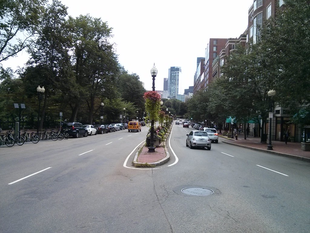
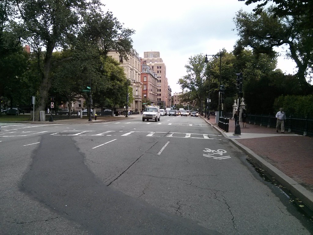
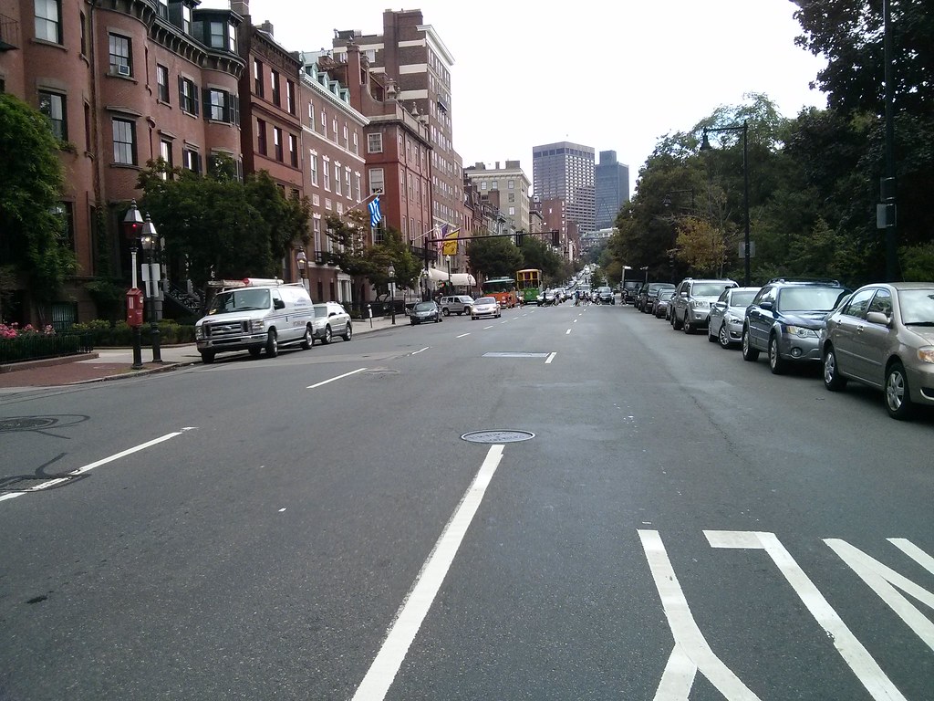
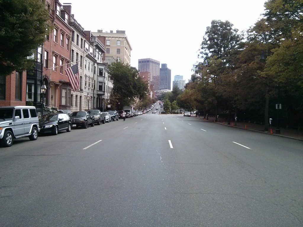
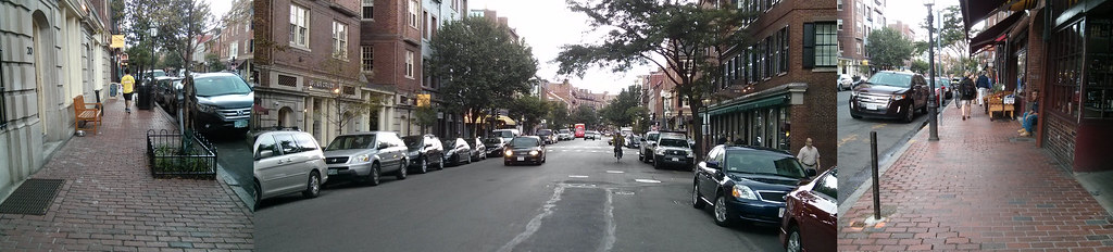
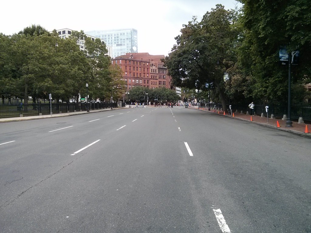
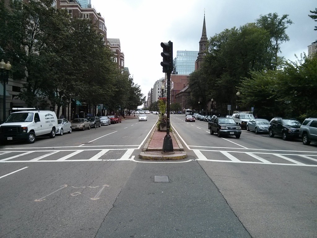
As anyone who has lived, or visited, here knows, the streets around the Public Garden and the Common are some particularly nasty, wide, one way racetracks. It seems absurd: the Public Garden being one of the jewels of Boston with so much money and effort invested in it, yet it is surrounded by a sea of pavement. How did it get to be so screwed up?

Well, we've heard about the dirty 1970s and the damage wrought on this city by traffic engineers and leaders who seemed determined to gut every nice aspect of town and turn it into a giant highway/parking lot. But it goes further than that. From the Ninth Annual Report of the City Planning Board (1923):
Boston was one of the first cities in this country to adopt the expedient of one-way streets in order to lessen congestion and confusion.
It must be hilarious, to generations of lost drivers, that they thought these one-way streets would actually "lessen confusion." But what's sadder is that this attitude comes from a time when pedestrians were being driven from the streets, murdered in mass numbers (200,000 in the 1920s), and stripped of their traditional rights to the street as a public space. The elites wanted wider streets for their cars and trucks, even though the vast majority of citizens did not possess either. And the elites got what they wanted. The City Planning Board, which had been formed only a decade earlier, seems to have viewed its job as primarily being about identifying blocks for destruction with the goal of widening streets.

They even sliced off a piece of the Public Garden itself -- unthinkable today -- and claimed that there was "no opposition" from the public:
Unfortunately, the matter had progressed beyond the stage of a public hearing before coming to the attention of the Board, and there being no opposition from the public or from the Transit Commission to a taking in excess of its recommendation, a further strip of the Public Garden was taken, and Boylston Street widened between Church and Arlington streets to a width of 120 feet.
And that's where it remains today.

The proposed cycletrack is a better use of all this excessive street space than current conditions. But there's an even better solution: Two-way complete streets. There's simply no sense in having a high-speed one-way loop around the Public Garden. It's incredibly irresponsible on the part of BTD. This aggressive engineering of multi-lane one-way streets here, and in adjacent blocks, is ridiculous, reckless and unjust. Let's take a tour:

Boylston Street is 120' from Garden to building line. I've noticed that crossing at this intersection (~80') is difficult for seniors because BTD doesn't care enough about pedestrians to set the timing right.
Well at least there's a nice sidewalk. You can see how the street flares out though.
Arlington Street is about 50' curb-to-curb. That's wider than Memorial Drive.
This bit of devilish engineering has more in common with a highway ramp than a city street.
Westbound racetrack, but not so helpful for people trying to go east.
Just ridiculously wide. Beacon Street varies between 50' and 65' curb-to-curb along this stretch.
This section of Charles Street is 45' wide curb-to-curb and functions as a one-way speedway. What in the world for? It's supposed to be a shopping street. There's simply no sane reason for it to be one-way, with so many lanes.

The sidewalks are tiny, pitiful, and difficult for people with disabilities to navigate. Or just difficult for crowds, period. Wide streets, tiny sidewalks. This street is a disgrace.
Back to Beacon Street. Hey look, it's two-way, and the world didn't end. Too many lanes though. This is highway-thinking, not city thinking.
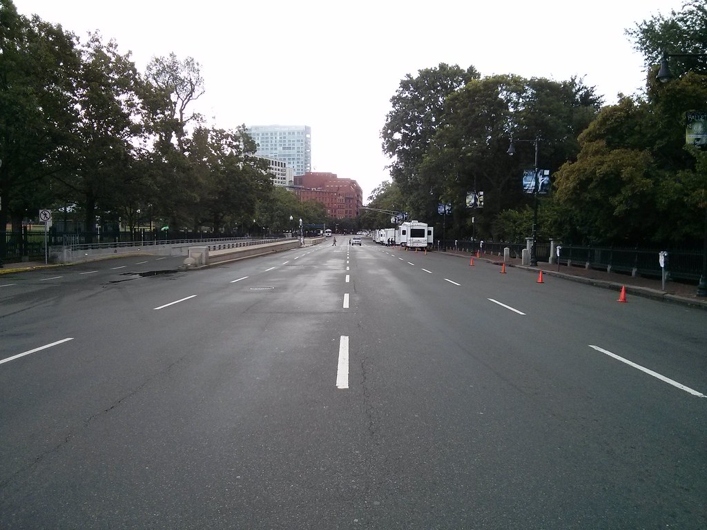
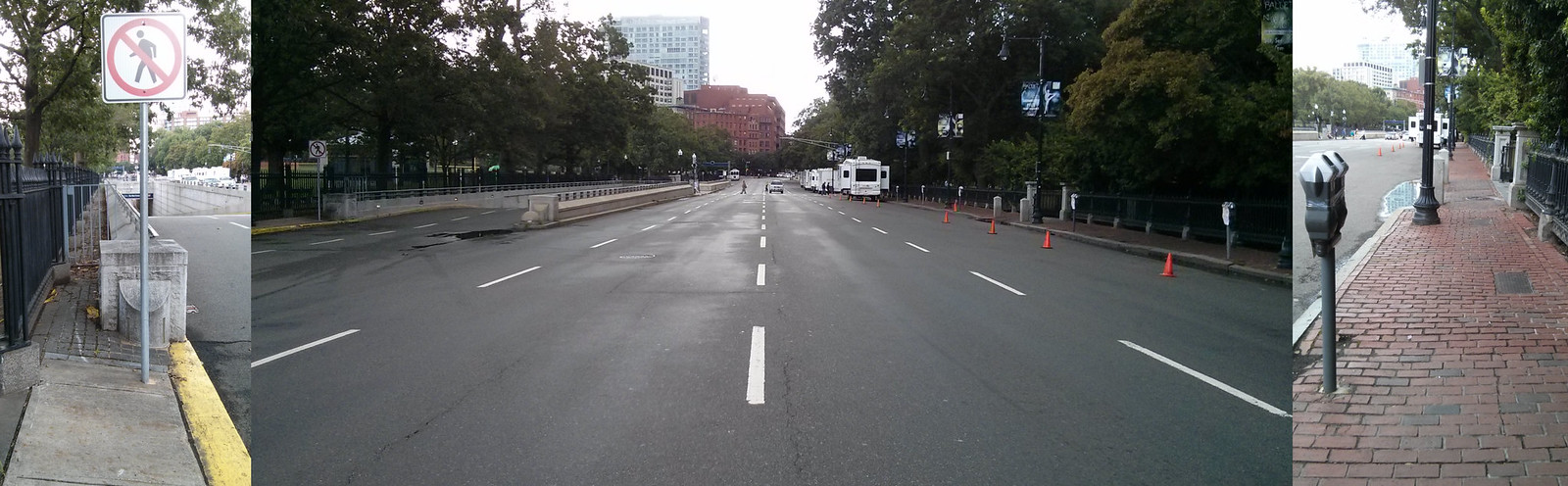
What "genius" thought a HIGHWAY between the Public Garden and the Common was a good idea? The roadway is 70' at this point. That's almost as wide as the nearby Mass Pike.
The fact that I can take these pictures indicates that this road is massively over capacity. It's like standing on a drag strip.
Tiny or impassable sidewalks, giant roadway. Yes you can walk through the parks, at least. But you can't ride there. And what kind of message does a 4-lane highway send about our city?
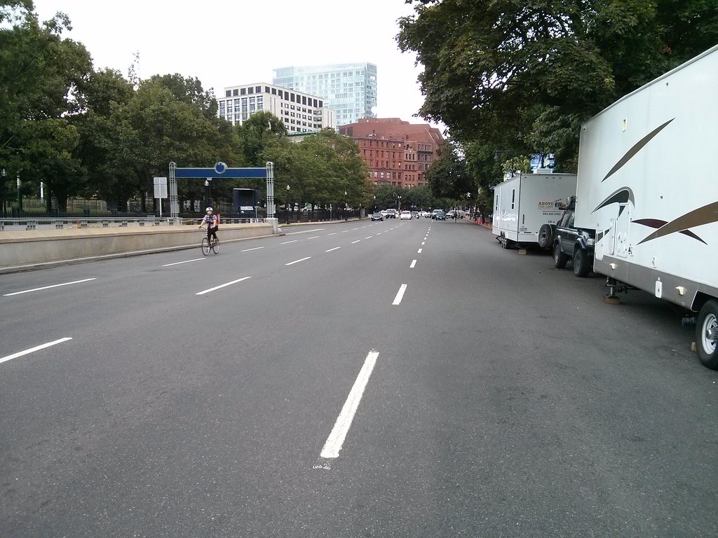
One rider braves the racetrack.
Just think about how much tax money gets sucked into maintaining this ridiculously wide monster road. It's anti-urban and it confuses drivers too. What a waste.
BTD probably thought putting a dinky little planter with some flowers in it is all that's needed to make everything better. Nothing that actually involves making the street safer or more human-oriented.
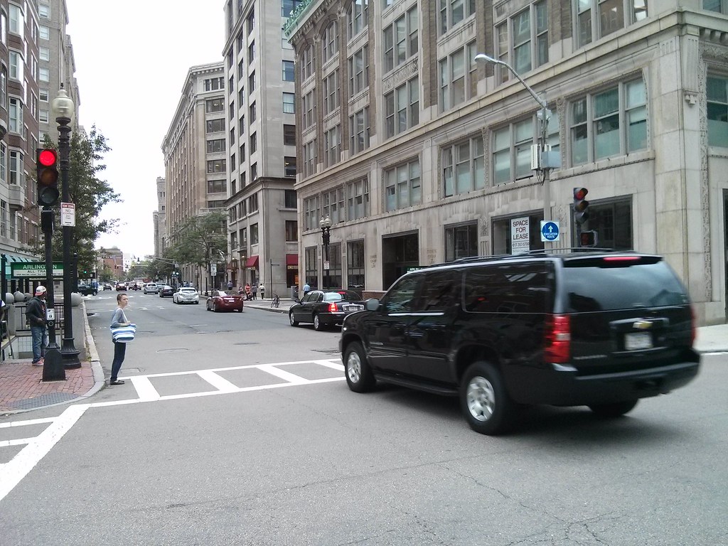
I guess the walk wouldn't have been complete without a large SUV running through the red light as I'm trying to take a picture.

The cycletrack idea is better than nothing, but it's a band-aide. The real problem is that our streets are still largely unchanged from the highway-crazed, anti-city transportation departments of past decades. What would really help everyone -- pedestrians, cyclists and drivers -- would be to discard all the ridiculous over-engineered intersections, and replace all the wide one-way streets with two-way streets that meet at simple, well-understood intersections. I also propose the following rules of thumb for city streets:

  • First, ensure sufficient walking space. If you can't guarantee 10' sidewalks then consider a "shared, slow street" concept.
  • If the street is wide enough for two lanes then it should be a two way street.
  • If the street is wider than that then either widen sidewalks (for slow streets) or create bike lanes (for slightly faster streets).
  • If it is even wider than that, then consider wider sidewalks, street parking, separated cycle tracks, buffered bike lanes, or bus lanes if there is a route.
  • If the street is really wide, then implement the Complete Streets concept. But why is the street so wide? Perhaps it should be narrower.
There really isn't a place for more than one travel lane in each direction on most city streets. Perhaps the busiest, widest and most central streets could have more, assuming there doesn't need to be a bus lane there. Intersections should be kept as simple as possible. Traffic signals which attempt to be too clever just confuse people, and almost always wind up screwing over pedestrians. Fancy traffic engineering is not appropriate or necessary. The point of a city street is not to be a sewer or a conduit, but to be part of our shared inheritance, our public open space, a public way that is open to everyone for business or pleasure. Having streets around the Public Garden designed in a way that is more appropriate for the city may even obviate the need for cycle tracks, and make it safer for pedestrians and drivers as well.

Thursday, June 20, 2013

The replacement of the Cambridge Street overpass of I-90

MassDOT has decided to expedite project 606376 to replace the deck of an overpass of the Mass Pike that is located in Allston, along Cambridge Street. The plans are already in 100% design state because they have been sitting around for a few years. However, they are offering a chance to comment over the next ten days, and at Tuesday's public meeting, they pledged to incorporate suggestions if possible. This is probably a once-in-a-generation opportunity to help fix a blight that has plagued Allston since the construction of the Mass Pike extension in the mid-60s.
[The comment period for all this is now, ending by July 3rd. Please e-mail dot.feedback.highway@state.ma.us and reference the Cambridge Street overpass over I-90 project number 606376. You may also read more on http://cambridgestreetoverpass.blogspot.com/.]


View Larger map (final design bus stops shown as blue markers)

The project scope extends from the intersection with Harvard Avenue in the west, to the intersection with Lincoln Street in the east. It also includes several minor repairs to the pedestrian footbridge across the pike at Franklin Street, but nothing more significant. MassDOT has suddenly gotten interested in this plan after it languished for several years, because the deck is deteriorating to the point where replacement must happen within the next couple of years. Conditions above the deck have been nearly intolerable for the past few years as well.
The sidewalk is fenced off because it has gaping holes
Dangerous conditions

A little history: prior to the construction of the Mass Pike extension in the mid 1960s, Cambridge Street had a smaller overpass of the Boston and Albany railroad. Lincoln Street, Mansfield Street, and Royal Street all connected directly to Cambridge Street.


Cambridge Street in 1925

The construction of the highway meant widening the right-of-way. Homes along the south side of Lincoln Street were taken (including Fred Salvucci's grandmother's home), as well as some homes on Mansfield and Royal, and the streets were reconfigured. Lincoln Street was redirected to curve to the northeast, paralleling the new highway. The ends of Mansfield and Royal were chopped off and reconnected to Lincoln Street. Then, Lincoln Street was rerouted over the Empire Street right of way and re-attached to Cambridge Street where Mayflower Street is shown on the map above. The net effect was to sever the street grid and create an overly long, uninterrupted block from Linden Street to the new Lincoln Street intersection. Motorists treat this stretch as if it were part of the highway, racing at high speeds along the excessive capacity, and creating a scary environment for anyone not surrounded by 2 tons of steel.

Eagle-eyed readers will notice there is a "tunnel" marking by Franklin Street. This was the location of a 19th century grade-separated walkway under the tracks. This was covered over and replaced in the 1960s by the current Franklin Street pedestrian overpass, which connects a point opposite Highgate Street on the south side, with Franklin Street on the north side.

The Cambridge Street berm
There is also a ramp at Mansfield Street, to replace the street connection that once existed. It climbs the berm so that people walking from Mansfield Street can reach Cambridge Street directly.

The Cambridge Street overpass of I-90 was given six lanes of automobile travel, small sidewalks, and no safe means of crossing, over 45 years ago. It has remained so since, but the bridge deck has reached the end of its lifespan and must be replaced.

Both MassDOT and BTD have shown a willingness to improve conditions on the bridge for walking and bicycling. They have recognized that six travel lanes is massive overkill: the feeder streets only have one lane in each direction, so there is simply not enough connecting capacity to fill six lanes anyway. As a result, they have drawn up buffered bike lanes and wider sidewalks into the current plans.

Crossing Cambridge Street
Unfortunately, in the same plans, they have decided to place a quarter-mile long fence right down the middle of Cambridge Street, from end-to-end of the scope. The claim is that they are concerned about "safety":  many people trying to get between North and South Allston are unwilling to walk a half-mile out of their way to use one of the intersections. So, instead of providing safe places to cross the street, the state agency is simply try to block all crossing. But that's unacceptable to the community. We need north-south permeability here. The sheer number of people willing to walk down the center median and climb the current concrete barrier attests to that. Many of these people live in North Allston and need to access jobs, shopping or bus stops in South Allston. Others live in South Allston and want to reach neighborhood resources in North Allston. MassDOT needs to accept that north-south travel is just as valid as east-west travel on this city street.


Now, MassDOT wants to stick to their scope and their schedule because they feel hurried to get this done. I also agree that this project needs to get done as soon as possible. So this comment period will likely be the last chance to ask for improvements in the final design.

What's exciting about this project is that the city has apparently been making plans quietly for a kind of "corridor to the river" from Allston to the Charles that uses Cambridge Street. For many decades, this street has been a barrier to walking and biking, with dangerous highway ramps and speeding trucks, but it could be transformed into a gateway instead.


View Cambridge Street corridor to the river in a larger map

The River Street Bridge replacement project (shown in blue) will be underway right after the Anderson bridge is complete. So, after that, the missing piece is in the middle: Cambridge Street.
  • Cambridge Street is a city street, and should look and feel like a city street, not a "mini-highway."
  • MassDOT and BTD are both onboard, in principle, with fixing Cambridge Street and building this "corridor to the river" but they seem to be fragmented in planning. Management of the corridor is split between the two agencies. We need them to be on the same page so that the final outcome is coherent.
  • A quarter-mile long fence with no crossings is not acceptable to the Allston community. There needs to be a safe place to cross. Some possibilities include the Linden Street intersection, or the Mansfield Street stairs. It should be possible to put a coordinated traffic signal at Linden Street which helps crossing with no impact on motor traffic.
  • During construction, a 2 year period, portions of the bridge will be closed. There will be three phases: each third of the bridge will be shutdown and replaced, from north to south. Although I understand that there will be unavoidable impacts, MassDOT needs to ensure that non-motorized access is considered seriously during this time-frame.
  • The Franklin Street overpass attracts heavy foot and bicycle traffic, which must share a narrow sidewalk along the north side of Cambridge Street near Harvard Avenue. The MassDOT plans call for directing the bicycle lane up a ramp and onto that same sidewalk. It will be widened to 13 feet, but, it turns MassDOT engineers had not anticipated that there currently is (and will be) 2-way bicycle traffic on this segment because of the overpass. Luckily, there is a grassy strip adjacent to the sidewalk which could be taken for a sidewalk-widening easement. That needs to be considered.
Two bicycles take up all the space already; but look at that potential width!

The comment period for all this is now, ending by July 3rd. Please e-mail dot.feedback.highway@state.ma.us and reference the Cambridge Street overpass over I-90 project number 606376. Or you may write a letter to:
Thomas F. Broderick, P.E., Chief Engineer
MassDOT - Highway Division
Attn: Bridge Project Management
10 Park Plaza
Boston, MA 02116-3973
You may also read more, including the 100% design plans, on http://cambridgestreetoverpass.blogspot.com/.


Saturday, May 4, 2013

Sign of spring


The bike racks are back, and busy as ever, helping keep the sidewalk clear of piled up bikes. Perhaps they are also a sign of thawed relations with BTD, which has started acknowledging the existence of non-motorists finally, this past year. They are also supposed to install a pilot "parklet" on Harvard Ave soon, near the @Union Cafe, and paint "bike priority shared lane markings" on Brighton Ave to try and address some of the safety issues along that corridor.

Friday, April 26, 2013

A better idea for Melnea Cass Boulevard

Chicago is proposing a conversion of a portion of one of its busiest bus routes to BRT. The street is 70' wide curb-to-curb and currently has 4 travel lanes, 2 parking lanes, and a median/turning lane in the center. The bus lanes will be created by taking 2 travel lanes and the center median; left turns will be prohibited. There will be off-board ticketing and signal priority to keep buses moving along.

Ashland Avenue proposal (source)
Compare that to the proposed Melnea Cass Boulevard bus lanes:

Melnea Cass Boulevard proposal (source: 3-6-13 presentation)
It's not entirely comparable -- CTA plans to use buses with doors on both sides -- but the Chicago proposal looks much more neighborhood friendly, and the street much safer to be around.

Melnea Cass Boulevard is much wider than Ashland Avenue, but the sidewalks are much smaller in the Boston proposal. The buses here will have to contend with left-turning traffic, unlike Ashland Avenue. And finally, the Melnea Cass proposal is for a very short segment of the handful of bus routes that use it, whereas the Chicago proposal starts with a ~6 mile segment and will eventually extend to a full 16 mile route. Here, if the Urban Ring were ever to be built using BRT, then the initial tiny segment would become something more significant. But widening would hurt the community along the Melnea Cass corridor permanently, even if it were to get transit service befitting an urban location. This Chicago proposal is a better model for a busy urban corridor in a well-developed American city.

Monday, March 4, 2013

Against the proposed widening of Melnea Cass Boulevard

The Friends and Neighbors of Melnea Cass Boulevard have put out an excellent op-ed piece: Widening Melnea Cass a bad idea.
As concerned members of Friends and Neighbors of Melnea Cass Boulevard, we write to highlight an urgent situation that many Roxbury residents may not be aware of. On Wednesday March 6, 2013 [at the Boston Water & Sewer Headquarters] an important public meeting will be held by the Boston Transportation Department to discuss its plan to widen Melnea Cass Boulevard (MCB), an ill-conceived project that will be detrimental to Lower Roxbury. The project would widen MCB by about 40 feet to add bus lanes, providing little public benefit because there are currently no plans to augment existing MBTA bus routes. The proposed project is at best a knee-jerk response to the availability of federal monies designated for such planning, which might be withdrawn if not used in the near future.
A little history: the land through which MCB now runs was once a neighborhood, but it was bulldozed and cleared as part of "urban renewal" and in preparation for the never-built Inner Belt expressway.

Comparison of the urban fabric in 1955 and the desolation found in 1995 (thanks to HistoricAerials)
The Inner Belt was stopped, but not in time to save this portion of Roxbury. Since then, for whatever reason, the land has lain underused. You can see in the pictures that a crosstown boulevard was established where none was before. The land around this boulevard is largely vacant or some sort of truck or car parking lot. For an area which is just over 2 miles away from downtown Boston, this seems strange and unnatural. The nearby Dudley Square has also suffered since the Orange Line was relocated to the Southwest Corridor about half a mile west. The question weighing on everyone is: what can be done about this situation?

Here are BTD's primary talking points for this project:
Transportation should work well for all modes:
  • Safe, efficient, calmed traffic
  • Lower speeds
  • Good bicycle and pedestrian connections
  • Effective transit
And one of the proposed cross-sectional designs:
And here's a sample of a proposed intersection:
I'm having a great deal of trouble reconciling these pictures with the notion of "safe, efficient, calmed traffic", "lower speeds" and "good pedestrian connections."

You're looking at 7 lanes of traffic just to get across the street. That's on the order of 80 feet of pavement. If you want to know how that will feel, just go to the corner of Melnea Cass Boulevard and Tremont Street currently. MCB widens out to about 77 feet at this point, and to make matters worse, Tremont is also really wide. It's not pleasant to be a pedestrian there. This plan looks a lot like Commonwealth Avenue just east of the Mass Pike bridge. That was rebuilt not too long ago. It used to be even more dangerous. It's been improved, but it's still pretty nasty. And that's with a much wider transit reservation.

Also, just in case you didn't have enough pavement, there's actually 9 lanes with parking. Those sidewalks are looking awfully tiny. Unfortunately, tiny sidewalks are a widespread problem in Boston, but why perpetuate that on what is supposed to be a "Complete Streets" design?

Where did those tall buildings come from in the rendering? Always fun to see what the artists imagine. But let's think about it. Suppose that kind of investment was attracted and allowed to flourish along MCB? What are the possibilities?

  1. Large parking lots are built under, around or behind those buildings; as current zoning dictates. The street environment stays car-oriented. Therefore everyone drives, all lanes of traffic are jammed, and the bus ridership is anemic. Nobody is happy, but drivers stare hungrily at those bus lanes and commence the "empty lanes attack" through political channels. Eventually, the bus lanes get turned over to general traffic, just like so many trolley lanes before them. The greenspaces become neglected and dangerous.
  2. A thriving transit-oriented development corridor is created. The bus lines function smoothly and efficiently so people use them and don't feel the need to use their car for every trip. Heck, suppose it even gets used for the Urban Ring! But still plenty of traffic is attracted to those lanes. Either they're uncongested and traffic flows at dangerously high speeds, or enough through-traffic is induced to jam them anyway. Either way, the majority of people making use of the corridor are on foot and yet they are squeezed into a small amount of the space, and put at risk.
BTD's plan is to take the existing 120' right-of-way and re-arrange it in such a way that it adds an extra 24' of pavement in the center for the bus lanes. This implies shifting the north side of the road further north onto the current bike path and line of trees. If they intend to keep MCB as a car-oriented corridor while adding a set of dedicated bus lanes, this is probably the best way to go about it, although it does sacrifice a lot of trees.

Is there a better way? I think so. If the neighborhood wants to become more walkable, more bike-friendly, and more transit-friendly, then I think the best solution is not to widen the pavement at all. Instead, if BTD really wants to show its dedication to "Complete Streets" then they will take two of the existing travel lanes, and convert them into dedicated bus lanes.

Some might argue the old trope that this will cause "gridlock" and traffic jams as drivers senselessly pile into one another without thought. That's nonsense. If the corridor is going to be reimagined and reinvented, then it will also change the way people travel along the corridor just as radically. People respond to their environment. If you want to have a highway, then by all means, keep the road wide. But if you want it to be a walkable place to build a neighborhood around, then you'll want to keep the lane count down.

My plan also saves the trees and costs a whole lot less money. It can be implemented with paint. Then, the city needs to allow the development of the vacant lots and the parking lots. Lower or outright remove any minimum parking requirements in the zoning code to help ease traffic. This area has been neglected by the city for far too long. It's time to clean up the mistakes of the 1960s, not repeat them.

Thursday, February 21, 2013

Transit signal priority

Following onto my last post about station elimination and consolidation: The topic of transit signal priority comes up frequently when discussing improvements to the Green Line. It was prominently discussed at last month's Green Line meeting. I went and did some background research on it.

What is transit signal priority (TSP)?

Example phases in a traffic light cycle (simplified)
Transit signal priority is the application of subtle changes to traffic light timing in order to assist the passage of transit vehicles. Broadly speaking, there are two categories: passive and active. Passive priority is static and predetermined: for example, changes to the timing of traffic light phases, or to the transit schedules. Active signal priority occurs dynamically, triggered as the system detects the approach of a transit vehicle. I will be focusing on active TSP.

TSP should not be confused with "preemption" which is the abrupt interruption of normal traffic signal functioning. Preemption is used for safety purposes primarily: to assist emergency vehicles, or to clear a railroad grade crossing. The key difference is subtlety: traffic signal priority should be almost completely unnoticeable to observers.

Who is using TSP?

In the United States and Canada, over twenty agencies report using TSP, including but not limited to: Los Angeles Metro, Houston MTA, Sacramento RT, Pierce Transit (Tacoma), TriMet (Portland), SEPTA (Philadelphia), PVTA (Springfield, MA) and Calgary Transit.

Some examples in other countries include: Zürich, Paris, London, Sheffield (UK), Amsterdam, Hannover (Germany), Sapporo and Curitiba (Brazil).


Why do TSP?

The primary benefit of TSP is enhanced reliability of schedules: better maintenance of headways and less bunching. One of the biggest causes of variability is the unpredictable delay caused by traffic signals, compounded over the course of many intersections. TSP makes it possible to avoid the worst-case delay. A secondary benefit of TSP is a slight reduction in average trip time: less waiting at intersections. Another benefit is a potential reduction in operating costs for the route; saving money or boosting resources elsewhere.

To see that, you must think about a transit route as a loop -- even linear routes must double back and return vehicles to their starting position somehow. Normally, after a vehicle returns to the beginning, it is allowed to rest for a certain period of time called the "layover." The driver gets a break, or changes out. If the vehicle is running late, but not too late, then the layover is shortened in order to "recover" the schedule.

Agencies build substantial "recovery time" into the layover time of a route, usually by tacking on a "padding" percentage of the round trip time. The percentage depends upon the reliability of the route: the goal is to minimize the probability that a vehicle finishes its round trip so late that it has exceeded the layover time allotted. So if TSP makes the route more reliable, then the layover time can be reduced.

Whether through increased reliability, or reduced round trip time, if the overall time can be reduced by enough, then fewer vehicles and fewer drivers are needed to operate it -- a major cost savings. To give an example: the MBTA Blue Book 2010 reports that in morning rush hour the "B" branch of the Green Line requires 20 trains which are supposed to be spaced at 5 minute headways. This means that trains can leave Boston College over the course of 100 minutes until a returning train must be reused. The Blue Book also states that the scheduled time to reach Government Center is 45 minutes, and the scheduled return time is 43 minutes, for a scheduled round trip time of 88 minutes and a layover of 12 minutes. That implies a 13.6% padding.

Now suppose that the padding could be reduced to 7% which happens to be the Swiss standard. That would imply a 6.2 minute layover, and at 5 minute headways, only 19 trains would be needed to provide morning rush hour service on the Boston College line. The NTD factsheet says that light rail costs $216/vehicle hour to operate here, so removing just that one train from just that one shift saves approximately $120,000 a year.

Even if 7% is considered to be too little padding for other reasons, the combined travel time and layover time savings could easily add up to 5 minutes or more, producing the same operating cost reduction. And applied to all shifts you might even see savings add up to millions of dollars per year which can be put into other operating improvements.

How does TSP work?

There are a few techniques that are generally applied to achieve active signal priority. Any combination of them may be deployed, depending on the conditions at each intersection. Vehicle detection methods must also be selected which are capable of providing enough notice of arrival to the traffic light controller. Such methods can be as simple as an induction loop in the ground, an optical sensor, or even information obtained from GPS satellites used to model the real-time schedule.


Green extension keeps the signal green for a short while longer to allow a detected transit vehicle enough time to pass a light that was about to turn red.

Early green hastens the expiration of the red light so that the detected transit vehicle can get moving as soon as possible.
Phase insertion waits for the next moment in the cycle that all conflicting traffic is stopped and then takes a few seconds for a special "phase" which gives the detected transit vehicle an opportunity to proceed.

Phase rotation changes the ordering of interchangeable phases so that the detected transit vehicle can proceed sooner rather than later. The best example is a left-turn-only phase which normally occurs before straight-through traffic goes: it can easily be "rotated" to occur after the straight-through phase instead.


What are the downsides?

Deployment of TSP should be transparent to the typical road user. Unless they are looking closely, they shouldn't notice anything different; although some techniques are more obtrusive than others. Green extension is probably the least noticeable intervention. On the other hand, early green has to allow enough time to safely clear the intersection: which can be difficult in the case of pedestrians. Phase insertion may be noticed by those waiting for the next phase, but it is a fairly short delay. Phase rotation may confuse those who have memorized the light patterns; but so would any change (Zürich chose to randomize such phases before implementing signal priority, to prepare the public in advance).

The North American systems studied in-depth by the FTA did not find any significant delay experienced by the non-priority traffic, but systems in the past have failed due to improper planning, so it is important to study the design. However, even if there were significant delay to vehicles, that is not the correct metric to be using. Traffic engineers infamously use "level of service" to grade intersections by vehicle-seconds of delay even though this kind of thinking is notoriously unsuitable for city streets with many different kinds of users. Instead, transportation departments ought to be thinking about optimizing the safe "movement of people" instead of the "movement of vehicles." And in that respect, even if a signal priority system does cause some measurable delay to non-priority vehicles, it needs to be evaluated by the overall effect it has on people, not vehicles.

For example, suppose the installation of TSP at an intersection causes an average of 5 seconds additional delay to 36,000 non-priority vehicles, but also manages to reduce average delay by 15 seconds to the transit vehicles carrying 30,000 people a day. Assuming an occupancy rate of 1.2 persons per car, that's 216,000 person-seconds of delay to non-priority traffic. That sounds pretty significant until you realize that it is massively outweighed by the 450,000 person-seconds saved by the riders. And 36,000 non-priority vehicles is very high; in most cases along the Green Line the number is much, much less.

A transportation department with its priorities straight would consider person-seconds the metric by which to optimize, not vehicle-seconds. And "level of service" is not a valid metric to use on city intersections because it does not make consideration for people, traveling in all modes, with or without vehicles.

Further reading.


Thursday, April 5, 2012

Access Boston and pedestrian safety guidelines

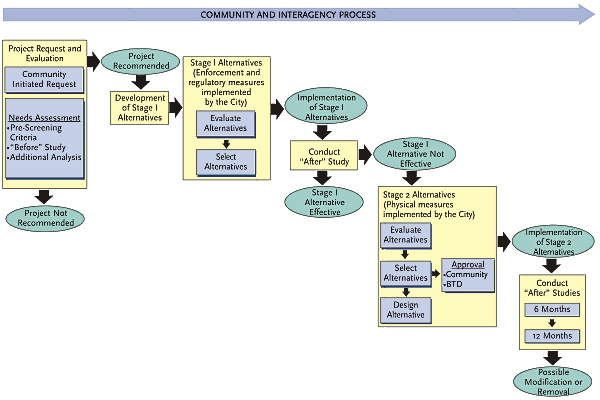
I was reading through the old Access Boston (2000-2010) website, which is still featured prominently on the City of Boston's transportation website. It's a fairly old document, but it doesn't seem like there's been any update in the past decade. Here's the process you need to go through in order to implement a proposed pedestrian safety improvement:


To begin, following a "Community Initiated Request" there must be a "pre-screening" and a "before" study:
The prescreening criteria include basic roadway characteristics that allow the BTD to determine if implementing transportation safety improvement measures are appropriate for residential streets. [...] First, the study will establish a traffic baseline from which the effectiveness of the project can be compared to later.  The second purpose is to collect data to perform a level of screening to ensure that it is still appropriate to consider transportation safety improvement measures.

Then BTD will consider some simple regulatory or sign changes, known as "Stage 1 alternatives." If that fails in the "after" study, then they will only consider physical changes for pedestrian safety if: (a) the road is under 40 feet wide, (b) not an emergency or bus route, (c) no more than one lane in each direction, (d) not too steep, and (e) not curved too much. There's more. For Stage 2 changes, a neighborhood organization must be formed to study the options. Ultimately, it suggests that a petition with 75% neighborhood support must be submitted, and it must also receive 100% of support from immediate abutters. And the City retains the right to refuse the proposal. And you must find funding through a source such as TEA-21, AAA, or squeezing it out of adjacent development projects. The Stage 2 modifications cannot cause adverse effects to neighboring roads, either.

Considering all that, I'm surprised that any of these pedestrian safety proposals were ever implemented.