Showing posts with label walking. Show all posts
Showing posts with label walking. Show all posts
Tuesday, July 7, 2015
The Epic Journey Across Ruggles Street at Southwest Corridor Park
I've been gathering footage around town with my digital camera. Here's my first attempt at creating a video, about a poorly-timed signalized crosswalk near Ruggles Station:

Sunday, March 22, 2015
Comm Ave Phase 2A public meeting: Tuesday March 24th

March 24th, 6 p.m.
565 Commonwealth Ave (Kenmore Classroom Building)
Room 101
The city is holding their long-awaited Comm Ave Phase 2A public meeting on Tuesday. This deals with the segment of Comm Ave between Packard's Corner and the BU Bridge (non-inclusive). One of the biggest topics of contention has been whether or not the bike lanes would finally be fixed on Comm Ave to match the Boston Bike Network plan for having a protected bike lane on Comm Ave.
 |
| The status quo |
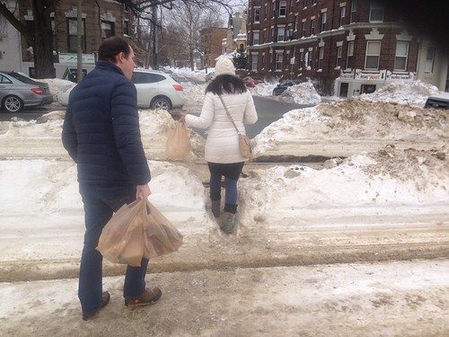
Another one of the major problems on the street is the lack of a crosswalk at Alcorn Street and Naples Road. On one side is a densely populated residential area, on the other side is the neighborhood supermarket. Most people simply wait and cross the street over the tracks when clear. But, the engineers believe that people should be walking over 1,000 feet out of their way, traversing 6 extra traffic lanes and waiting through extra cycles of the traffic light, simply to get across the street. While carrying heavy bags. This is a clear case of a disconnect between the planning department -- who only see this street on paper -- and the people who live here.

Even in the heavy snowfall, people would still rather cross here than go around the long way.

 |
| (source) |
Finally, I would like to mention that although the MBTA has finally put out a plan for much-needed station consolidation, it is not clear that they will be ready to go before the city starts the reconstruction project. That will put us in the absurd situation of rebuilding the street around the 4 old stations. Then, presumably, the MBTA will come along and cut those out, and rebuild 2 properly accessible stations, but at that point they will simply leave the old station locations as dead space. That's a terrible waste, and a lot of extra pain too -- as the time period of construction would be lengthened. It seems to make a lot more sense to simply get both projects done simultaneously, so that the new street doesn't have to waste space, and so that the station construction can proceed in parallel with the street reconstruction, in a fully integrated fashion.
Friday, February 20, 2015
Snow daze
 |
| Spotted this while passing through -- first snow of the year and it's still fun for bicicle snow man |
 |
| Blizzard returns streets to people |
 |
| Best way of getting around now |
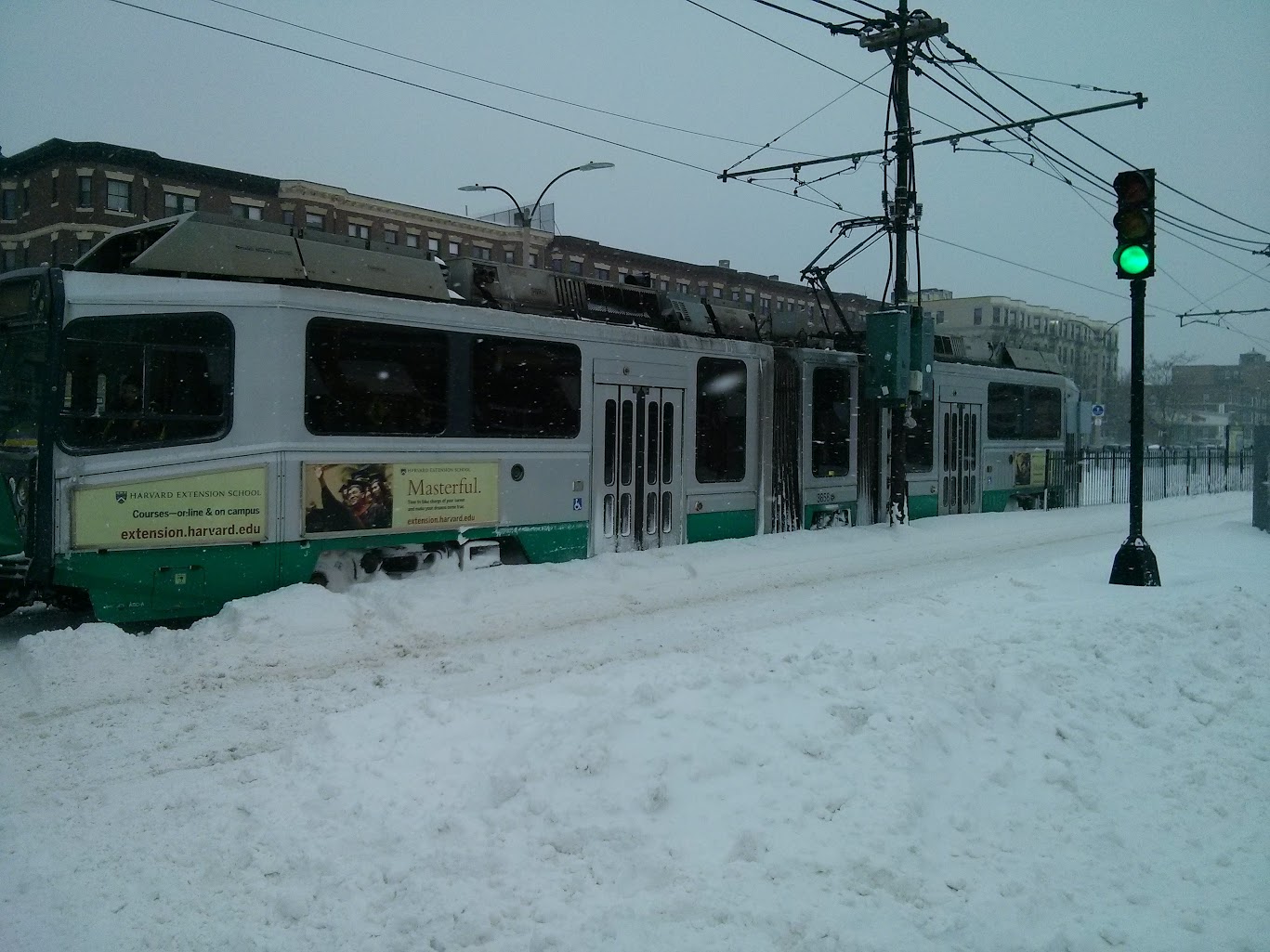 |
| No revenue service, but trains clearing snow still need a second operator apparently! |
 |
| A space taken by automobiles returned to the people for one day. |
 |
| Headed for the hills |
 |
| Second best way of getting around in the snow (after skiing) |
 |
 |
| Such a strong desire line @ Naples Rd that people climb mounds of snow to use it |
 |
| Snow soccer in what is regularly a dangerous intersection |
 |
| Walking is the dominant mode of transportation on Comm Ave |
 |
| Even on the deteriorating highway overpass, with tiny sidewalks |
 |
| Guess who the city doesn't care about! |
 |
| I could not navigate this canyon |
 |
| Not a flake on the ground for drivers, however! |
 |
| The bus stop is starting to disappear beneath the mounds of snow |
 |
| Beautiful nearly dry pavement for motorists -- slush for people walking. |
 |
| Cambridge Street overpass of I-90 is even less friendly in a blizzard |
 |
| Sidewalk's gone |
 |
| All that remains of the Framingham line |
 |
| That Kenmore Square crosswalk STILL hasn't been cleared out |
 |
| Park your car on the sidewalk and avoid shoveling snow! City says: "No violation found" either. |
 |
| Relics of civilization pasT |
 |
| Ah screw it |
 |
| The Green Line is canceled and now what? |
 |
| Snow tracks |
 |
| Free (illegal) parking deemed more important than transit |
 |
| Let's build a mountain of snow on the tracks! |
 |
| The mountain is moving faster than the Green Line: faster than zero |
 |
| The 57 cannot handle the load even late at night |
 |
| Naples Rd desire line strong as ever, no matter what |
 |
| They're waiting for the shuttle bus that may never come |
Wednesday, December 17, 2014
Stupid idea of the month: pretending to solve pedestrian signal timing issues using Pong
 |
| Game lets you play Pong with a person on other side of the crosswalk (source) |
The ActiWait is a new generation of traffic light buttons. Installed at a pedestrian traffic light with long red phases, it offers pedestrians the possibility to convert boring waiting times into positive experiences. Through a touch screen which is installed in the upper shell of the button, people can interact with each other across the street.
As a public art project, it's neat. Especially while it retains novelty value. But as a "solution" to long red phases, it's incredibly stupid and condescending. Let's get this straight: is it okay to subject pedestrians to needlessly long wait times at traffic signals, so long as you give them a 1970s video game to play? Absurd. What's the message being sent here? As near as I can tell, the message is: "You walked? Well then, your time is worth less than that of a driver. Here, play a game, instead of getting where you're trying to go."
The solution to long waiting times is not games... the solution is shorter waiting times. Engineers should respect the fact that pedestrians are people too and they don't appreciate being forced to wait excessively long times simply for the convenience of motor vehicle drivers. This is not a difficult topic, and it demands no techno-wiz solution. The answer is simple: shorten traffic signal cycle times to reduce average waiting times. And don't require the use of "beg buttons" to cross the street. Pedestrians should be given at least as much respect as drivers. If you don't make drivers press buttons or play games at traffic lights, then you shouldn't force pedestrians do that either.
 |
| Slides from Ricardo Olea, SF MTA (source) |
San Francisco is known for its pedestrian-friendly signal timing. As you can see, engineers at SF MTA understand that overall cycle length is very important to the pedestrian experience.

Doubling the cycle length causes the average delay for pedestrians to more than double. In San Francisco, a 60 second cycle length is fairly standard. Unfortunately, in Boston, most signal cycle lengths are between 90 and 120 seconds. Sometimes they vary depending upon time of day -- usually lengthening during rush hour. 110 seconds is a fairly common cycle length, in my experience. All of this is firmly in the "red" according to SF MTA, leading to unhappy pedestrians. Well, actually what happens is that Bostonians quickly learn to ignore the signals because the timing is quite obviously terrible.
ActiWait is from Germany so hopefully they will stay over there. Or perhaps they can invent a game that convinces traffic engineers to treat pedestrians better. Here's an idea: perhaps a little device that can be installed in their cars. At every single signaled intersection, it forces them to stop, push a button, and wait 50 seconds on average for a green light. The fun part is that if you push the button at the wrong time during the cycle, you may have to wait an extra cycle to go around before you get a chance to proceed. That's how signals in Boston are programmed. All the fun of a slot machine, and none of the reward!
Sunday, November 2, 2014
Induced demand is a real problem and it makes congestion relief nearly impossible
For some reason, contrarian articles on "induced demand" seem to be the topic du jour. While they are right to point out that induced demand is a more subtle and nuanced concept than the way it is sometimes popularly handled, both articles seem to err too far in the other direction. Induced demand is a real problem, even if some people sometimes misuse it when making arguments.
Reliability, frequency, and speed
I want to take a quick detour to talk about goals in transportation investment. People tend to make decisions about transportation based on many factors, which I will boil down into three: reliability, frequency, and speed. Reliability encompasses factors such as predictability of trip time, probability of vehicle breakdown, and in general, the ability to make a confident statement about your location at a future time. Frequency is a metric of opportunity: the number of chances that will you have to undertake your trip in the window of time that you have available. And speed is the cost of the trip in time. To be sure, there is some crossover: frequency affects average speed and predictability, for instance. But let's roll with this for now.
There are two major categories: scheduled transportation and unscheduled transportation. Scheduled transportation is largely mass transit, whether public or private. Unscheduled transportation includes modes such as walking, biking and most driving. Frequency is obviously a huge deal for transit; there is also a frequency limitation on unscheduled transportation caused by things like traffic signals, but it is usually small enough to go without notice.
For many people, reliability is the most important characteristic. Walking and biking tend to have the most reliability because they are the least complex modes. Transit with a dedicated right-of-way is also supposed to be highly reliable: a properly run railroad should operate like clockwork (the MBTA on the other hand...). Modes such as driving are very susceptible to being caught in unpredictable and chaotic traffic congestion because they are highly inefficient in terms of space. Cars are also complex pieces of machinery that can easily break down. And mixed-traffic transit gets the worst of it because it has to contend with traffic congestion as well as passenger loading.
Speed should be broken down into average and top speed. Walking is obviously the slowest in average and top speed. Biking does not have high top speed (for most people) but can often maintain decent average speed comparable to a local city bus or a slow train. Transit can vary depending upon quality of right-of-way and maintenance. Driving is usually the mode with highest top speed but in typical traffic conditions can have significantly slower average speeds; possibly even slower than transit or biking.
The speed and reliability of walking is almost always independent of the number of people walking, except in the extreme cases (important as they are). Biking is also mostly able to enjoy that same feature. Transit in a dedicated right-of-way has the capability of operating reliably independent of the number of people attempting to ride it -- up to a point. Once the number of people reaches a certain "crush" capacity then dwell times can be impacted if the operator takes no further action. Finally, driving and mixed-traffic transit are most clearly the modes that are bothered the most by other vehicles on the road. As a driver, or as a mixed-traffic transit rider, the reliability and speed of your trip is highly dependent upon the decisions made by thousands of other people.
Perception and reality don't always match. For example, many people perceive to be in "more control" when driving. But in fact, they're highly dependent on the behavior of other people. Another: many transit riders don't perceive slowness because they are absorbed in some other activity such as reading or working; whereas drivers traveling at the same average speed might be seething and pounding the steering wheel in frustration. And of course: "There is a very strong element of psychology behind traffic patterns."
So, when considering a transportation investment, there are multiple ways to increase capacity. But they do not all have the same effect, even when viewed in such an abstract fashion.
Induced demand
Halloween just passed, so let's talk about candy. Prior to Halloween, there is a high, and one might say inelastic, demand for candy. Many people want to buy candy for Halloween, almost no matter what. This usually shows up in stores as an increase in both supply and prices. Luckily for kids (and the young at heart), supply of candy is relatively easy to increase.
Post-Halloween, the demand drops off. People remember why they don't binge on candy, or let their kids do so, all year. Excess supply is sold off as prices drop in response to the lower, much more elastic, demand. Then the market returns to normal, at least, until the next spike in demand.
Normally, I don't eat much candy. I try to avoid too much sugar for health and personal reasons. And I don't want to spend money on something like that. I could easily go for weeks and months without having a piece of candy. But if you put a bowl of chocolates in front of me, I'll probably take one sooner or later. The low price and ready supply has literally induced my demand. But not every type of candy will have this effect. I'm mostly not a fan of hard candy and will probably just ignore it. And perhaps I've generated economic activity by consuming a piece of chocolate, but I may also be ruining my diet and harming my health.
You probably guessed where I'm going with this. One major difference between candy and transportation is that the supply of the latter is much, much harder to increase. With transportation, very large, very expensive fixed investments are usually expected to accommodate all fluctuations in demand over time. Furthermore, in the United States, people generally do not expect the nominal monetary cost of everyday transportation to vary based on supply and demand, even though prices regularly change for commodities such as candy, food and other items. Instead, the cost fluctuation of everyday transportation is usually expressed as traffic congestion or overcrowding.
When a transportation investment is made, it can both increase the supply and possibly lower the overall cost of travel (either perceived or real) in that corridor. And the way that travel patterns change is hard to predict, despite many efforts.
Former Bostonian, and now Los Angeles transportation blogger VamonosLA writes:
In a large city, there’s almost always going to be trips that people want to make but don’t because of large travel times. This is especially true in large US cities, where we underprice road capacity to the point that new lanes are almost always quickly filled. We misinterpret the construction of the new lane as having caused the demand, but it was there all along.
This is true but is only part of the story. To be sure, some trips generated do represent increased economic activity. Other trips might represent less efficient usage of the now-cheaper resource. For example, you might make multiple trips where one would have sufficed in the past. Or, it might be due to drivers who were enticed into giving up existing car-pools, or who ditched transit. They might even have switched from walking or biking in cases where the distances were feasible (perhaps not in LA).
For a rather stark example, suppose you live in a neighborhood with sidewalks and you are able to walk for many trips. Suddenly, the DOT decides to "improve transportation" by taking away your sidewalks and replacing them with additional car travel lanes. Most people would then choose to stop walking and start driving everywhere. Nowadays it seems unimaginable that such a thing would happen, but it has in the past, and continues to a lesser extreme: oftentimes it is not that sidewalks are removed entirely, but rather, walking is made more unpleasant for the benefit of motor vehicle traffic.
An unknown contributor to the Transportationist named JW writes:
I hate the term “Induced Demand”. I hate the idea that induced demand is something bad; something to be avoided.
[...] From the individual’s point of view, access provides opportunities to more jobs, more entertainment and social options, and more alternatives for consumption of goods and services. From a business’ point of view, access provides a larger pool of labor and more raw materials. From a retailer’s point of view, access provides a larger pool of consumers. From a municipal government’s point of view, access allows more efficient provision of police protection, fire protection and ambulance service by reducing the number of facilities necessary for a given response time.
[...] Transportation improvements that provide greater access per unit of time lower transaction costs. Lower transaction cost lead to great efficiency in the economy and a higher standard of living.
Although JW is careful to couch it in terms of access, which is a good thing, this otherwise sounds like an argument that could be lifted straight out of a 1950s highway builder's manual: new highways lead to greater efficiency and higher standard of living! According to this logic, the congestion on the new highway facilities justifies the construction of even more highways. Clearly something is broken in this reasoning.
The mistake that JW is making is that not all transportation improvements are equal, and that there are more considerations than just raw "access per unit of time", which itself is a difficult thing to measure in practice. For one thing, the increase in access by one mode (say, private car) can lead to the degradation in access by another mode (such as walking, or emergency vehicles). For another, some modes lead to far more pollution and other bad side effects like poor urban planning decisions (e.g. minimum parking requirements, urban renewal, pro-sprawl zoning laws, etc).
Congestion relief
But I think that by far the biggest confusion stemming from the debate around induced demand comes because people are often talking about different things. When highway builders are trying to sell expansion, and when the general public is getting excited about it, they often refer to "congestion relief" as the major feature of the proposal. But what is "congestion relief?" Is congestion relief equivalent to the fact that more people can travel more miles by car? Is congestion relief the possibly increased economic activity and higher standard of living that JW talks about? Is congestion relief the fulfillment of "latent demand" as described by VamonosLA?
I would argue that congestion relief is none of those things in the popular understanding of the term. Instead, congestion relief is generally understood to be an increase in reliability of travel and a subjective decrease in the frustration that each individual has when using the transportation facility. Highway builders sell highway expansion to a public that is hungry for predictable travel times and less stress behind the wheel. However, that sort of congestion relief is largely a false hope, precisely because of the phenomenon that has come to be known as induced demand. It doesn't matter whether that comes from latent demand, or even that it might represent increased economic activity: if the typical driver still experiences large variance in travel times, and high levels of stress, then the congestion relief was a mirage as far as he or she is concerned.
Even the level of spending associated with projects like the Big Dig did not make it immune from this effect. From the Globe:
A Globe analysis of state highway data documents what many motorists have come to realize since the new Central Artery tunnels were completed: While the Big Dig achieved its goal of freeing up highway traffic downtown, the bottlenecks were only pushed outward, as more drivers jockey for the limited space on the major commuting routes.The new tunnels may have been able to handle the flow coming into them, but those outer links themselves were not able to live up to the induced demand.
Ultimately, many motorists going to and from the suburbs at peak rush hours are spending more time stuck in traffic, not less. The phenomenon is a result of a surge in drivers crowding onto highways - an ironic byproduct of the Big Dig's success in clearing away downtown traffic jams.
[...] The findings also call into question the promises made when ground was broken in 1992. At the time, state officials said in a promotional mass mailing to the public that, when it was all done, "people will find the commute to their jobs faster and easier than ever."
Conclusion
So what can be done about congestion, then? It has rightly been pointed out that transit improvement and biking facilities do not "reduce congestion" in this sense. Actually that point should be clarified further: those improvements do not "reduce congestion" when the travel demand is virtually inexhaustible. However, it is possible that in some cases demand is actually exhaustible: for example travel along Comm Ave in Allston, in which case those kinds of improvements can be very effective at real congestion relief. But for destinations such as downtown Boston, there will almost always be another driver willing to replace a trip that is mode-switched away from private vehicle.
All that does not make transit, walking and biking improvements worthless. Jarrett has discussed several reasons why transit is still very worthwhile even without "congestion reduction" and I won't reiterate, but I will add that dedicated-lane transit, walking and biking facilities all increase the supply of "reliable transportation" that boosts accessibility without the harmful side effects imposed by increased car travel. Walking and biking also have great implications for the health of urban neighborhoods and are worthwhile goals on their own.
The idea behind congestion relief is to try and make personal motor vehicles as reliable as walking, biking, or riding a well-run railroad. There are only two known ways to make that actually happen: (a) rigorous scheduling, or (b) decongestion pricing. Railroads avoid congestion and conflict by imposing very strict discipline and heavily analyzed schedules on the movement of trains. To try and apply that same discipline to private cars on roads is politically and practically unfeasible. Therefore that leaves decongestion pricing as the only known way to make private motor vehicle travel reliable, and it works by allowing the price of travel to vary based upon the supply and demand for travel. This is, of course, standard procedure for allocating just about every other resource in our society, but for some reason is completely ignored when it comes to roads. In any case, this article is about induced demand and I have already gone on too long, so I will leave discussion of pricing to others.
Saturday, September 6, 2014
Vision for the Green Line moving forward: a focus on accessibility for everyone
The effort to improve Commonwealth Ave Phase 2A is well under way and there are many proposals to fix the sidewalks and the bicycle facilities that are under discussion. For this post, though, I want to discuss the MBTA Green Line, because of the reservation that runs along Comm Ave, as well as the ones that are on Beacon Street and Huntington Ave.
 Generally, when other people speak of "vision" in relationship to the Green Line they probably are thinking about the Green Line Extension project at the other end in Cambridge, Somerville and Medford. That is certainly an exciting project and will make a huge difference to people living there. It's also making a big splash at $1.3 billion. However, in terms of big infrastructure, it's a decent move even at the inflated price, because it has the potential to attract many tens of thousands of riders. The main thing here is to ensure that the project is seen through to at least College Ave. Pushing for extensions to Route 16, and along the Fitchburg branch to Porter Square, are possible thoughts for the future.
The vision I have for the Green Line does not involve any further extensions, however, although it does not preclude them. After the bulk of the work on the GLX is complete, with the to-be-built Brickbottom Yard in place, the Green Line will be in a "balanced" form for the first time in modern history, with major maintenance and storage facilities both west and "east" of Park Street station. Plus, hopefully by that time, the MBTA will have concluded enough of its "power study" to comprehend what, if anything, needs to be done about the traction power system. And we'll be closer to having some new vehicles, beyond the 24 ordered for the first segment of the GLX. All this infrastructure should enable easing some long-standing Central Subway scheduling and congestion difficulties. But infrastructure is only part of the story.
Jarrett Walker made a good point in a recent post where he said that transit infrastructure does not cause ridership -- transit service causes ridership. And that is true: the frequency, reliability and speed of the transit service is what attracts (or repels) ridership. The Green Line could most certainly use improvement in frequency, reliability and speed. Although the schedule is fairly frequent, the reliability of that schedule is poor, leading to common cases of train bunching and overcrowding. The speed is well, ..., legendarily slow. The at-grade segments average between 6 and 9 mph normally, making them slower than a typical human runner. So there is definitely room for significant improvement. But I doubt that Jarrett is thinking about systems like the Green Line -- which, despite its problems, does attempt to have good frequency and attract strong ridership. He is thinking of newer systems such as Salt Lake City's S-Line that is both slow and infrequent.
But the Green Line does demonstrate a point that qualifies as a slight quibble with Jarrett's argument. Yes, it is true that service levels are the most important feature of a transit system. But there is an infrastructural component that I think also qualifies as a form of "service" and that's accessibility. You could build the most wonderful light rail system in the world, with a train every few minutes that takes you speedily to your destination, but it would be totally useless if you had to cross a dangerous high-speed roadway just to get to a station. Or if the station was designed with so many fences and obstacles that just getting to the platform is a journey in itself. Obviously this is a huge issue for people with disabilities, and 24 years after the passage of the ADA we're still far behind where we should be. But accessibility is also an issue for people without disabilities. First of all, just about every person born in this world will probably deal with some kind of mobility limitations of the course of a lifetime. Whether it be broken bones, aging knees, arthritis, or anything else, it still shouldn't disqualify you from being able to access public transportation. And even if you are fortunate enough to be in perfect health, you are still probably less likely to use a service if the access path to reach it is long and arduous.
Furthermore, all these problems are exacerbated if you have to climb steep stairs to get on or off the vehicle. And if you have to push and shove through a crowd just to get to a seat -- or even merely an open space for standing. And then push just to escape from the tiny front door, and be forced to climb down those steep stairs again.
I bring this topic up because the Green Line has a serious problem with poor accessibility, both for people with and without disabilities. And it's completely unnecessary. In theory, the surface Green Line could be the most accessible of all the segments of train lines in Boston. The platforms are at the same grade as the sidewalk, which means no stairs nor elevators needed. The tracks naturally guide the vehicle close to the platform edge, nearly the same place every time, without any additional effort from the driver. We have the technology that makes low-floor vehicles possible. Modern fare collection systems can work at any door. Using the Green Line could be as easy as walking through the entrance of a building.
But in practice, it's not. People with disabilities consistently rate the Green Line as one of the worst to use. Everyone else just seems to put up with the problems. The MBTA actively makes life worse for its customers by choosing the most bizarre and inefficient operating procedures. I understand that there are fiscal constraints preventing the T from replacing the existing high floor vehicles (which are also, alas, the only reliable vehicles in the fleet). I understand that there are historical constraints in the tunnels preventing the T from purchasing widely-used, modern vehicles (although I think they could try harder to fix some of these longstanding issues). But there is really no excuse for refusing to open up all of the doors of a train at every single station (especially the low-floor doors). There is no excuse for failing to implement the modern fare collection method that SF MUNI now deploys system-wide, and that even the MBTA was going to adopt until they mysteriously decided to give up trying, a few years ago. And there is no excuse for designing stations in maximally obnoxious ways that seem to be catering more to the desires of speeding car drivers than to the needs of transit riders.
Here's my vision for the MBTA Green Line going forward: doing all the little things right, the way they should have been done years ago.
The vision I have for the Green Line does not involve any further extensions, however, although it does not preclude them. After the bulk of the work on the GLX is complete, with the to-be-built Brickbottom Yard in place, the Green Line will be in a "balanced" form for the first time in modern history, with major maintenance and storage facilities both west and "east" of Park Street station. Plus, hopefully by that time, the MBTA will have concluded enough of its "power study" to comprehend what, if anything, needs to be done about the traction power system. And we'll be closer to having some new vehicles, beyond the 24 ordered for the first segment of the GLX. All this infrastructure should enable easing some long-standing Central Subway scheduling and congestion difficulties. But infrastructure is only part of the story.
Jarrett Walker made a good point in a recent post where he said that transit infrastructure does not cause ridership -- transit service causes ridership. And that is true: the frequency, reliability and speed of the transit service is what attracts (or repels) ridership. The Green Line could most certainly use improvement in frequency, reliability and speed. Although the schedule is fairly frequent, the reliability of that schedule is poor, leading to common cases of train bunching and overcrowding. The speed is well, ..., legendarily slow. The at-grade segments average between 6 and 9 mph normally, making them slower than a typical human runner. So there is definitely room for significant improvement. But I doubt that Jarrett is thinking about systems like the Green Line -- which, despite its problems, does attempt to have good frequency and attract strong ridership. He is thinking of newer systems such as Salt Lake City's S-Line that is both slow and infrequent.
 |
| Steep stairs to get on and off board: arduous for people with mobility impairments |
But the Green Line does demonstrate a point that qualifies as a slight quibble with Jarrett's argument. Yes, it is true that service levels are the most important feature of a transit system. But there is an infrastructural component that I think also qualifies as a form of "service" and that's accessibility. You could build the most wonderful light rail system in the world, with a train every few minutes that takes you speedily to your destination, but it would be totally useless if you had to cross a dangerous high-speed roadway just to get to a station. Or if the station was designed with so many fences and obstacles that just getting to the platform is a journey in itself. Obviously this is a huge issue for people with disabilities, and 24 years after the passage of the ADA we're still far behind where we should be. But accessibility is also an issue for people without disabilities. First of all, just about every person born in this world will probably deal with some kind of mobility limitations of the course of a lifetime. Whether it be broken bones, aging knees, arthritis, or anything else, it still shouldn't disqualify you from being able to access public transportation. And even if you are fortunate enough to be in perfect health, you are still probably less likely to use a service if the access path to reach it is long and arduous.
Furthermore, all these problems are exacerbated if you have to climb steep stairs to get on or off the vehicle. And if you have to push and shove through a crowd just to get to a seat -- or even merely an open space for standing. And then push just to escape from the tiny front door, and be forced to climb down those steep stairs again.
I bring this topic up because the Green Line has a serious problem with poor accessibility, both for people with and without disabilities. And it's completely unnecessary. In theory, the surface Green Line could be the most accessible of all the segments of train lines in Boston. The platforms are at the same grade as the sidewalk, which means no stairs nor elevators needed. The tracks naturally guide the vehicle close to the platform edge, nearly the same place every time, without any additional effort from the driver. We have the technology that makes low-floor vehicles possible. Modern fare collection systems can work at any door. Using the Green Line could be as easy as walking through the entrance of a building.
But in practice, it's not. People with disabilities consistently rate the Green Line as one of the worst to use. Everyone else just seems to put up with the problems. The MBTA actively makes life worse for its customers by choosing the most bizarre and inefficient operating procedures. I understand that there are fiscal constraints preventing the T from replacing the existing high floor vehicles (which are also, alas, the only reliable vehicles in the fleet). I understand that there are historical constraints in the tunnels preventing the T from purchasing widely-used, modern vehicles (although I think they could try harder to fix some of these longstanding issues). But there is really no excuse for refusing to open up all of the doors of a train at every single station (especially the low-floor doors). There is no excuse for failing to implement the modern fare collection method that SF MUNI now deploys system-wide, and that even the MBTA was going to adopt until they mysteriously decided to give up trying, a few years ago. And there is no excuse for designing stations in maximally obnoxious ways that seem to be catering more to the desires of speeding car drivers than to the needs of transit riders.
 |
| A cage for transit riders, surrounded by wide lanes for speeding motor vehicles. |
Here's my vision for the MBTA Green Line going forward: doing all the little things right, the way they should have been done years ago.
- Consolidate stations that are within a 2-3 minute walk of each other.
- Continue the process of making every station ADA and AAB compliant.
- Maximize pedestrian accessibility to stations:
- multiple points of access,
- making it as easy as possible to walk from all directions to the station platform,
- and creating a street environment that is pedestrian-friendly all around.
- All doors open at all stations. No excuses, no delays, no wasting time. No more forcing passengers who might have disabilities to mount those steep stairs and push into the vehicle.
- Pre-payment on the platform and/or CharlieCard kiosks installed at every door.
- Every intersection should have a form of signal priority installed that minimizes signal delay for Green Line trains as much as possible.
These reforms are relatively cheap up front and will save money over the long run. And by relatively cheap, I mean compared to the cost of massive capital expenditure such as extending the subway. Plus, putting the train underground causes you to lose that accessibility advantage. And anyway, it's not necessary to do expensive grade separation in order to achieve significant service improvement. We're more than capable of doing much better with the existing tracks.
Sunday, July 27, 2014
Boston the walking city
Spotted this data visualization by the creators of the "Human app" for the iPhone. I don't have an iPhone so I'll let them explain it:
In addition, it finds that 46% of activity in Boston was walking, compared to 43% motorized, 4% running, and 6% bicycling. I also noticed that the visualization of motorized activity includes the surface portions of all the MBTA rail lines: if you look closely you can see them all traced out pretty clearly where they diverge from other roadways. No tunnels are included in the charts at all, presumably because GPS doesn't work underground. So, it seems that in this case, "motorized activity" also includes riding the T. Boston's high walking rate puts it in the top ten worldwide, and only behind Washington, D.C. and New York City in the United States.
I think that's a nice confirmation of what we already knew from census and survey data. If anything, it may show that those estimates were too low, especially since they often focus only on journey to work, which is usually considered to comprise about 20% of total trips. I think that the main criticism of this work, and the one thing that holds it back from being scientifically useful, is that it is only measuring people with iPhones AND the Human app. And I have no idea how well iPhones are distributed among the population, but I can guess: they probably skew towards the rich and technologically literate. So there are some fairly egregious gaps in data. For example, much of southern Boston is simply ... missing. I couldn't tell you whether that's because walking is rare there, or because iPhones are less common. Based on personal experience, I don't think walking is rare in neighborhoods like Roxbury and Dorchester, so I think it's more likely that there are just fewer people carrying iPhones with the Human app installed.
Human is an iPhone app that runs in the background of your phone and automatically detects activities like walking, cycling, running, and motorized transport. All visualizations are solely based on aggregated data from people using the Human app. Imagery shown does not involve the use of maps, as white pixels were drawn by moving Humans.
 |
| Walking in Boston as measured by the app (source) |
I think that's a nice confirmation of what we already knew from census and survey data. If anything, it may show that those estimates were too low, especially since they often focus only on journey to work, which is usually considered to comprise about 20% of total trips. I think that the main criticism of this work, and the one thing that holds it back from being scientifically useful, is that it is only measuring people with iPhones AND the Human app. And I have no idea how well iPhones are distributed among the population, but I can guess: they probably skew towards the rich and technologically literate. So there are some fairly egregious gaps in data. For example, much of southern Boston is simply ... missing. I couldn't tell you whether that's because walking is rare there, or because iPhones are less common. Based on personal experience, I don't think walking is rare in neighborhoods like Roxbury and Dorchester, so I think it's more likely that there are just fewer people carrying iPhones with the Human app installed.
Sunday, March 2, 2014
The perversity of the Beacon Hill historic district
Beacon Hill (the neighborhood, not the state house) is in the news this past week for the Beacon Hill Architectural Commission's (BHAC) refusal to comply with the Americans with Disabilities Act. Apparently, accessible pavers and handicap ramps, they claim, would mar the historic character of the neighborhood. Adam has some fine snark in response:
Yes, they would seriously detract from the hundreds of colonial automobiles parked on colonial asphalt underneath all those colonial Resident Parking signs when their drivers (garbed in breeches, no doubt) aren't busy stopping for colonial traffic signals and colonial stop signs.Here's what Mark Kiefer, a member of the BHAC, and apparently the most oblivious person in the city, had to say about tactile strips which help the visually impaired:
“It’s a matter of the visual impact,” he said. “We don’t want prominent things people will see commonly to smack of modernity.”
I happened to stop by Beacon Hill this weekend and it reminded me just how hypocritical, stuck-up, and snobby these BHAC cretins are. Here's Bowdoin Street, near the edge of the historic district, where a historic six-lane highway leaves hardly any room to pass by on the sidewalk. Apparently, this scene does not "smack" Mark Kiefer "of modernity" at all?
 |
| Historic SUV parked on historic asphalt next to charming lamppost blocking historically small sidewalk. Approximately 75% of the street width is devoted to automobiles and fast-moving vehicular traffic. |
My impression of Bowdoin Street is that it is a half-victim of urban renewal, actually. It was originally constructed as a 40-foot street in 1727. I haven't found records of the widening, but, the far side of the street all looks like relatively newer construction with a historic-looking facade. If I had to take a guess, I'd say this is probably a victim of the Boston City Planning Board's insane zeal for street widening at any cost. Or, maybe Ed Logue and the BRA, since it is Government Center-adjacent. Whichever way it came about, here's how I'd describe it: not historic.
My post last year about the horrifically wide streets around the Public Garden also touches upon some Beacon Hill streets, notably Charles Street and Beacon Street:
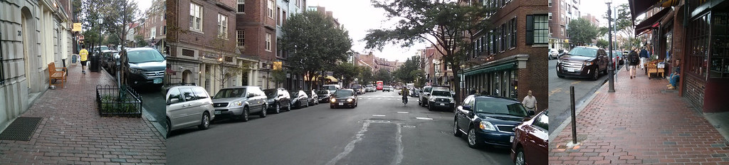 |
| Massive motorway -- tiny, oft-obstructed sidewalks. Ridiculous. |
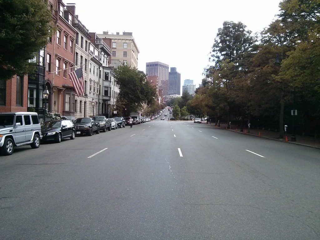 |
| Nothing more historic than a four-lane highway. Right? |
I understand the desire for historic preservation. I am, after all, a huge fan of narrow, medieval-style streets, such as those still found in some parts of Beacon Hill. I realize that historic preservation movements managed to save some parts of neighborhoods from the horrors of urban renewal and modernism. But there's a point where the movement becomes self-parody. This is one of those points: when cars are treated with more respect than people, the neighborhood has lost its way.
Remember the reason why historic preservation resonates with people: it's because the architecture of the latter 20th century is so terribly inhuman. Therefore, we cling to anything from the past, to buildings built during a time when designers still remembered how to relate to the human beings walking on the street. In a way, we're still stuck in the architectural Dark Ages, trying to feel our way out, trying to relearn was what forgotten during the modernist era. But one new idea that we do have right, in law if not in fact, is the notion that the city should be accessible to all its citizens.
Beacon Hill, get your streets in order. Put people first.
Tuesday, February 4, 2014
Boston's narrow streets are safest for walking and riding a bike: wide streets are the most dangerous.
 |
| A wide street, Brighton Ave: 80 feet wide. Chung-Wei Yang was killed by a bus here. |
But urban biking does present risks, especially in Boston with its narrow streets and aggressive drivers. In 2012, five cyclists were killed in accidents — though none in winter.This false, lazy sentiment about Boston's streets is unfortunately somewhat widespread. In fact, Boston doesn't really have many narrow streets. But, the narrow streets that Boston does have are one of its greatest advantages over other American cities.
In general, narrow streets are safer. From that study in Colorado:
“The most significant causal relationships to injury and accident were found to be street width and street curvature,” according to the report. “The analysis illustrates that as street width widens, accidents per mile per year increases exponentially, and that the safest residential street width is 24 feet (measured from curb face).”Even 24 feet is fairly wide (enough for two fast-moving traffic lanes), but that town did not have any smaller streets to study. Even without the research, it's easy to see that the main purpose of wide roads is to make it easier to drive faster -- and speed is the biggest danger to life and limb. One of the reasons New York City is having so many problems with street injury is because, other than a few, relatively small areas of Manhattan and Brooklyn, that city is cursed with extremely wide streets.
 |
| Huntington Ave (courtesy: Google): about 95 feet wide. Kelsey Rennebohm was killed by a bus here. |
 |
| Beacon St and Charlesgate West: at least 100 feet wide. Kanako Miura was killed by a dump truck here. |
 |
| Comm Ave at St Paul St (courtesy: Google): about 110 feet wide. Chris Weigl was killed by a tractor trailer here. |
Here's some more data. BPD identified several intersections which had the most crashes involving a bicyclist in 2012:
 |
| From Cyclist Safety Report 2013: most problematic intersections |
- Beacon St at Massachusetts Ave: 50 feet
- Massachusetts Ave at Beacon St/Comm Ave: 60 feet
- Harvard Ave at Brighton Ave: 50 feet
- Brighton Ave at Harvard Ave: 80 feet
- Comm Ave at Harvard Ave: 160 feet
- Huntington Ave at Belvedere St: 95 feet
- Belvedere St at Huntington Ave: 60 feet
- Columbus Ave at Cedar St: 70 feet
- Cedar St at Columbus Ave: 26 feet
All of those streets are very wide except for Cedar St; a small side street that is one of the only ways to walk or bike between two densely populated residential sections of Roxbury, and requires crossing the very dangerous Columbus Ave between two very long blocks.
 |
| Columbus Ave (courtesy: Google): about 65 feet wide. A woman was struck and killed here on Christmas Eve. |
I could keep going on and on, but I think I've made my point quite clear: wide streets are dangerous. Unfortunately, Boston has many wide streets, and it is very difficult to fix them once they are created. The best way to create safer streets is to build them narrower from the beginning. But in the rare cases where we have that opportunity, we are still building wide streets because people do not know or understand the danger. Engineers claim to try and anticipate future traffic growth, and they do not consider the costs of the wider streets at all. Fire marshals want wider streets and turning radii for their trucks, but they don't think about the people who will be killed or injured by those design choices. Architects like wide streets because it feeds their egos: they're always trying to build the next "grand Parisian boulevard" and, at least in the bad old days, they could care less about the human cost. Even the new planners, with their "complete streets", tend to favor wider streets: to squeeze more stuff onto. That is unfortunate. Complete streets should be seen as a way to reduce the danger of overly wide streets, not as an excuse to make the mistake of building wider streets from the start.
If we want streets to be safer in the future, what we really need is a program which encourages narrow, human-scaled streets, and also celebrates the narrow streets that we have inherited from the past.
Subscribe to:
Posts (Atom)