Article: Vertical farms offer a bright future for hungry cities.
My impression: It seems like it's just another set of wildly Utopian schemes along the lines of Ebenezer Howard's "Garden Cities." Except, instead of returning people to the farm, it's returning the farm to the city. The goal seems to be the same: curing those wicked sinful city folks with some virtuous farming and "green" space (of a sort).
However, if for whatever insane reason "vertical farming" takes off, I will then propose a revolutionary idea: "horizontal farming." It's where you go out to a place with lots of cheap land, abundant water and sunshine from the sky. Then you use the natural dirt and soil to grow lots of crops at very low cost, using machines such as "tractors" and "combines" to save labor. Finally, you ship it off to market using a highly efficient, fancy new technology called a "freight train." This lets you free up all that valuable land occupied by vertical farms in cities, turning it over to be used by much needed housing developments, employment opportunities, schools and parks.
Showing posts with label greenspace. Show all posts
Showing posts with label greenspace. Show all posts
Saturday, August 30, 2014
Wednesday, August 7, 2013
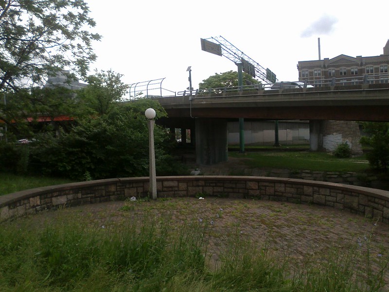
The Bowker Overpass and Storrow Drive
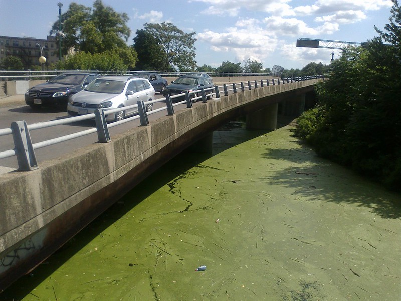 |
| Who says we don't have Green Space here? |
This is an unfortunate, though not entirely unexpected development. The Bowker Overpass crosses the Mass Pike and covers the Charlesgate Park: once the "crown jewel" of Olmsted's Emerald Necklace; now reduced to an overgrown, weedy hideout for bums.
The portion over the Mass Pike can't be escaped, but the overpass of Charlesgate Park is actually redundant with the surface roads. It was built at a time when grade-separation was all the rage: the 1950s and the heady days of highways. The Bowker Overpass combines with a spaghetti mess of ramps to interchange with Storrow Drive: consuming large portions of the Esplanade which never should have been taken in the first place.
Mostly unusable "greenspace" due to the ramps (google)
All of this was constructed before the Mass Pike was extended into downtown Boston. It has not aged well. Storrow Drive is decrepit, a blight on the city that acts as a barrier between Boston and the Charles River. The Storrow Drive tunnel/double-deck roadway is in miserable shape; it was even recently rated the Most Dangerous Bridge in the country. Repairing the Bowker Overpass without talking about the Storrow Drive tunnel is irresponsible.
The fact is: the city and MassDOT need to have a serious conversation about grounding Storrow Drive. The 1950s grade-separations are falling apart: they have long exceeded their lifetimes and were not properly maintained either. And we should not shackle ourselves to outdated 1950s ideas about automobiles and the city. It is not such a fascinating idea anymore that you could drive your car on swirling ramps through the air to avoid intersections. Nowadays, we're more focused on connectivity, and accessibility; two things which grade-separation is bad at achieving within reasonable expense.
Once you manage to get on the grade-separated Storrow Drive, you're essentially trapped. You have very poor access to the various streets in Beacon Hill, the Back Bay, Kenmore, or Allston. And there are very few places to cross the highway: so if you are looking to spend time near the river, you have to find one of the few bridges across. This also hurts safety: poor connectivity leads to fewer "eyes on the park" at night, and makes it harder for police to patrol the area.
Grounding Storrow Drive and the Bowker Overpass could achieve many things:
- Rid us of a festering sore under the overpass.
- Restore a ton of parkland currently cordoned by ramps.
- Connect the Esplanade more closely to the city, increasing accessibility and safety.
- Connect more of the street grid to Storrow Drive, easing access for all modes.
- Save a boatload of money not rebuilding the $300+ million separation structures.
- Reduce construction nightmare that rebuilding the Storrow tunnel would entail.
What's the catch? Well, it might take a little bit longer to drive to your destination via the same route you used in the past. On the other hand, you might also save a lot of time by not having to go around and around in loops on one-way streets. I know that some traffic engineers will be screaming that this represents a "downgrade" but they can take that attitude back to the 1950s where it came from. For the rest of us, this would represent an upgrade: a better city. Plus, $300 million saved! Heck maybe more. I suspect that any attempt to replace the Storrow tunnel will quickly turn into it's own "little Big Dig" with rapidly inflating costs. That's a lot of money that could be put into so many other, better, actual improvements. Like making the MBTA an attractive option for people who currently feel like they have no alternative but to drive along this way.
How MassDOT approaches the impending dilemma of the Bowker Overpass and the related Storrow Drive tunnels will tell if they are really serious about their "GreenDOT" proposal or not.
Friday, May 25, 2012
The definition of Greenspace
"Greenspace": An open lot covered with some form of green plant matter primarily for the purpose of satisfying some kind of aesthetic, bureaucratic or other formal requirement. A greenspace is not intended for direct use or enjoyment by people.
 |
| The BRA map and the Google satellite map of the Monsignor Casey Overpass |
Menino said sometimes people have to think outside the box and his vision would have the overpass being rebuilt with green space underneath it. That would connect Arnold Arboretum to the Franklin Park, creating one continuous line of green space, he said.
 |
| The Casey Overpass (src: MassDOT) |
The image at the top of this post is a great example. The BRA has highlighted in green the areas that it considers to be "Greenbelt Protection Overlay Districts." Curiously, nearly all of the space covered by the "Greenbelt" designation is actually occupied by highways for fast moving vehicular traffic, with manicured median strips. Such a "green" space is not created to be directly enjoyed or used by anyone. It is created purely to please the vanity of planners, with nary a thought to the folks who actually have to live with the consequences. From the heights of their offices, or from the windows of their chauffeured cars, they can look out, smile and nod to themselves, "Yes, we have provided the people with more green."
Update: I had forgotten that Nathan Lewis wrote a really good article about this "greenspace" problem a while back: Place and Non-Place. Check it out.
Subscribe to:
Posts (Atom)