Pages

Showing posts with label mbta. Show all posts

Tuesday, May 26, 2015

Happy 115th birthday to the Green Line "B" branch, and thoughts on the future

Commonwealth Ave when it was provisionally named 'Massachusetts Ave' in 1885 (source)
The section of Commonwealth Avenue between Packard's Corner and Chestnut Hill Avenue was largely built in the 1890s. Trolley service along this relatively new stretch of Comm Ave began May 26th, 1900. Prior to that, service to Lake Street typically ran via Beacon Street and Chestnut Hill Avenue.

Construction of Comm Ave near Lake Street (source)

Trolley service near Wallingford Road, in the early years (source)

A description of a journey that was published in 1904:
From the Newton line, by taking a Commonwealth Avenue car, another attractive ride is afforded for the return journey. The car turns off to the left and runs through a delightful combination of city and country until it reaches the Brighton junction, off to the left being the links of the Kenilworth Golf Club. At Pleasant Street, on the left, may be seen the links of the Allston Golf Club, and one of the most picturesque county clubhouses in the country is visible across a little pond. The car comes back into Beacon Street again after passing Cottage Farm station

Yes, it existed: the Allston Golf Club house (source)
Tudor Manor, 1930 (source)
The electric streetcar service would eventually attract the transit-oriented development of the avenue that we see today, with large, graceful apartment buildings of various styles from the early to mid-twentieth century. Sadly, the current zoning code (from 1990) has chosen for aesthetic reasons to retroactively ban these kind of apartment buildings, and so none of them could be built today without many variances. That's a strange policy to maintain in a city that is ostensibly trying to generate housing units that are attainable to people of middle-class means.

Comm Ave near Allston Street, present day

1958 view from near Washington Street, during road-widening construction (source)

Snow didn't stop them in 1938, near Warren Street (source)
I was fortunate enough to view a presentation on the history of Comm Ave last year but it was not until recently that the slides and pictures were made available on-line. For more of these pictures and history, please visit the website.

What we now call the Green Line "B" branch has gone through many changes over the years. Obviously when the MBTA was formed, the rebranding changed it from merely having a streetcar number into being integrated as part of the color-coded 'rapid transit' map (sadly, while not really improving service). The reservation has been shifted towards the center as part of road-widening efforts in the 1950s and the 1970s, resulting in the awkward intersection at Warren Street, where work ceased. The trolleys gave way to big 'light rail vehicles' that now carry approximately 30,000 passengers a day, averaging a snail-like 6-10 mph due to overcrowding and degrading infrastructure. The stations have not seen much in the way of upgrades, either, largely remaining as tiny asphalt strips with the occasional concrete barrier or plastic shelter added.


Chestnut Hill Avenue station platform (for thin people only)

Looking down the hill

At times, many stops were eliminated or consolidated, most recently about ten years ago, when Mt Hood Rd, Summit Ave, Greycliff Rd, and Fordham Rd were permanently retired to help improve spacing. We're looking forward to having another four closely-spaced stations be consolidated into two appropriately-spaced, fully accessible stations. The T has promised us signal priority for years, and claims to be experimenting with it. We're still waiting for the use of all doors on the surface to help speed up boarding and alighting, as well as full accessibility for everyone.

As the twentieth century progressed, Comm Ave was turned more and more into an asphalt wasteland: big sections carved out for angled parking, with a few sickly looking trees inhabiting the neglected median islands that were left. The Green Line and its riders were largely disregarded, probably considered relics of the past that would be replaced by mass car ownership and buses. But the Green Line is a survivor. Despite how poorly it has been treated by the city and the MBTA, the "B" remains the busiest branch of the Green Line, and the surroundings remain highly transit-oriented, with some of the lowest car ownership rates outside of Boston proper.

We have an opportunity to change the future. The city is brewing up a design for what they call Comm Ave Phases 3 and 4. That covers the section of Comm Ave from Packard's Corner up to Warren and Kelton Streets. This is part of the section that was constructed in the 1890s, and it's 200 feet wide, a lot of space. Despite that, daily vehicle volumes are very low, about 12,000 ADT, a figure which is low enough that it could easily be handled even on a street with merely a single lane in each direction. Clearly, this should be a street designed for people. The city has claimed that they are going to do something to make the avenue much more friendly for walking, biking, and riding the Green Line. They claim that they will do something about the fact that there are extremely long intervals between crosswalks (and then those are also inaccessible to the disabled), with a fence blocking off part of Allston/Brighton from another. They claim that they can restore the idea of a Comm Ave 'greenway', an echo of its original conception, a park that connects from the Charles River to the Chestnut Hill Reservoir. The 21st century version of Comm Ave could be a lot friendlier to the community. But only if we remember to show up and hold them to it.

Wednesday, April 15, 2015

It's not so easy to re-route buses in Boston

The Boston Globe ran an editorial today calling for the MBTA to radically re-examine its bus routes:
If Charlie Baker wants to find inexpensive ways to improve the T, he might consider one fact: In 1954 — two years before he was born — the 34 bus ran from Forest Hills, down Washington Street past Roslindale, and onward to the Dedham line. 
In 2015, it still does.
The map of where the T runs its buses would appear to be etched in stone: In some cases, today’s MBTA buses are still running along the same routes as the trolleys that preceded them. Yet the city surrounding those buses is unrecognizable, with huge population shifts and the emergence of whole new employment centers.
That sounds like one of those "smart managerial" pieces of advice, but in fact, it's mostly bullshit. I'll go into why later, but first I will mention a few things that should be done with the buses to make them run better:
  • Dedicated bus lanes
  • All-door boarding, all the time
  • Signal priority
  • Queue-jump lanes where needed
  • Further stop consolidation where appropriate
  • Upgrade to full accessibility everywhere
  • Clean-up of confusing numbering or naming
  • Well-targeted re-routings that either clean up twisty "coverage" routes or,
  • Provide better routes through and into bus hubs and major stations like Dudley.
However, instead of promoting those ideas, for whatever reason, the Globe editorial aimed directly at the 34 on Washington Street. A re-routing of that bus makes little to no sense whatsoever. They want a study? I'll do a study for free, with help from you, the reader. Let's take a look at Washington Street in Roslindale:


Go ahead, zoom in and out, follow it along. What will you see? There are no parallel streets to Washington Street in Roslindale! In fact, the 34, along with a whole host of other buses along Washington Street, follows a straight line, the only possible one. Actually, as far as route geometry goes, it's nearly ideal. So if I may quote Jarrett Walker, the 34 is already mostly as good as it gets, geometrically-speaking: "An efficient transit line -- and hence one that will support good service -- connects multiple points but is also reasonably straight so that it's perceived as a direct route between any two points on the line." The 34 itself is nearly perfectly a straight line, and it serves a street that is nearly perfectly a straight line.

The companion route 34E continues that straight line, except to diverge at one point for the Dedham Mall. And at the point where it diverges to serve that suburban mall, it turns out that it's really difficult politically to do anything about that. But the problem there is that a suburban mall like that is nearly impossible to serve well with transit. The error lies with the land use, not with the bus planning, which is trying to make the best out of a mess. I'd support a re-routing that gets the 34E out of the Dedham Mall if that were possible. But that goes to my point above: a targeted re-routing. There's simply no way to take the 34/34E off of Washington Street itself because there are no alternatives. And a whole century's worth of development has taken place with the idea of there being frequent service along Washington Street. That's nothing to scoff at. That's simply how Boston has developed.

Now you could reasonably argue that perhaps the 34/34E just needs to be folded into a more comprehensive scheme of naming and numbering the various routes that ply Washington Street in Roslindale. It's a confusing soup of routes, and probably the busiest bus corridor that is not designated on any key bus route, a fact that is a travesty. You could also probably reasonably argue that Washington Street needs more buses, as well as the various street improvements that I described above. That's all good. But that's not what the Globe editorial called for:
While the T often changes the frequency of buses, treating the routes themselves as sacrosanct is a recipe for inefficiency. To make sure the T is maximizing the value of its buses and drivers, the agency should imagine how the map would look if it were building a Boston bus network from scratch, based on today’s population and economy — not that of 1954 or 1912.
First of all, the MBTA needs to do a bus service planning process update. It hasn't had the funding to do so in a few years. Getting that done is a good idea! But it won't involve re-routing buses, so apparently, that's not good enough for the Globe. Instead they'd rather have the T spend money on a study that can only come to one conclusion: that there's no alternative to Washington Street for the 34/34E. That's wasteful.

The problem, more generally

I promised earlier that I would describe why Boston's street network makes the bus re-routing style of optimization that was accomplished in other cities much harder here. Not always impossible, but of much more questionable value, especially for the really heavy workhorse routes. You could probably find some changes in a meandering route like the 51, but that's small potatoes. No, the reason that Boston's bus network largely follows the streetcar routings of a century ago has to do with the way Boston developed: as an amalgamated set of Streetcar Suburbs.

At this point, some folks might say: "Oh Boston, all those cow-paths!" Well that's a cute but apocryphal story. And it's not the part of Boston that I'm concerned with right now. The downtown streets that were laid out in the 17th and 18th centuries are wonderful, great, and not really plied by many buses at all. The streets of the Back Bay are mid-19th century and still follow that nice, connected, pre-streetcar pattern. But once you get outside of Boston proper, into the territories that were annexed in the late 19th century, into the portions that were really built by the streetcar, things change. Let's take a look:


This section of Blue Hill Ave was once served by the "29" streetcar but is now served primarily by the key bus route 28. If I may summarize the story of "Streetcar Suburbs" very quickly and very broadly: These suburbs were laid out by developers interested in maximizing their investment by providing streetcar access to as many homes as possible. The streets were often privately built and "donated" to the town/city later. What mainly characterizes these streets is the long blocks that feed primarily into a single, wide avenue where the streetcar ran, moderated by hills and valleys. The result was a kind of "hierarchy" of streets that would later be taken to extremes by auto-centric suburban planning, but at this point in history was merely a result of trying to maximize investment in the streetcar adjacent plots of land.

What you should notice right away, again, is that: there are no efficient alternative routings. This is not a freak accident. It's a very, very common pattern throughout Boston's inner streetcar suburbs. I actually brought this up at the YPT event with Jeff Speck, if anyone happened to be there, and it's an endlessly frustrating quirk of a large number of Boston's neighborhoods that impacts us in many ways other than bus routings. Besides Blue Hill Ave and Seaver Street, there's Columbus Ave and Tremont Street, Warren Street, Washington Street (Roxbury, Dorchester, South End, Roslindale, and Brighton editions!), Dorchester Ave, Columbia Road, Huntington Ave and South Huntington/Centre/South, Massachusetts Ave, Beacon Street, and Commonwealth Ave. I'm sure you could name more. These are all streets that were built in neighborhoods that have all traffic (foot and vehicular) funneled onto them. Intentionally. And there are not any easy alternatives, especially when dealing with heavy buses that shouldn't be making awkward turns onto small side streets.

The Boston Elevated Railway company understood this. That's why their version of Boston's streetcar network was based around the idea of hub-and-spoke: feeding the surface lines into big hubs around rapid transit stations. Now, Jarrett Walker's great idea in many other cities is to take a bunch of duplicative, one-seat-ride-style routes, and to reform them into a more powerful grid using connections. But Boston's surface line system is already based around the concept of using connections: to the rapid transit network, and also to each other. Yes, it's not a grid in the sense of San Francisco, but Boston doesn't have a grid of streets. It doesn't even have good connectivity of streets, outside of the core. That's why the rapid transit lines have been so important and are so heavily used in proportion to city size: because they cut through the web.

These are the major surface lines on the Boston bus network today, frequency-mapped [full-size]
The surface line network is a web of routes woven onto a set of rapid transit points. The buses largely follow the streetcar network because the streetcars built the streets in the first place. And those same streetcars laid out the development patterns in the 19th century that we still live with today. I live in a building that was erected in 1895. Most people in Boston live in buildings that are over 70 years old. That's no accident. When zoning was legalized and authorized in the 1950s, it basically squelched small, incremental redevelopment. That's one reason why we still have single-story retail. It's also one reason why most of us still live in the same places (often the same buildings) and follow the same patterns that people of a hundred years ago did. The other major reason is path-dependency: it's hard to change things that thousands of people depend upon. Such changes often came about because of massive mega-projects, and often for the worst reasons.

Change does happen

I just spent a lot of time explaining why it's hard to change bus routes in Boston. But now I will offer some examples of where change does happen. First of all, I have to be thankful for the existence of the Transit History Roster of the MBTA. Now, let's take a look at the kind of changes that we see. The 1 actually provides a good example straight away: "This route was created in September 1962 by merging Routes 76 Harvard-Mass. Station and 47 Mass. Station-Dudley." Not really a re-route, just a through-routing that was probably happening anyway for equipment management reasons. Or maybe because the trolley barn on Newbury was being closed.

Let's look at a route created in the MBTA era: 47 "This route was initiated as a brand-new Monday-Friday only cross-town service in April 1972. The route traveled in new territory between Kenmore Sq. and Dudley via Brookline Ave, Longwood Ave, Huntington Ave, Ruggles St. and Shawmut Ave." Obviously there have been further changes to the route since then, and if you go to page 190, you can read the gory details. The 47 was created in 1972 to serve one of the "new economy" nodes that the Globe crows about: Longwood Medical Area. And it is well-used, in my experience, being packed to the brim. It needs higher frequency. It needs bus lanes. It does have a few jogs that I find to be obnoxious: The U-shape it makes inside of Longwood; the loop around Ruggles; the in-and-out it does to serve Dudley. But you cannot eliminate those jogs without annoying key constituencies. Longwood, Ruggles, and Dudley are important nodes. It's really not clear how the 47 could be better routed while still serving those nodes. I bet some clever street reconfiguration could make it a lot less painful, however.

The problem that Longwood has always had, and the 47 is only a band-aide, is that it was built up in a bit of a transit dead-spot. The "D" and "E" branches of the Green Line tangentially glance off of it. Those stations are heavily used by LMA workers, despite the walk, which is great. But barring the sudden appearance of $10 billion from the sky, to dig a tunnel, the LMA will never have the same kind of powerful, frequent radial transit that the Back Bay enjoys, for example. There's some hope for the Urban Ring to descend upon us and provide a real upgrade to the 47, but I'm skeptical about it ever happening. That's another article, for another time, though.

A major change happened when the Southwest Corridor was opened and the Orange Line was moved from Washington Street. Many buses had to be rearranged slightly to connect with Ruggles Station instead of or as well as Dudley. In fact, key bus route 28 was created out of pieces of two former streetcar routes at this time, and extended to serve Ruggles. The resulting route is approximately as direct a path as you can get between Mattapan, Dudley, and Ruggles, and it also happens to pick up right in front of Roxbury Community College. It's hard to imagine what other routing could accomplish so much. It's already one of the top buses in the system, by ridership. What it needs is dedicated bus lanes, signal priority, and all-door boarding. Yes, it's possible that the 28X package that was offered up a few years ago could have achieved some of that. I wasn't involved so I don't know first-hand what went wrong. But I've heard second-hand that the reason it failed was that it was shoved suddenly and heavy-handedly, from the top-down, on a riding community that was wary of changes arriving in such a manner. Much like the Melnea Cass BRT plan from two years ago that was roundly rejected. What this teaches us is that bus routes are political topics and it's important not to approach them from a purely technocratic viewpoint, as much as such technical ideas are useful for steering the conversation.

A commission to "re-examine bus routes from scratch" would be stirring up a hornet's nest for very little gain. Maybe some twisty routes like the 51 could be rejiggered. But we're not going to be cutting new streets through existing neighborhoods anytime soon, I hope. A committee to examine the routing of the 34 bus on Washington Street (Roslindale) is going to come back with same result every time: keep it on Washington Street, duh. The 77 should stay on Mass Ave (and no, the Red Line extension to Alewife did not eliminate the need for the 77 to Harvard!). Blue Hill Ave south of Grove Hall needs to be served with lots of buses. That's not going to change. What might change the bus network is the opening of the most recent rapid transit line to be built: the Green Line Extension. But how that will change things remains to be seen.

Instead of wasting time debating the routing of the 34, the 28 or the 77, we should be focusing our resources on getting bus lanes, signal priority, full accessibility, all-door boarding, more efficient routes through stations, clearer route information, more buses, more service, and the like. We should be clear about the goals of various bus routes, whether it be "Coverage" or "Ridership". Some of this could happen through the supposedly 'biennial' service planning process, if it were funded again. And some of it requires coordination with the city of Boston and the various other municipalities in the area. Perhaps the new "future focused transportation improvements" policies from the city are an indication of changes to come.

Saturday, March 28, 2015

"Self-checkout" for passengers boarding trains and buses

While walking to the supermarket today, I passed by a trolley boarding a line of riders, at a station platform. One person would step up to the top stair, pay the $2.10 fare, and go inside. Then the line would slowly move along, trudging through the wind and snow.

At the supermarket, I collected my food and items, went to the self-checkout aisle, rang up $33, and paid it. I took my receipt, my bags, and went home. All of this accomplished without any waiting on line, nor with any interaction by a store employee.

As I was walking out the door, I realized how bizarre the difference was: I could be trusted to ring up and pay for $33 of assorted items at the supermarket, but not a $2.10 trolley ticket nor a $1.60 bus ticket. And that's hardly unusual. Many retail businesses have moved to the self-checkout model. It's a natural way of cutting costs and speeding up service, especially in the modern era. Yet, the MBTA continues to waste money, and everyone's time, delaying trains at stations while riders slowly file through a single door.

The stakes are higher for the T than for a retail shop. Delays to a transit vehicle add up and propagate. The long line at the station platform translates to a train that's late. Bunching gets worse. Lines get longer. The average speed of the system drops below 7 mph. Riders get antsy. Half-hour trips stretch out into an hour. People can't get on or off the vehicle easily anymore, while the driver hoarsely shouts "move to the rear!"

Wouldn't it make much more sense to use all the doors for boarding and alighting? The rear doors on the trolleys are wider as well. The newer ones have floors that are level with the platform, making it much easier for people with disabilities. Reduce delays, improve quality of service, help people with disabilities. Win, win, win.

In fact, it's such a good idea, that in San Francisco, the local agency MUNI decided to transition to all-door boarding on all of their vehicles. In the past, I have commented on my experience with MUNI's all-door boarding system. MUNI has a lot in common with the MBTA: an extensive subway-surface trolley network that uses light-rail vehicles nowadays, and many connecting buses.

Recently, MUNI released a report on their experience allowing all-door boarding of buses and trolleys system-wide. It has been a great success. The MUNI report identified three key findings:
  • Shorter Stops – Legalizing All-Door Boarding has encouraged boarding customers to distribute themselves more evenly between the front and rear doors, thereby reducing average dwell times. Pre- and post-implementation surveys at busy Muni stops found average reductions of 1.5 seconds (38%) per customer entry or exit. All-Door Boarding also has improved dwell time consistency and lowered variability, an important factor in helping reduce vehicle bunches and gaps and making service more reliable and predictable.
  • Faster Trips – From FY 2010-2011 through FY 2013-2014, average bus system speeds (including stops) improved modestly from 8.41 to 8.56 mph (2%). All-Door Boarding has helped keep Muni moving during a period of rapid growth in San Francisco and increasing demand on the transportation system. All-Door Boarding is just one of many tools such as exclusive transit lanes, transit signal priority and parking management that together can help reduce travel time.
  • Improved Fare Compliance – A series of four fare surveys between 2009 and 2014 indicate that fare compliance continues to improve. The fare evasion rate has decreased from 9.5% to 7.9% over five years and the estimated uncaptured revenue due to fare evasion has dropped from $19.2 million to $17.1 million.
I hear that, especially after this winter, the MBTA is looking for opportunities to do more with less. How about a method that is proven to improve reliability, reduce costs, and generate positive cash flow? What are they waiting for!?

And, why not do exclusive transit lanes, signal priority and parking management as well, while they're at it. It looks like they have a willing partner in the city of Boston.

Sunday, March 22, 2015

Comm Ave Phase 2A public meeting: Tuesday March 24th


March 24th, 6 p.m.
565 Commonwealth Ave (Kenmore Classroom Building)
Room 101

The city is holding their long-awaited Comm Ave Phase 2A public meeting on Tuesday. This deals with the segment of Comm Ave between Packard's Corner and the BU Bridge (non-inclusive). One of the biggest topics of contention has been whether or not the bike lanes would finally be fixed on Comm Ave to match the Boston Bike Network plan for having a protected bike lane on Comm Ave.

The status quo
Good news seems to be that they will be presenting some kind of protected bike lane option at the meeting, so that represents a major step forward for the city. The precise details remain to be seen.

Another one of the major problems on the street is the lack of a crosswalk at Alcorn Street and Naples Road. On one side is a densely populated residential area, on the other side is the neighborhood supermarket. Most people simply wait and cross the street over the tracks when clear. But, the engineers believe that people should be walking over 1,000 feet out of their way, traversing 6 extra traffic lanes and waiting through extra cycles of the traffic light, simply to get across the street. While carrying heavy bags. This is a clear case of a disconnect between the planning department -- who only see this street on paper -- and the people who live here.

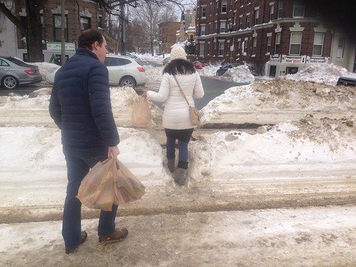
Even in the heavy snowfall, people would still rather cross here than go around the long way.

(source)
So, while there has been a great deal of progress made on the design, compared to where it was 3 years ago, there is still some more to go.

Finally, I would like to mention that although the MBTA has finally put out a plan for much-needed station consolidation, it is not clear that they will be ready to go before the city starts the reconstruction project. That will put us in the absurd situation of rebuilding the street around the 4 old stations. Then, presumably, the MBTA will come along and cut those out, and rebuild 2 properly accessible stations, but at that point they will simply leave the old station locations as dead space. That's a terrible waste, and a lot of extra pain too -- as the time period of construction would be lengthened. It seems to make a lot more sense to simply get both projects done simultaneously, so that the new street doesn't have to waste space, and so that the station construction can proceed in parallel with the street reconstruction, in a fully integrated fashion.

Friday, February 20, 2015

Snow daze

Spotted this while passing through -- first snow of the year and it's still fun for bicicle snow man
Blizzard returns streets to people
Best way of getting around now
No revenue service, but trains clearing snow still need a second operator apparently!
A space taken by automobiles returned to the people for one day.

Headed for the hills
Second best way of getting around in the snow (after skiing)

Such a strong desire line @ Naples Rd that people climb mounds of snow to use it
Snow soccer in what is regularly a dangerous intersection
Walking is the dominant mode of transportation on Comm Ave
Even on the deteriorating highway overpass, with tiny sidewalks
Guess who the city doesn't care about!
I could not navigate this canyon
Not a flake on the ground for drivers, however!
The bus stop is starting to disappear beneath the mounds of snow
Beautiful nearly dry pavement for motorists -- slush for people walking.
Cambridge Street overpass of I-90 is even less friendly in a blizzard
Sidewalk's gone
All that remains of the Framingham line
That Kenmore Square crosswalk STILL hasn't been cleared out
Park your car on the sidewalk and avoid shoveling snow! City says: "No violation found" either.
Relics of civilization pasT
Ah screw it
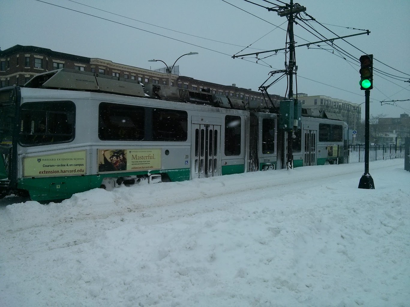
The Green Line is canceled and now what?
Snow tracks
Free (illegal) parking deemed more important than transit
Let's build a mountain of snow on the tracks!
The mountain is moving faster than the Green Line: faster than zero
The 57 cannot handle the load even late at night
Naples Rd desire line strong as ever, no matter what
They're waiting for the shuttle bus that may never come

Sunday, January 11, 2015

Taking a look at Green Line average speeds by hour of the day

Stairs can make boarding
be unnecessarily difficult
for some people.
With the real-time data available for the surface Green Line since mid-October, I thought I'd try some analysis with my gathered database. One thing we can look at is average speed of travel. Although the trains can ostensibly move at up to 25 mph in their dedicated lanes, or even faster off-street, they tend to spend a lot of time waiting at signaled intersections and station stops. In fact, the more passengers that are trying to use the system, the slower trains tend to go: overcrowding results in long dwell times as it becomes harder and harder for people to squeeze on and off the train. This effect is made worse whenever the MBTA forces everyone to use only the front door for boarding and alighting the train. The front door is small, and it has stairs, which makes the process take much longer as everyone has to slowly file in and out of the tiny opening.

The net result is that the Green Line can sometimes feel like it is traveling more slowly than if you walked. Well, perhaps that is hyperbole. However, it is possible to outrun a Green Line train on the "B" branch. A typical human runner, with some training, can sustain about 8-9 miles per hour. So we should expect to see average "B" branch speeds in a similar range.

The first thing we can do is consult the schedule by using a convenient mapping website to plot a trip from Boston College to Blandford Street at 8 o'clock in the morning. We find that the MBTA expects a "B" train to take about 27 minutes to cover the approximately 4 mile distance. That's about 8.9 miles per hour. Does that match up with the findings from the real-time data?

The following zoomable line chart is derived by calculating average speeds for the surface "B" branch during each hour of the day from 5 a.m. through 11 p.m., and breaking it down by week. So, for example, we can see that on the week of November 3rd, average speed at 8 a.m. was about 6.79 MPH and at 5 p.m. (hour 17) the average speed dropped to 6.61 MPH. That corresponds to an approximately 36 minute trip between Boston College and Blandford Street. Note that this chart does not distinguish one direction from another, so it is quite possible that the peak direction is much slower and the off-peak direction moves more quickly.


Plot of "B" branch average speed in MPH for the hours of the day from 5 am until 11 pm, looking at each week in November and December separately.


The weeks with the most rapid travel appear to be the final two weeks of December. This is not surprising. Much of the passenger load on the "B" branch comes from the universities, and those are on break during that time. Slightly surprising is the distant third-place finish for the week of Thanksgiving. Although the performance is better than the "normal" weeks, it is still rather low for a week when most students are traveling.
The "B" branch gets busy during the
off-peak hours as well.

In any case, the shape of the chart overall is telling. The two major valleys correspond to the traditional rush hours, when crowding on the Green Line grows extreme and dwell times increase accordingly. The most snappy performance is found either in the very early morning, or later in the evening. There seems to be a slight bump around 9 p.m. that might correspond to the late dinner and nightlife rush.

The difference between an average speed of 6.61 MPH and 10 MPH doesn't seem like much, but it is actually quite a bit: that's a difference of 12 minutes in end-to-end trip times. If the Green Line can manage an average speed of merely 10 MPH on a consistent basis, then a typical passenger can realize a savings of up to 12 minutes on their commute each way. That's pretty significant. Especially if you are able to increase reliability and cut out the variances that can sometimes lead to 15, 20 or more minute delays.

That's why I find prosaic improvements such as proper station spacing, transit signal priority, and all-door boarding to be vital. They don't have the same flashy pizzazz as building a new section of subway. But they can achieve much of the same benefit at a fraction of the cost.