It's been a bit over a week since Anita Kurmann was killed in a crash with a turning truck that then drove off without stopping. Few details are available but there are two things that we can be certain about: first that it is a terrible tragedy, and second that little to nothing will be done to prevent such tragedies in the future. There are possible alleviating measures that exist and could be required by proper regulation, including truck side-guards, or restrictions on the size, weight, number of axles, and length of trucks that are allowed on certain city streets. Our public street rights-of-way were laid out long before the concept of a 5-axle, 40 ton, 53-foot long truck was ever conceived. And it is difficult to imagine how a human-friendly environment could ever be compatible with such behemoths.
Although technically receiving more oversight than the personal car, the trucking industry is remarkably regulation-free compared to other transportation sectors. No other form of transportation allows size, weight and maneuverability concerns to be so radically dismissed in the same way. Air traffic control would never allow an oversized jumbo jet to land at a tiny airport. Railroad companies would never tolerate oversized freight cars that slammed into bridge abutments. Yet, for some reason, when it comes to the road, we simply shrug when oversized trucks cause death and destruction on a daily basis. It is curiously ironic that city planners have spent the past century meticulously separating people's homes away from industry, but still continue to design extremely dangerous, high-speed roads carrying heavy industrial truck traffic right next to those very same homes.
When it comes to regulation of motor vehicles, all the furor seems to focus around taxicabs vs Uber, where the regulations have no safety purpose, but are just one piece of a tug-of-war between the few dirty 1970s-style dirtbags who run the taxicab business and the slick B-school douchebags who run Uber. And when it's not about profits, it's about traffic speeds, because the only thing, besides money, that seems matter to people in power is convenience for suburban drivers. Such regulation has nothing to do with safety and everything to do with privileging the powerful. Meanwhile, some drivers manage to keep their license long enough to score four OUI offenses and kill someone. Or even when the police determine that a driver is an "immediate threat" the antiquated system cannot process the paperwork in time to prevent him from killing. Those are some real examples of problems that could be fixed with proper rules, procedures and regulations. I wonder if it will ever happen.
The trouble is, of course, that regulations are not created solely based upon merit in achieving objective goals such as safety. Regulations are a product of politics, a swirling morass of money, culture, personal vendettas, and tribalism. 149 people were killed by motor vehicle crashes in the first 6 months of this year. But no politician is going to be held accountable for that carnage. Few voters even spend much time thinking about it. So the perverse story doesn't change from year to year. I won't pretend to have an answer, but I will note that if the problem is politics, then the solution has to be too.
Showing posts with label safety. Show all posts
Showing posts with label safety. Show all posts
Monday, August 17, 2015

Sunday, March 22, 2015
Comm Ave Phase 2A public meeting: Tuesday March 24th

March 24th, 6 p.m.
565 Commonwealth Ave (Kenmore Classroom Building)
Room 101
The city is holding their long-awaited Comm Ave Phase 2A public meeting on Tuesday. This deals with the segment of Comm Ave between Packard's Corner and the BU Bridge (non-inclusive). One of the biggest topics of contention has been whether or not the bike lanes would finally be fixed on Comm Ave to match the Boston Bike Network plan for having a protected bike lane on Comm Ave.
 |
| The status quo |
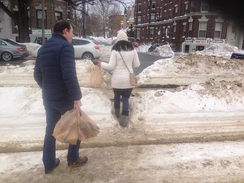
Another one of the major problems on the street is the lack of a crosswalk at Alcorn Street and Naples Road. On one side is a densely populated residential area, on the other side is the neighborhood supermarket. Most people simply wait and cross the street over the tracks when clear. But, the engineers believe that people should be walking over 1,000 feet out of their way, traversing 6 extra traffic lanes and waiting through extra cycles of the traffic light, simply to get across the street. While carrying heavy bags. This is a clear case of a disconnect between the planning department -- who only see this street on paper -- and the people who live here.

Even in the heavy snowfall, people would still rather cross here than go around the long way.

 |
| (source) |
Finally, I would like to mention that although the MBTA has finally put out a plan for much-needed station consolidation, it is not clear that they will be ready to go before the city starts the reconstruction project. That will put us in the absurd situation of rebuilding the street around the 4 old stations. Then, presumably, the MBTA will come along and cut those out, and rebuild 2 properly accessible stations, but at that point they will simply leave the old station locations as dead space. That's a terrible waste, and a lot of extra pain too -- as the time period of construction would be lengthened. It seems to make a lot more sense to simply get both projects done simultaneously, so that the new street doesn't have to waste space, and so that the station construction can proceed in parallel with the street reconstruction, in a fully integrated fashion.
Tuesday, January 20, 2015
False pretexts: motorists only pretend to care about ambulances when doing so happens to be convenient
Two bits of news hit recently that may seem unrelated, at first: Lawmakers seek crackdown on highway protests:
Rep. Colleen Garry, a Democrat from Dracut, proposed making it a felony to block highways. She told the Lowell Sun she was furious about the Thursday morning protests that blocked two sections of the heavily traveled highway through Boston, one north of the city and one south.
"I'm just outraged that people would be that reckless," Garry said. "Everyone has a right to protest, but to do that kind of thing in a highway or a roadway?" [...]
Nearly 30 protesters were arrested and arraigned on charges including trespassing, disorderly conduct, resisting arrest and willfully obstructing an emergency vehicle.
State police said an ambulance transporting a seriously injured car crash victim to a Boston hospital was forced to divert to a hospital outside the city that did not have a trauma unit. The man survived.
State Sen. Richard Ross, a Wrentham Republican, filed legislation that would impose a minimum $5,000 fine and allow a jail sentence of up to six months for willfully trespassing on state highways. Current law allows for a maximum $50 fine and a jail term of no more than three months.And the same week, State to propose opening S. Boston Bypass Road to all drivers:
State transportation officials will file a notice in February with Massachusetts environmental regulators to allow cars coming into South Boston to use the Bypass Road, which is currently restricted to trucks and other commercial vehicles. The pilot program would last six months and could begin as soon as March. [...]
The 1.1-mile road was built to accommodate trucks during the construction of the Central Artery, and when the tunnels were done, the road remained restricted. But as traffic becomes heavier in the fast-growing Seaport District, there has been pressure to open up the road to everyone. [...]
As part of its filing, the state will also propose letting all drivers use the high-occupancy vehicle lanes outside of South Station and the South End.These two pieces of news are, in fact, related: because together they illustrate the hypocrisy and insincerity of our Commonwealth's transportation policy with regard to emergency vehicles. If our elected officials truly cared about emergency vehicle response time -- which they should -- then they would put a quick end to this proposal that will destroy the efficacy of both the South Boston Bypass Road as well as the HOV lanes outside of the South End. If not, then it is quite clear that these politicians, Rick Ross and Colleen Garry, are merely posturing and mouthing platitudes, all while silently sticking it to emergency responders. By far the most common obstacle for emergency vehicles on our roads is not protesters: on a daily basis, emergency vehicles are obstructed by other motorists and the traffic jams created by motor vehicles.

First, a little background: it is quite common for ordinary motorists to believe that the exact same facilities that enable their own travel at high speeds are also beneficial to emergency vehicles. A related objection to certain traffic-calming measures is that they will slow emergency response. However, in reality, the truth is much more complex and requires context-specific analysis. More car capacity might help emergency vehicle response time, under some circumstances. In other scenarios, additional car capacity might harm emergency vehicle response time. An additional, open, free-flowing lane can help emergency vehicles -- but if that same lane jams up with private automobiles then that lane just becomes an obstacle: an overall detriment to response times. In that scenario, removal of a jammed travel lane -- a reduction in car capacity -- can give emergency vehicles the maneuvering room they need in order to avoid the obstacle created by other motorists.
 |
| BU Bridge under renovation (source) |
But none of those safety issues were important to motorists such as Stanley Spiegel, who was quoted in the Boston Globe, in February of 2009, making this threat:
"There's going to be road rage," predicted Stanley Spiegel, who lives across the bridge in Brookline. "If you're going to spend public money to go for an improvement, you don't predictably make things worse.This kind of attitude shows zero concern for the safety of anyone else, but it is sadly all too common among entitled motorists of Mr. Spiegel's ilk. Whenever safety or emergency response goals conflict with increased car capacity, we can see quite clearly where motorists like him stand. Thankfully, in the case of the BU Bridge thus far, MassDOT has not capitulated to the bullies who would remove the shoulder space and turn it back into a fourth congested travel lane.
 |
| The South Boston Bypass Road (source) |
For a number of years, pundits such as Shirley Leung have been campaigning to allow private cars on it. She has quoted old-school 'highwaymen', such as Frank DePaola (who coincidentally is the interim Secretary of Transportation right now), with statements like this: "If you have traffic, and you want to relieve it, you have to find road capacity." As a result of this kind of short-sighted thinking, the South Boston Bypass Road will be jammed up with private cars and will not be able to serve its former purposes any longer. And it goes to show, that when the political push comes to shove, concerns about emergency vehicles suddenly disappear, in favor of a temporary band-aid covering up much deeper, systemic problems with South Boston transportation.
HOV lanes are also a popular target of attack by privileged motorists. It's so common that it's even got a name: the "Empty Lanes Attack", so called because drivers will often claim that the HOV lanes are "mostly empty" or not being used, and therefore should be given over to single-occupancy vehicles. What they (intentionally) fail to realize is that the relative emptiness is what gives the HOV lane its value: it is passable. If it were congested, then it would not be useful. Too bad, then, that even our Boston MPO doesn't seem to understand that most basic of concepts. And because such lanes are designed not to be congested, they are also useful for emergency vehicles that need to bypass major traffic congestion. Thus, the proposal to 'open' the HOV lanes outside of South Station to general traffic will result in degradation of emergency response times.
Where is the outrage? Why, of course there is none: because motorists only pretend to care about ambulances when doing so happens to be convenient. The "Empty Lanes Attack" trumps their false concern about emergency vehicles: the allure of additional single-occupancy vehicle road capacity takes precedence over safety principles.

If officials really cared about emergency response times, then I-93 would have full-width shoulders and/or HOV facilities/zipper lanes extended all the way from end-to-end: taking existing lane space where necessary. It's the only responsible way. But, in fact, the current configuration of the highway that excludes such safety features from much of its length, especially where most constrained. This shows where the true priorities lie: always pushing for 8 lanes of general travel no matter what the consequences are to emergency vehicles or highway safety. Convenience for drivers of single-occupancy vehicles is more important than safety, to our decision-makers.
The fact is that it's easy for officials to claim that they care about emergency vehicle response times when doing so also means more capacity for drivers. But real courage would be shown by officials who show that they care about emergency response even when it's not politically convenient to do so. That means support for restricted lanes such as HOV or bus lanes. That means supporting safety features within the existing right-of-way of roads, without requiring costly expansion. And that means not playing these insincere political games in which 'concern' for safety only arises when it is useful for pursuing another agenda; when that same 'concern' suddenly vanishes the moment it is no longer useful.
Saturday, October 11, 2014
If you need a flashing sign then you failed at street design
In June, a speeding car spun out of control and killed two pedestrians walking on Beacon Street in the Back Bay. More recently, police arrested a man caught operating his Maserati at 100 mph on the same street. The city has responded by putting a sign on up Beacon Street near Clarendon:
Charles Marohn has spent several years traveling the country, talking about the dangers of streets that are overbuilt for speed. Beacon Street is a prime example:
 |
| Too little, too late |
Charles Marohn has spent several years traveling the country, talking about the dangers of streets that are overbuilt for speed. Beacon Street is a prime example:
 |
| The sign says "30" and the street says "FAST". |
Each of the three travel lanes on this street appear to be at least 11 feet in width, all going in the same direction. According to MGL Ch90 Sec17 the speed limit for a "thickly settled district" is 30 MPH. Yet, when looking at this wide open expanse of asphalt, is it any surprise that the speed limit is routinely flouted? A speed limit that is already set too high: The chance of a pedestrian being seriously injured or killed if struck by a car is 45% if the car is travelling at 30 mph but only 5% at 20 mph.
Jeff Speck has recently written an article calling upon all cities and towns to replace their 12- and 11-foot travel lanes with lanes no larger than 10 feet. This article is timely. Boston continues to design streets with 11 foot travel lanes, like Beacon Street, and the new design for Commonwealth Ave. This decision to build wide, highway-like lanes is a terrible mistake, with disastrous consequences for anyone not surrounded by two tons of steel. On Comm Ave, the city is actually planning on a 35 MPH design speed, even though the speed limit is 30 MPH, and the city itself recommends 25 MPH as a limit.
 |
| Boston has an unfounded belief in tiny, barely noticeable signs. |
By designing and building such high-speed roadways, it's almost as if the city is encouraging drivers to break the speed limit. The situation would be ludicrous if it weren't so deadly serious. If Boston officials truly want safer streets, and I believe that they do, then it's time to reduce design speeds on all upcoming and future street plans. And for Beacon Street, it's long past time to re-stripe smaller and fewer lanes. That street may not be up for reconstruction for a while, but that's no excuse not to do some planter and paint-based interventions in the meantime.
A quote from the Globe:
A flashing sign does nothing. The city must face the fact that Beacon Street, and many like it, are overbuilt in favor of speed. That is the problem that must be resolved.Sam Wallace, president of the Neighborhood Association of Back Bay, who lives in a condominium at the scene of Saturday’s crash, said speeding has become commonplace recently and pedestrian safety in the area is a major concern among the residents.“This is no longer Beacon Street; it’s the Indianapolis Speedway,” Wallace said. “The noise, the motorcycle races, the car races. And the later it gets, the worse it is.”
Tuesday, February 4, 2014
Boston's narrow streets are safest for walking and riding a bike: wide streets are the most dangerous.
 |
| A wide street, Brighton Ave: 80 feet wide. Chung-Wei Yang was killed by a bus here. |
But urban biking does present risks, especially in Boston with its narrow streets and aggressive drivers. In 2012, five cyclists were killed in accidents — though none in winter.This false, lazy sentiment about Boston's streets is unfortunately somewhat widespread. In fact, Boston doesn't really have many narrow streets. But, the narrow streets that Boston does have are one of its greatest advantages over other American cities.
In general, narrow streets are safer. From that study in Colorado:
“The most significant causal relationships to injury and accident were found to be street width and street curvature,” according to the report. “The analysis illustrates that as street width widens, accidents per mile per year increases exponentially, and that the safest residential street width is 24 feet (measured from curb face).”Even 24 feet is fairly wide (enough for two fast-moving traffic lanes), but that town did not have any smaller streets to study. Even without the research, it's easy to see that the main purpose of wide roads is to make it easier to drive faster -- and speed is the biggest danger to life and limb. One of the reasons New York City is having so many problems with street injury is because, other than a few, relatively small areas of Manhattan and Brooklyn, that city is cursed with extremely wide streets.
 |
| Huntington Ave (courtesy: Google): about 95 feet wide. Kelsey Rennebohm was killed by a bus here. |
 |
| Beacon St and Charlesgate West: at least 100 feet wide. Kanako Miura was killed by a dump truck here. |
 |
| Comm Ave at St Paul St (courtesy: Google): about 110 feet wide. Chris Weigl was killed by a tractor trailer here. |
Here's some more data. BPD identified several intersections which had the most crashes involving a bicyclist in 2012:
 |
| From Cyclist Safety Report 2013: most problematic intersections |
- Beacon St at Massachusetts Ave: 50 feet
- Massachusetts Ave at Beacon St/Comm Ave: 60 feet
- Harvard Ave at Brighton Ave: 50 feet
- Brighton Ave at Harvard Ave: 80 feet
- Comm Ave at Harvard Ave: 160 feet
- Huntington Ave at Belvedere St: 95 feet
- Belvedere St at Huntington Ave: 60 feet
- Columbus Ave at Cedar St: 70 feet
- Cedar St at Columbus Ave: 26 feet
All of those streets are very wide except for Cedar St; a small side street that is one of the only ways to walk or bike between two densely populated residential sections of Roxbury, and requires crossing the very dangerous Columbus Ave between two very long blocks.
 |
| Columbus Ave (courtesy: Google): about 65 feet wide. A woman was struck and killed here on Christmas Eve. |
I could keep going on and on, but I think I've made my point quite clear: wide streets are dangerous. Unfortunately, Boston has many wide streets, and it is very difficult to fix them once they are created. The best way to create safer streets is to build them narrower from the beginning. But in the rare cases where we have that opportunity, we are still building wide streets because people do not know or understand the danger. Engineers claim to try and anticipate future traffic growth, and they do not consider the costs of the wider streets at all. Fire marshals want wider streets and turning radii for their trucks, but they don't think about the people who will be killed or injured by those design choices. Architects like wide streets because it feeds their egos: they're always trying to build the next "grand Parisian boulevard" and, at least in the bad old days, they could care less about the human cost. Even the new planners, with their "complete streets", tend to favor wider streets: to squeeze more stuff onto. That is unfortunate. Complete streets should be seen as a way to reduce the danger of overly wide streets, not as an excuse to make the mistake of building wider streets from the start.
If we want streets to be safer in the future, what we really need is a program which encourages narrow, human-scaled streets, and also celebrates the narrow streets that we have inherited from the past.
Monday, January 20, 2014
The term "jaywalker" is a slur
Excerpts from Peter Norton's book, "Fighting Traffic:"
Prior to the 1920s, it was generally held that the public streets were public spaces, and that all people had a customary and ancient right to use them, with or without a vehicle. Terms like "jaywalker" were slurs invented by people expressing a crude emotional state, but it was not yet an epithet enshrined in law. During and after the 1920s, due to the lobbying efforts of organized automobile groups, the public figures became more comfortable with invoking slurs such as "jaywalker" in a more formal setting. This effort to redefine streets as a place only for cars, led by groups promoting the automobile, was followed by decades of declining freedom for children, pedestrians and other non-motorized users of the street.
In recent decades, efforts to reclaim freedom of the city street for pedestrians have boiled up in a number of cities around the country. But the old laws are still on the books, the laws that use slurs like "jaywalker" and which confine the pedestrian to tiny pieces of the public right of way, with limited mobility, facing danger on all sides. In proper, walking cities like Boston and New York, those old regulations have generally been held to be relics of the bad old days, mere curiosities, detritus. Only uncouth, unwalkable places such as Los Angeles, or most of Florida, would actually discriminate against pedestrians like so.
Alas, the old regulations do still have bite, especially when combined with the unaccountable, irresponsible arrogance of a police force such as NYPD. Although I have more faith in BPD than NYPD, the events of this weekend can show how rapidly things can turn for the worse, even in the strong walking culture of an Northeastern city. It is time to remove all laws and regulations on the books which discriminate against pedestrians, and it is long past time for slurs such as "jaywalker" to be deemed unacceptable jargon for use in formal, legal documents or pronouncements by public figures.
For Massachusetts, it could be relatively simple, since most of the anti-pedestrian language is found in the Code of Massachusetts Regulations, which are rules created by administrative department under a general authority granted by the legislature. In this case, it is 720 CMR 9.09, which, thankfully, actually refrains from using the term "jaywalker" itself. However, the existing code was written with the primary goal of speeding up cars and trucks traveling along streets, and segregates pedestrians in order to get them out of the way. The code was written at a time when the pedestrian was considered an obstacle, and a barely tolerated user of the street. The regulations should be reformed to put the safety of the pedestrian first and foremost, while preserving the traditional right of access to the public right-of-way that is entitled to every person. The upshot will be primarily one of calming streets, slowing traffic to reasonable speeds in city neighborhoods, and creating a much more relaxed, freer environment where drivers and pedestrians can share the use of our public streets.
This kind of environment was, actually, the direction that motor vehicle regulation had been headed in the 1920s: before automobile groups prevailed over safety councils in the halls of power. There are many quotes in Norton's book like this one:
It seems to me that if we are repeating the struggle of the 1920s between motoring interests and city interests, then we should take heed of the lessons of the twentieth century. Grade separation does not work for city streets. The promotion of vehicle speed, over the safety and access of pedestrians, only leads to desolation and abandonment of the city. The police cannot be trusted to judiciously apply "pedestrian law" and it doesn't make sense anyway: nobody was ever killed by a speeding pedestrian.
The more appropriate path is the one that was unwisely abandoned in the 1920s: the recognition that on city streets, speed is anathema to safety. Socially, many people are coming to realize that the old way is the best way forward: the proliferation of safe street, complete street, livable street movements is testament to that. However, the law still enshrines the dangerous twentieth century dalliance with speed at the expense of safety, and the slur "jaywalker" is still considered valid jargon for use by public figures. It may be the only such slur. Changes in concrete take time, but changes in terminology need not.
Police resources should not be used as a weapon against walking. For one thing, it strikes at the heart of the city, which is the vitality of its walking population. For another, pedestrians have enough danger to contend with already: protecting themselves from heedless motor vehicle drivers who cannot be bothered to respect even the little scraps of street space the law grants to people on foot. Deploying police action against pedestrians is radically unjust, and an all too tempting case for abuse, as the NYPD demonstrated yesterday. After all, catching pedestrians is a lot easier than catching speeding motorists, because pedestrians pose no threat to anyone's safety. The penalty for misjudging the speed of a vehicle is already quite steep---injury or death---and a citation is simply heaping insult on top of that. On the other hand, everyone knows that the vast majority of reckless driving goes unpunished, and the penalty relatively toothless in comparison with the potential devastation wreaked.
Boston, in particular, has a major difference from many other counterpart cities: the extensive usage of "beg buttons" and the very poor programming of pedestrian signals and infrastructure. The status of Boston as a "walking city" is despite the infrastructure: because people have learned to routinely dismiss the signals as untrustworthy. Even BTD Commissioner Jim Gillooly has admitted that he does not really expect pedestrians to wait for the signal, and he personally does not either. So, Boston's status as a good walking city is largely dependent upon the choice of the powers-that-be not to enforce the anti-pedestrian regulations on the books.
New Mayor Marty Walsh has had a mixed record in his former job, the state legislature. While he has promoted bills which would reduce speed limits in urban areas, he has also pushed for doubling of penalties upon pedestrians, quite a regressive measure. Going forward, I hope that he chooses to distinguish himself from Mayor Bill de Blasio, by choosing methods of bringing safety to our streets that do not include pedestrian discrimination: walking should not be a crime, and making it so will only lead to conflict and disaster.
When motorists first intruded upon city streets, annoyed pedestrians found epithets for the more aggressive ones. Some called them "joy riders," others "speed maniacs." Both terms connoted irresponsibility and a reckless disregard for the rights and safety of other street users. In 1909, for example, joy riders were motorists who abused their "power of life and death" over rightful but weaker occupants of streets: "pedestrians, ... the aged and inform, ... children playing in the streets"; in 1912 they were "automobilists" whose "aggressions" intruded upon the rights of pedestrians "to the very great danger of children and aged people." Both views reflected the unspoken assumptions of their time: that people on foot, including children at play, had a rightful claim to street space.
Motorists replied with epithets of their own. They hit upon the most effective one early: "jaywalker." A "jay" was a hayseed, out of place in the city; a jaywalker was someone who did not know how to walk in a city. Originally the term applied as much or more to pedestrians who obstructed the path of other pedestrians---by failing, for example, to keep to the right on the sidewalk. As autos grew common on city streets, jaywalkers were more often pedestrians oblivious to the danger of city motor traffic. According to one early, more general definition (1913), jaywalkers were "men so accustomed to cutting across fields and village lots that they zigzag across city streets, scorning to keep to the crossings, ignoring their own safety" and "impeding traffic."
Overworked police "cornermen" soon applied the term to pedestrians who ignored their directions. By 1916, "jaywalker" was a feature of "police parlance." Police use modified the word's meaning and sparked controversy. "Jaywalker" carried the sting of ridicule, and many objected to branding independent-minded pedestrians with the term. In 1915 New York's police commissioner, Arthur Woods, attempted to use it to describe anyone who crossed the street at mid-block. The New York Times objected, calling the word "highly opprobrious" and "a truly shocking name." Any attempt to arrest pedestrians would be "silly and intolerable."Fast-forward one hundred years. Yesterday, an elderly Asian man was brutally attacked by NYPD officers. The reason? "Jaywalking." Earlier the same day, in the same vicinity, one pedestrian had been slain after being tossed by an ambulance into the path of an SUV, and another person was killed by a tour bus. The previous week, a taxi driver killed a 9 year old boy who was walking with his father in the crosswalk. No charges were filed against drivers in any of the cases.
 |
| NYPD bloodily beats an 84-year old man for crossing the street. (source: G.N. Miller/NY Post) |
In recent decades, efforts to reclaim freedom of the city street for pedestrians have boiled up in a number of cities around the country. But the old laws are still on the books, the laws that use slurs like "jaywalker" and which confine the pedestrian to tiny pieces of the public right of way, with limited mobility, facing danger on all sides. In proper, walking cities like Boston and New York, those old regulations have generally been held to be relics of the bad old days, mere curiosities, detritus. Only uncouth, unwalkable places such as Los Angeles, or most of Florida, would actually discriminate against pedestrians like so.
Alas, the old regulations do still have bite, especially when combined with the unaccountable, irresponsible arrogance of a police force such as NYPD. Although I have more faith in BPD than NYPD, the events of this weekend can show how rapidly things can turn for the worse, even in the strong walking culture of an Northeastern city. It is time to remove all laws and regulations on the books which discriminate against pedestrians, and it is long past time for slurs such as "jaywalker" to be deemed unacceptable jargon for use in formal, legal documents or pronouncements by public figures.
For Massachusetts, it could be relatively simple, since most of the anti-pedestrian language is found in the Code of Massachusetts Regulations, which are rules created by administrative department under a general authority granted by the legislature. In this case, it is 720 CMR 9.09, which, thankfully, actually refrains from using the term "jaywalker" itself. However, the existing code was written with the primary goal of speeding up cars and trucks traveling along streets, and segregates pedestrians in order to get them out of the way. The code was written at a time when the pedestrian was considered an obstacle, and a barely tolerated user of the street. The regulations should be reformed to put the safety of the pedestrian first and foremost, while preserving the traditional right of access to the public right-of-way that is entitled to every person. The upshot will be primarily one of calming streets, slowing traffic to reasonable speeds in city neighborhoods, and creating a much more relaxed, freer environment where drivers and pedestrians can share the use of our public streets.
This kind of environment was, actually, the direction that motor vehicle regulation had been headed in the 1920s: before automobile groups prevailed over safety councils in the halls of power. There are many quotes in Norton's book like this one:
Police and judicial authorities recognized pedestrians' traditional rights to the streets. "The streets of Chicago belong to the city," one judge explained, "not to the automobilists." Some even defended children's right to the roadway. Instead of urging parents to keep their children out of the streets, a Philadelphia judge attacked motorists for usurping children's rights to them. He lectured drivers in his courtroom. "It won't be long before children won't have any rights to the streets at all," he complained. As the usurper, the motorist, not the child, should be restricted: "Something drastic must be done to end this menace to pedestrians and to children in particular."By 1930, the motoring enthusiasts succeeded in enshrining "speed" as the foremost goal of street regulation, and placated safety advocates by suggesting a system of grade-separated highways and elevated pedestrian sidewalks which would entirely segregate cars from walkers (and bikers). After nearly nine decades of experience, and millions of deaths, we know that the realities of such fantasies are horrific for pedestrians and the city, to the point where several decades and untold billions of dollars have been spent ripping down the elevated freeways that were built.
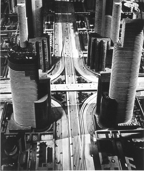 |
| Futurama exhibit at 1939 World's Fair ("City of 1960!") by Normal Bel Geddes |
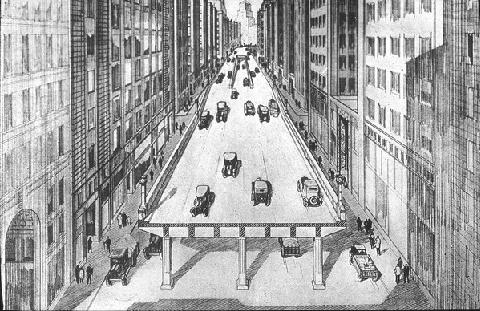 |
| Artist's conception of elevated highway in Boston, 1930 (source) |
 |
| Reality of the Central Artery (source) |
It seems to me that if we are repeating the struggle of the 1920s between motoring interests and city interests, then we should take heed of the lessons of the twentieth century. Grade separation does not work for city streets. The promotion of vehicle speed, over the safety and access of pedestrians, only leads to desolation and abandonment of the city. The police cannot be trusted to judiciously apply "pedestrian law" and it doesn't make sense anyway: nobody was ever killed by a speeding pedestrian.
The more appropriate path is the one that was unwisely abandoned in the 1920s: the recognition that on city streets, speed is anathema to safety. Socially, many people are coming to realize that the old way is the best way forward: the proliferation of safe street, complete street, livable street movements is testament to that. However, the law still enshrines the dangerous twentieth century dalliance with speed at the expense of safety, and the slur "jaywalker" is still considered valid jargon for use by public figures. It may be the only such slur. Changes in concrete take time, but changes in terminology need not.
Police resources should not be used as a weapon against walking. For one thing, it strikes at the heart of the city, which is the vitality of its walking population. For another, pedestrians have enough danger to contend with already: protecting themselves from heedless motor vehicle drivers who cannot be bothered to respect even the little scraps of street space the law grants to people on foot. Deploying police action against pedestrians is radically unjust, and an all too tempting case for abuse, as the NYPD demonstrated yesterday. After all, catching pedestrians is a lot easier than catching speeding motorists, because pedestrians pose no threat to anyone's safety. The penalty for misjudging the speed of a vehicle is already quite steep---injury or death---and a citation is simply heaping insult on top of that. On the other hand, everyone knows that the vast majority of reckless driving goes unpunished, and the penalty relatively toothless in comparison with the potential devastation wreaked.
Boston, in particular, has a major difference from many other counterpart cities: the extensive usage of "beg buttons" and the very poor programming of pedestrian signals and infrastructure. The status of Boston as a "walking city" is despite the infrastructure: because people have learned to routinely dismiss the signals as untrustworthy. Even BTD Commissioner Jim Gillooly has admitted that he does not really expect pedestrians to wait for the signal, and he personally does not either. So, Boston's status as a good walking city is largely dependent upon the choice of the powers-that-be not to enforce the anti-pedestrian regulations on the books.
New Mayor Marty Walsh has had a mixed record in his former job, the state legislature. While he has promoted bills which would reduce speed limits in urban areas, he has also pushed for doubling of penalties upon pedestrians, quite a regressive measure. Going forward, I hope that he chooses to distinguish himself from Mayor Bill de Blasio, by choosing methods of bringing safety to our streets that do not include pedestrian discrimination: walking should not be a crime, and making it so will only lead to conflict and disaster.
Saturday, January 18, 2014
Walk audit of Union Square, Allston and suggestions for the future
 |
| Union Square, Allston. The view from the Twin Donuts shop, facing east. |
(Updates in bold posted 12th November 2015).
Let's take a look at Union Square in Allston, a vibrant neighborhood of the city of Boston. This is the convergence of several busy streets, a transit hub for buses, a retail district, with an elementary school and plenty of nearby residents living within a few minutes walk. I will call this a kind of "audit" because it is based on my observations, as an outsider. The audit uses timings from a weekend study. The main difference between a weekend and a weekday here is length of the full cycle: 90 seconds on the weekend, 110 on the weekday. Adjust accordingly.
 |
| Union Square, landmarks and street names. All satellite imagery courtesy Google. Click on it for larger view. |
- The "level of service" given to the Union Square intersection, by the New Balance transportation study, is "D" (35s to 55s average delay/vehicle) during weekday a.m. peak and "E" (55s to 80s delay/vehicle) during p.m. peak and Saturday peak. "D" is considered normal in cities.
- Traffic levels have declined by about 5-6% here since 2002.
- An examination of the signal schematic (below) shows that for cars, no direction of travel has to wait more than 72 seconds to be given a green phase, on a weekend.
- Yet, the minimum time for a pedestrian to cross Union Square (north/south), legally, is about 100 seconds, if you happen to arrive at the intersection at the optimal moment in the cycle.
- For the less lucky, the expected crossing time is about 145 seconds with a worst case of about 190 seconds.
- For the less capable walkers, the worst case is about 258 seconds. If you happen to be elderly, or a young child. the city expects you to wait 4.3 minutes to cross 95 feet. That's a rate of 0.25 mph.
- The green right turn arrow given to traffic moving eastbound from Cambridge Street is in direct conflict with a walk signal for people crossing between the school and the fire dept station (see picture below).
- The 21 seconds of walk phase given to the 110' crosswalk of Cambridge Street between the Jackson Mann school and Twin Donuts is not enough time for a healthy adult, much less a person with disabilities or a child going to the school.
- There is no crosswalk marked at the Hano Street bus stop, despite heavy ridership. Instead, the city put up a new sign telling pedestrians not to cross there, in response to a tragic crash.
- In the long-term, a Poynton-style redesign should be seriously considered, with a shared space design such as a single-lane roundabout (or similar) completely replacing the traffic signal-controlled intersection. All users of the intersection would benefit, as would the surrounding neighborhood.
Monday, November 11, 2013
Help make the Cambridge Street overpass safer and better
MassDOT has called a second public meeting on the Cambridge Street overpass replacement with some updates. They intend to issue the notice to proceed in the early winter.

Despite some changes, the plan still calls for a fence down the middle of the street, blocking pedestrian crossing for over a quarter-mile. The plan does not address any of the existing ADA incompatibility issues, and it still calls for mixing of walkers and multiple streams of bikers by the Franklin Street pedestrian overpass.
Several advocates and community members have written a new public letter to the agency calling for more changes to the design. I encourage everyone to check it out and sign it, particularly if you live in the area. I also encourage everyone to come to the public meeting on November 19th, at 6 p.m., in the Jackson Mann school's auditorium.

Despite some changes, the plan still calls for a fence down the middle of the street, blocking pedestrian crossing for over a quarter-mile. The plan does not address any of the existing ADA incompatibility issues, and it still calls for mixing of walkers and multiple streams of bikers by the Franklin Street pedestrian overpass.
Several advocates and community members have written a new public letter to the agency calling for more changes to the design. I encourage everyone to check it out and sign it, particularly if you live in the area. I also encourage everyone to come to the public meeting on November 19th, at 6 p.m., in the Jackson Mann school's auditorium.
Friday, September 6, 2013
The streets around the Public Garden
There is an upcoming public meeting to discuss the possibility of a two-way cycle track around the Public Garden. I encourage people to attend. The mess of one-way streets around the Public Garden (and around downtown Boston) makes it difficult for bike riders to get around safely. It's good that they are looking into fixing this. Perhaps it can integrate with Connect Historic Boston. But there's so much more to these streets than just cyclist safety, as important as that is.
As anyone who has lived, or visited, here knows, the streets around the Public Garden and the Common are some particularly nasty, wide, one way racetracks. It seems absurd: the Public Garden being one of the jewels of Boston with so much money and effort invested in it, yet it is surrounded by a sea of pavement. How did it get to be so screwed up?
Well, we've heard about the dirty 1970s and the damage wrought on this city by traffic engineers and leaders who seemed determined to gut every nice aspect of town and turn it into a giant highway/parking lot. But it goes further than that. From the Ninth Annual Report of the City Planning Board (1923):
Boston was one of the first cities in this country to adopt the expedient of one-way streets in order to lessen congestion and confusion.It must be hilarious, to generations of lost drivers, that they thought these one-way streets would actually "lessen confusion." But what's sadder is that this attitude comes from a time when pedestrians were being driven from the streets, murdered in mass numbers (200,000 in the 1920s), and stripped of their traditional rights to the street as a public space. The elites wanted wider streets for their cars and trucks, even though the vast majority of citizens did not possess either. And the elites got what they wanted. The City Planning Board, which had been formed only a decade earlier, seems to have viewed its job as primarily being about identifying blocks for destruction with the goal of widening streets.
They even sliced off a piece of the Public Garden itself -- unthinkable today -- and claimed that there was "no opposition" from the public:
Unfortunately, the matter had progressed beyond the stage of a public hearing before coming to the attention of the Board, and there being no opposition from the public or from the Transit Commission to a taking in excess of its recommendation, a further strip of the Public Garden was taken, and Boylston Street widened between Church and Arlington streets to a width of 120 feet.And that's where it remains today.
The proposed cycletrack is a better use of all this excessive street space than current conditions. But there's an even better solution: Two-way complete streets. There's simply no sense in having a high-speed one-way loop around the Public Garden. It's incredibly irresponsible on the part of BTD. This aggressive engineering of multi-lane one-way streets here, and in adjacent blocks, is ridiculous, reckless and unjust. Let's take a tour:
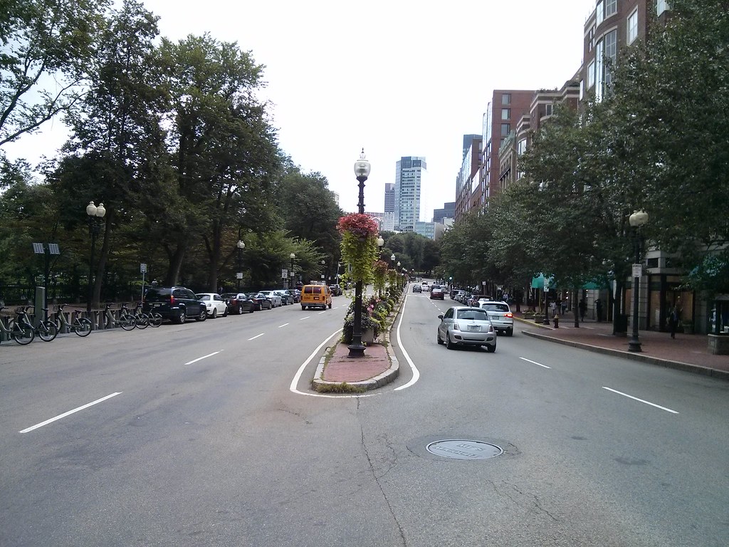 |
| Boylston Street is 120' from Garden to building line. I've noticed that crossing at this intersection (~80') is difficult for seniors because BTD doesn't care enough about pedestrians to set the timing right. |
 |
| Well at least there's a nice sidewalk. You can see how the street flares out though. |
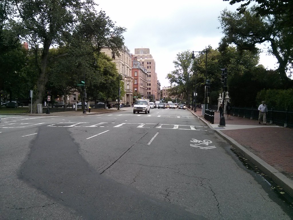 |
| Arlington Street is about 50' curb-to-curb. That's wider than Memorial Drive. |
 |
| This bit of devilish engineering has more in common with a highway ramp than a city street. |
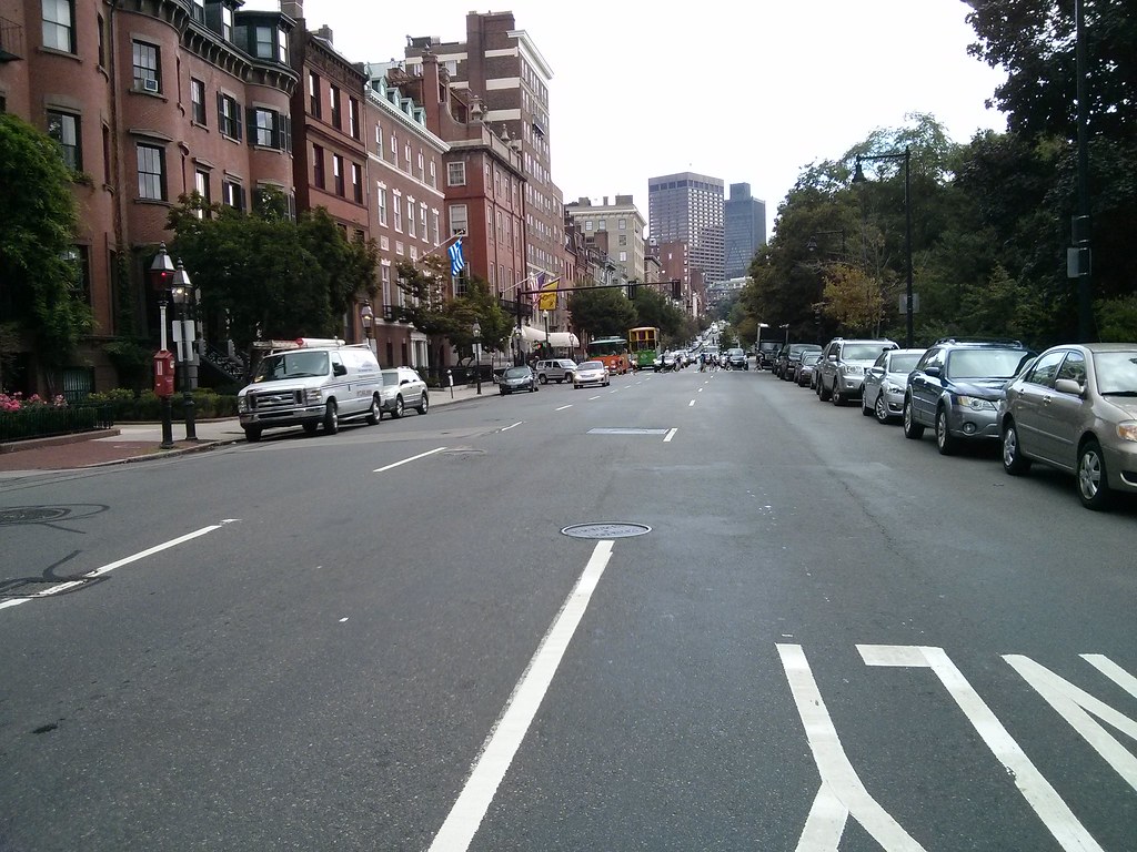 |
| Westbound racetrack, but not so helpful for people trying to go east. |
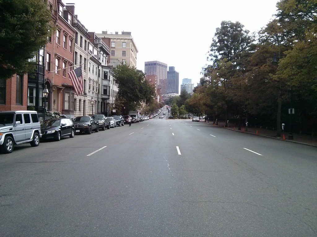 |
| Just ridiculously wide. Beacon Street varies between 50' and 65' curb-to-curb along this stretch. |
 |
| This section of Charles Street is 45' wide curb-to-curb and functions as a one-way speedway. What in the world for? It's supposed to be a shopping street. There's simply no sane reason for it to be one-way, with so many lanes. |
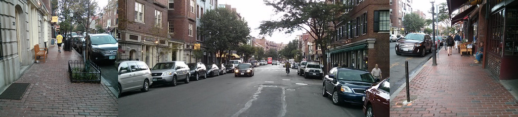 |
| The sidewalks are tiny, pitiful, and difficult for people with disabilities to navigate. Or just difficult for crowds, period. Wide streets, tiny sidewalks. This street is a disgrace. |
 |
| Back to Beacon Street. Hey look, it's two-way, and the world didn't end. Too many lanes though. This is highway-thinking, not city thinking. |
 |
| What "genius" thought a HIGHWAY between the Public Garden and the Common was a good idea? The roadway is 70' at this point. That's almost as wide as the nearby Mass Pike. |
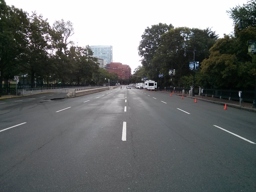 |
| The fact that I can take these pictures indicates that this road is massively over capacity. It's like standing on a drag strip. |
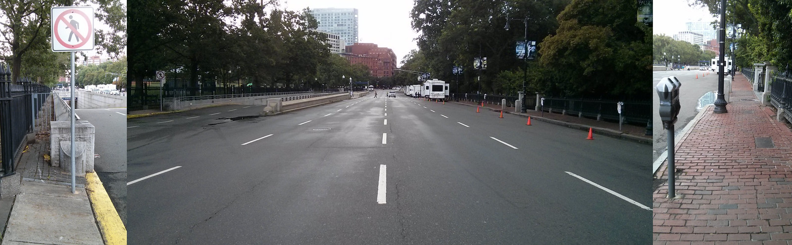 |
| Tiny or impassable sidewalks, giant roadway. Yes you can walk through the parks, at least. But you can't ride there. And what kind of message does a 4-lane highway send about our city? |
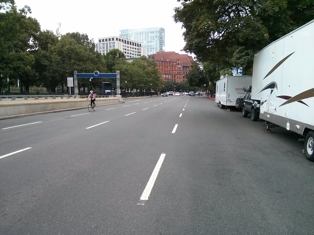 |
| One rider braves the racetrack. |
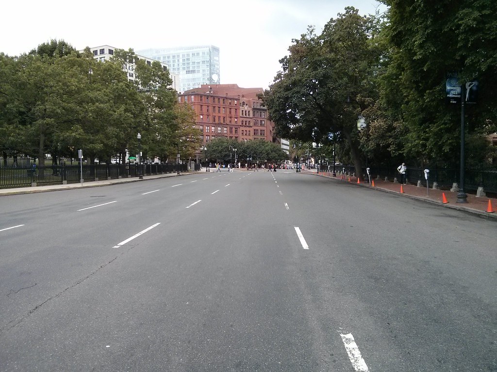 |
| Just think about how much tax money gets sucked into maintaining this ridiculously wide monster road. It's anti-urban and it confuses drivers too. What a waste. |
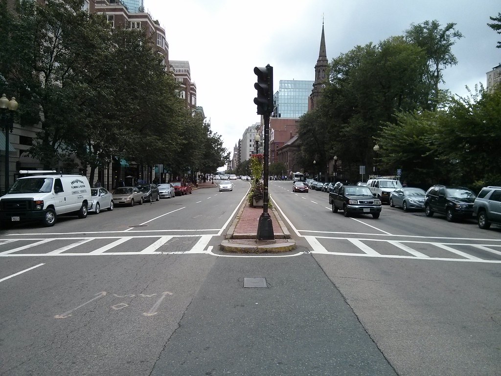 |
| BTD probably thought putting a dinky little planter with some flowers in it is all that's needed to make everything better. Nothing that actually involves making the street safer or more human-oriented. |
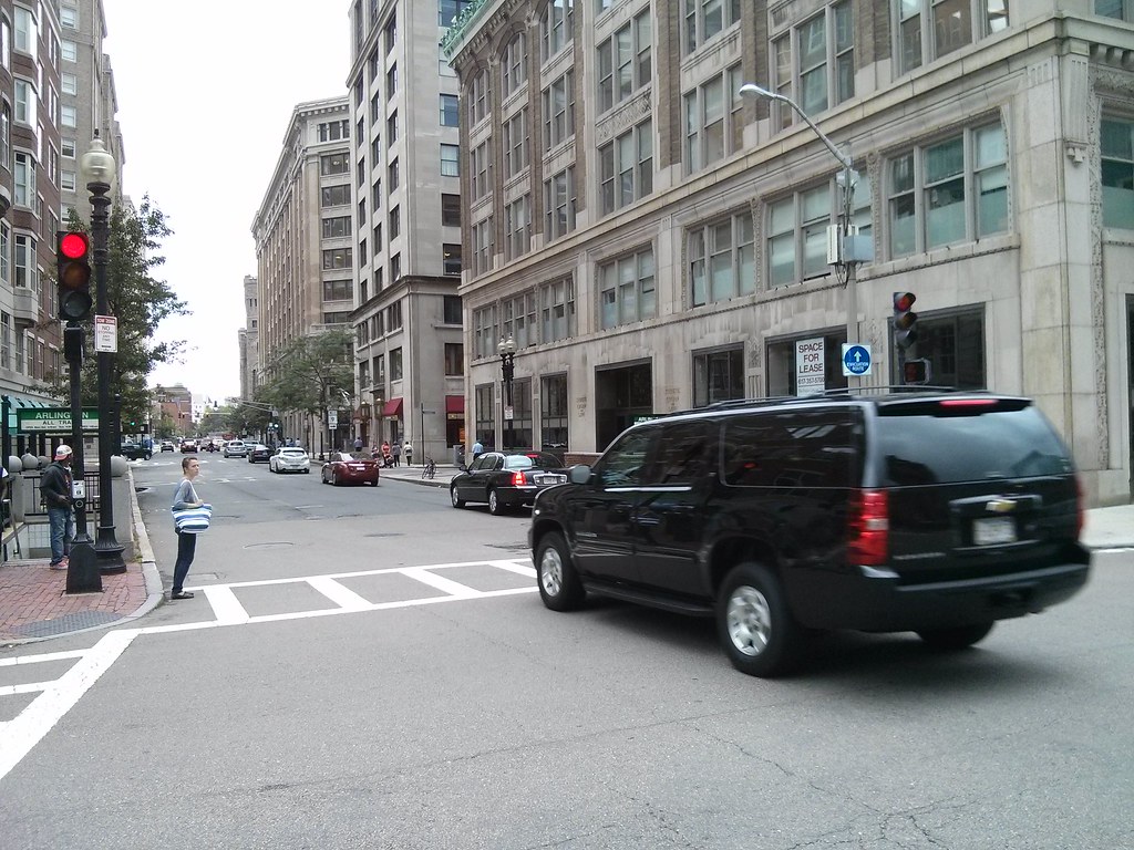 |
| I guess the walk wouldn't have been complete without a large SUV running through the red light as I'm trying to take a picture. |
The cycletrack idea is better than nothing, but it's a band-aide. The real problem is that our streets are still largely unchanged from the highway-crazed, anti-city transportation departments of past decades. What would really help everyone -- pedestrians, cyclists and drivers -- would be to discard all the ridiculous over-engineered intersections, and replace all the wide one-way streets with two-way streets that meet at simple, well-understood intersections. I also propose the following rules of thumb for city streets:
- First, ensure sufficient walking space. If you can't guarantee 10' sidewalks then consider a "shared, slow street" concept.
- If the street is wide enough for two lanes then it should be a two way street.
- If the street is wider than that then either widen sidewalks (for slow streets) or create bike lanes (for slightly faster streets).
- If it is even wider than that, then consider wider sidewalks, street parking, separated cycle tracks, buffered bike lanes, or bus lanes if there is a route.
- If the street is really wide, then implement the Complete Streets concept. But why is the street so wide? Perhaps it should be narrower.
There really isn't a place for more than one travel lane in each direction on most city streets. Perhaps the busiest, widest and most central streets could have more, assuming there doesn't need to be a bus lane there. Intersections should be kept as simple as possible. Traffic signals which attempt to be too clever just confuse people, and almost always wind up screwing over pedestrians. Fancy traffic engineering is not appropriate or necessary. The point of a city street is not to be a sewer or a conduit, but to be part of our shared inheritance, our public open space, a public way that is open to everyone for business or pleasure. Having streets around the Public Garden designed in a way that is more appropriate for the city may even obviate the need for cycle tracks, and make it safer for pedestrians and drivers as well.
Wednesday, August 7, 2013
The Bowker Overpass and Storrow Drive
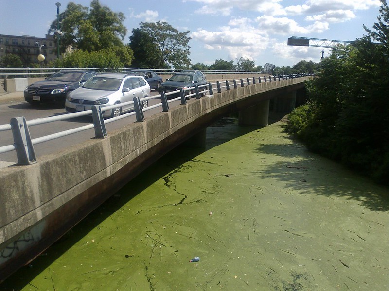 |
| Who says we don't have Green Space here? |
This is an unfortunate, though not entirely unexpected development. The Bowker Overpass crosses the Mass Pike and covers the Charlesgate Park: once the "crown jewel" of Olmsted's Emerald Necklace; now reduced to an overgrown, weedy hideout for bums.
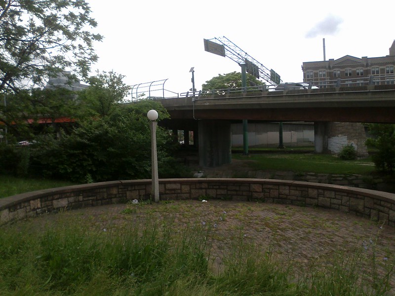
The portion over the Mass Pike can't be escaped, but the overpass of Charlesgate Park is actually redundant with the surface roads. It was built at a time when grade-separation was all the rage: the 1950s and the heady days of highways. The Bowker Overpass combines with a spaghetti mess of ramps to interchange with Storrow Drive: consuming large portions of the Esplanade which never should have been taken in the first place.
Mostly unusable "greenspace" due to the ramps (google)
All of this was constructed before the Mass Pike was extended into downtown Boston. It has not aged well. Storrow Drive is decrepit, a blight on the city that acts as a barrier between Boston and the Charles River. The Storrow Drive tunnel/double-deck roadway is in miserable shape; it was even recently rated the Most Dangerous Bridge in the country. Repairing the Bowker Overpass without talking about the Storrow Drive tunnel is irresponsible.
The fact is: the city and MassDOT need to have a serious conversation about grounding Storrow Drive. The 1950s grade-separations are falling apart: they have long exceeded their lifetimes and were not properly maintained either. And we should not shackle ourselves to outdated 1950s ideas about automobiles and the city. It is not such a fascinating idea anymore that you could drive your car on swirling ramps through the air to avoid intersections. Nowadays, we're more focused on connectivity, and accessibility; two things which grade-separation is bad at achieving within reasonable expense.
Once you manage to get on the grade-separated Storrow Drive, you're essentially trapped. You have very poor access to the various streets in Beacon Hill, the Back Bay, Kenmore, or Allston. And there are very few places to cross the highway: so if you are looking to spend time near the river, you have to find one of the few bridges across. This also hurts safety: poor connectivity leads to fewer "eyes on the park" at night, and makes it harder for police to patrol the area.
Grounding Storrow Drive and the Bowker Overpass could achieve many things:
- Rid us of a festering sore under the overpass.
- Restore a ton of parkland currently cordoned by ramps.
- Connect the Esplanade more closely to the city, increasing accessibility and safety.
- Connect more of the street grid to Storrow Drive, easing access for all modes.
- Save a boatload of money not rebuilding the $300+ million separation structures.
- Reduce construction nightmare that rebuilding the Storrow tunnel would entail.
What's the catch? Well, it might take a little bit longer to drive to your destination via the same route you used in the past. On the other hand, you might also save a lot of time by not having to go around and around in loops on one-way streets. I know that some traffic engineers will be screaming that this represents a "downgrade" but they can take that attitude back to the 1950s where it came from. For the rest of us, this would represent an upgrade: a better city. Plus, $300 million saved! Heck maybe more. I suspect that any attempt to replace the Storrow tunnel will quickly turn into it's own "little Big Dig" with rapidly inflating costs. That's a lot of money that could be put into so many other, better, actual improvements. Like making the MBTA an attractive option for people who currently feel like they have no alternative but to drive along this way.
How MassDOT approaches the impending dilemma of the Bowker Overpass and the related Storrow Drive tunnels will tell if they are really serious about their "GreenDOT" proposal or not.
Sunday, June 30, 2013
Tiny signs
Lately, these street signs have been popping up on and near Commonwealth Avenue:
 |
| "Caution: High Bicycle & Pedestrian Activity Zone. 25 M.P.H." |
It seems that this is the follow-up to this announcement: Mayor Menino and Boston University Launch Bike-Safety Initiative.
In a continuing five-year effort to improve safety and calm traffic along its 1.5 mile-long main campus straddling Commonwealth Avenue, Boston University today announced with the City of Boston a series of measures to further protect cyclists and pedestrians, encourage bike use, and promote awareness of cyclists and pedestrians among motor-vehicle drivers. They will include new signage, enhanced bike-lane markings, and highway reflectors in the pavement.Sounds good. I appreciate the consideration. But I have to wonder: does posting these tiny signs really accomplish anything? Personally, I barely notice them when I'm walking past. I can't imagine anyone in a car stopping to squint at a sign like this. Some are a bit more visible, some are not so much.
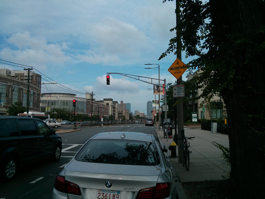 |
| "Share the Road" |
And there's still legacy screw-ups like this:
 |
| "Turning Vehicles - Yield to Bike" |
Going back to the 25 M.P.H. sign in the first picture: is this setting the legal limit? Or is it just a suggestion? It is an orange sign instead of the MUTCD standard design. I know that Commonwealth Avenue is signed for 30 M.P.H. elsewhere, which is the standard speed limit for these sorts of roads in Massachusetts (*).
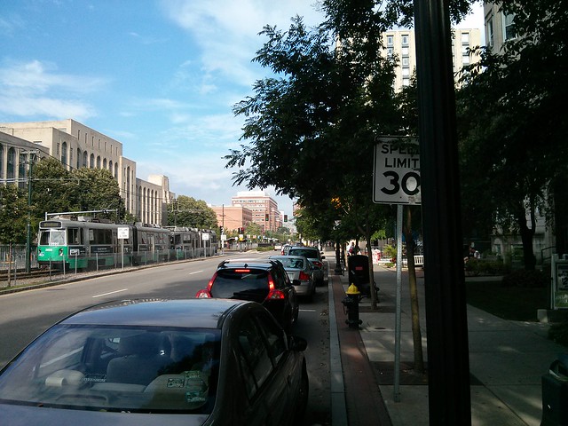
It's not really clear how these signs are supposed to help. Judging by the speeds at which motorists fly down Comm Ave, I don't think they're noticing the signs either, or caring. Signs don't substitute for good design. Instead of merely telling motorists that this is a busy pedestrian area, the layout of the street should show it.
(*) Write to your legislators in support of H. 3129 to change the default speed limit to 25 M.P.H. in urbanized areas.
Thursday, June 20, 2013
The replacement of the Cambridge Street overpass of I-90
MassDOT has decided to expedite project 606376 to replace the deck of an overpass of the Mass Pike that is located in Allston, along Cambridge Street. The plans are already in 100% design state because they have been sitting around for a few years. However, they are offering a chance to comment over the next ten days, and at Tuesday's public meeting, they pledged to incorporate suggestions if possible. This is probably a once-in-a-generation opportunity to help fix a blight that has plagued Allston since the construction of the Mass Pike extension in the mid-60s.
View Larger map (final design bus stops shown as blue markers)
The project scope extends from the intersection with Harvard Avenue in the west, to the intersection with Lincoln Street in the east. It also includes several minor repairs to the pedestrian footbridge across the pike at Franklin Street, but nothing more significant. MassDOT has suddenly gotten interested in this plan after it languished for several years, because the deck is deteriorating to the point where replacement must happen within the next couple of years. Conditions above the deck have been nearly intolerable for the past few years as well.
A little history: prior to the construction of the Mass Pike extension in the mid 1960s, Cambridge Street had a smaller overpass of the Boston and Albany railroad. Lincoln Street, Mansfield Street, and Royal Street all connected directly to Cambridge Street.
The construction of the highway meant widening the right-of-way. Homes along the south side of Lincoln Street were taken (including Fred Salvucci's grandmother's home), as well as some homes on Mansfield and Royal, and the streets were reconfigured. Lincoln Street was redirected to curve to the northeast, paralleling the new highway. The ends of Mansfield and Royal were chopped off and reconnected to Lincoln Street. Then, Lincoln Street was rerouted over the Empire Street right of way and re-attached to Cambridge Street where Mayflower Street is shown on the map above. The net effect was to sever the street grid and create an overly long, uninterrupted block from Linden Street to the new Lincoln Street intersection. Motorists treat this stretch as if it were part of the highway, racing at high speeds along the excessive capacity, and creating a scary environment for anyone not surrounded by 2 tons of steel.
Eagle-eyed readers will notice there is a "tunnel" marking by Franklin Street. This was the location of a 19th century grade-separated walkway under the tracks. This was covered over and replaced in the 1960s by the current Franklin Street pedestrian overpass, which connects a point opposite Highgate Street on the south side, with Franklin Street on the north side.
There is also a ramp at Mansfield Street, to replace the street connection that once existed. It climbs the berm so that people walking from Mansfield Street can reach Cambridge Street directly.
The Cambridge Street overpass of I-90 was given six lanes of automobile travel, small sidewalks, and no safe means of crossing, over 45 years ago. It has remained so since, but the bridge deck has reached the end of its lifespan and must be replaced.
Both MassDOT and BTD have shown a willingness to improve conditions on the bridge for walking and bicycling. They have recognized that six travel lanes is massive overkill: the feeder streets only have one lane in each direction, so there is simply not enough connecting capacity to fill six lanes anyway. As a result, they have drawn up buffered bike lanes and wider sidewalks into the current plans.
Unfortunately, in the same plans, they have decided to place a quarter-mile long fence right down the middle of Cambridge Street, from end-to-end of the scope. The claim is that they are concerned about "safety": many people trying to get between North and South Allston are unwilling to walk a half-mile out of their way to use one of the intersections. So, instead of providing safe places to cross the street, the state agency is simply try to block all crossing. But that's unacceptable to the community. We need north-south permeability here. The sheer number of people willing to walk down the center median and climb the current concrete barrier attests to that. Many of these people live in North Allston and need to access jobs, shopping or bus stops in South Allston. Others live in South Allston and want to reach neighborhood resources in North Allston. MassDOT needs to accept that north-south travel is just as valid as east-west travel on this city street.
Now, MassDOT wants to stick to their scope and their schedule because they feel hurried to get this done. I also agree that this project needs to get done as soon as possible. So this comment period will likely be the last chance to ask for improvements in the final design.
What's exciting about this project is that the city has apparently been making plans quietly for a kind of "corridor to the river" from Allston to the Charles that uses Cambridge Street. For many decades, this street has been a barrier to walking and biking, with dangerous highway ramps and speeding trucks, but it could be transformed into a gateway instead.
View Cambridge Street corridor to the river in a larger map
The River Street Bridge replacement project (shown in blue) will be underway right after the Anderson bridge is complete. So, after that, the missing piece is in the middle: Cambridge Street.
The comment period for all this is now, ending by July 3rd. Please e-mail dot.feedback.highway@state.ma.us and reference the Cambridge Street overpass over I-90 project number 606376. Or you may write a letter to:
[The comment period for all this is now, ending by July 3rd. Please e-mail dot.feedback.highway@state.ma.us and reference the Cambridge Street overpass over I-90 project number 606376. You may also read more on http://cambridgestreetoverpass.blogspot.com/.]
View Larger map (final design bus stops shown as blue markers)
The project scope extends from the intersection with Harvard Avenue in the west, to the intersection with Lincoln Street in the east. It also includes several minor repairs to the pedestrian footbridge across the pike at Franklin Street, but nothing more significant. MassDOT has suddenly gotten interested in this plan after it languished for several years, because the deck is deteriorating to the point where replacement must happen within the next couple of years. Conditions above the deck have been nearly intolerable for the past few years as well.
 |
| The sidewalk is fenced off because it has gaping holes |
 |
| Dangerous conditions |
A little history: prior to the construction of the Mass Pike extension in the mid 1960s, Cambridge Street had a smaller overpass of the Boston and Albany railroad. Lincoln Street, Mansfield Street, and Royal Street all connected directly to Cambridge Street.
 |
| Cambridge Street in 1925 |
The construction of the highway meant widening the right-of-way. Homes along the south side of Lincoln Street were taken (including Fred Salvucci's grandmother's home), as well as some homes on Mansfield and Royal, and the streets were reconfigured. Lincoln Street was redirected to curve to the northeast, paralleling the new highway. The ends of Mansfield and Royal were chopped off and reconnected to Lincoln Street. Then, Lincoln Street was rerouted over the Empire Street right of way and re-attached to Cambridge Street where Mayflower Street is shown on the map above. The net effect was to sever the street grid and create an overly long, uninterrupted block from Linden Street to the new Lincoln Street intersection. Motorists treat this stretch as if it were part of the highway, racing at high speeds along the excessive capacity, and creating a scary environment for anyone not surrounded by 2 tons of steel.
Eagle-eyed readers will notice there is a "tunnel" marking by Franklin Street. This was the location of a 19th century grade-separated walkway under the tracks. This was covered over and replaced in the 1960s by the current Franklin Street pedestrian overpass, which connects a point opposite Highgate Street on the south side, with Franklin Street on the north side.
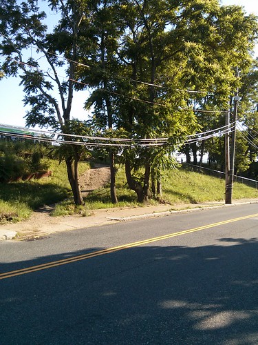 |
| The Cambridge Street berm |
The Cambridge Street overpass of I-90 was given six lanes of automobile travel, small sidewalks, and no safe means of crossing, over 45 years ago. It has remained so since, but the bridge deck has reached the end of its lifespan and must be replaced.
Both MassDOT and BTD have shown a willingness to improve conditions on the bridge for walking and bicycling. They have recognized that six travel lanes is massive overkill: the feeder streets only have one lane in each direction, so there is simply not enough connecting capacity to fill six lanes anyway. As a result, they have drawn up buffered bike lanes and wider sidewalks into the current plans.
 |
| Crossing Cambridge Street |
Now, MassDOT wants to stick to their scope and their schedule because they feel hurried to get this done. I also agree that this project needs to get done as soon as possible. So this comment period will likely be the last chance to ask for improvements in the final design.
What's exciting about this project is that the city has apparently been making plans quietly for a kind of "corridor to the river" from Allston to the Charles that uses Cambridge Street. For many decades, this street has been a barrier to walking and biking, with dangerous highway ramps and speeding trucks, but it could be transformed into a gateway instead.
View Cambridge Street corridor to the river in a larger map
The River Street Bridge replacement project (shown in blue) will be underway right after the Anderson bridge is complete. So, after that, the missing piece is in the middle: Cambridge Street.
- Cambridge Street is a city street, and should look and feel like a city street, not a "mini-highway."
- MassDOT and BTD are both onboard, in principle, with fixing Cambridge Street and building this "corridor to the river" but they seem to be fragmented in planning. Management of the corridor is split between the two agencies. We need them to be on the same page so that the final outcome is coherent.
- A quarter-mile long fence with no crossings is not acceptable to the Allston community. There needs to be a safe place to cross. Some possibilities include the Linden Street intersection, or the Mansfield Street stairs. It should be possible to put a coordinated traffic signal at Linden Street which helps crossing with no impact on motor traffic.
- During construction, a 2 year period, portions of the bridge will be closed. There will be three phases: each third of the bridge will be shutdown and replaced, from north to south. Although I understand that there will be unavoidable impacts, MassDOT needs to ensure that non-motorized access is considered seriously during this time-frame.
- The Franklin Street overpass attracts heavy foot and bicycle traffic, which must share a narrow sidewalk along the north side of Cambridge Street near Harvard Avenue. The MassDOT plans call for directing the bicycle lane up a ramp and onto that same sidewalk. It will be widened to 13 feet, but, it turns MassDOT engineers had not anticipated that there currently is (and will be) 2-way bicycle traffic on this segment because of the overpass. Luckily, there is a grassy strip adjacent to the sidewalk which could be taken for a sidewalk-widening easement. That needs to be considered.
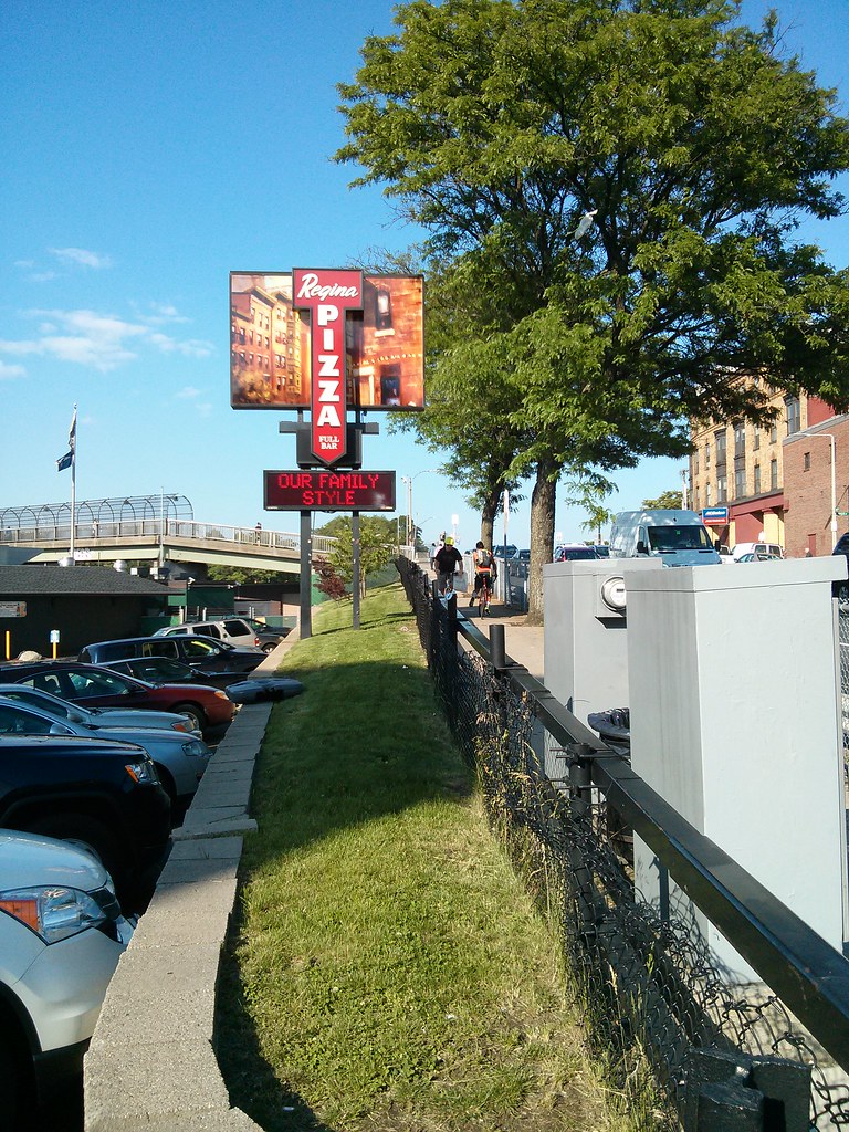 |
| Two bicycles take up all the space already; but look at that potential width! |
You may also read more, including the 100% design plans, on http://cambridgestreetoverpass.blogspot.com/.Thomas F. Broderick, P.E., Chief EngineerMassDOT - Highway DivisionAttn: Bridge Project Management10 Park PlazaBoston, MA 02116-3973
Subscribe to:
Posts (Atom)