Pages

Tuesday, August 27, 2013

How slow were our buses?

With the key bus route improvement project slowly moving ahead, but slipping its already long delayed schedule, I thought it might be interesting to take a look at average bus speeds from last year's data. Here's all routes under 10 MPH. Key/SL bus routes in bold.


Seeing the 1 and the 66 show up in the worst ten is no surprise. Both of them are massively overcrowded at most hours, which lengthens dwell times. The SL4/5 are also crowded, and they also obtain their infamy from the slow crawl through Chinatown. So much for the vaunted Bus 'Rapid' Transit. Having said that, they do have better on-time percentage than most, hitting the low-80%s, which is itself a sad reminder that most of the bus routes cannot achieve even the low service delivery standard of 75% on-time. I will be interested to see if the key bus route improvement project can do anything about the miserable slowness and on-time performance of the 1, 66, 15 and 23. Expectations are low.

Let's put aside the 114, which barely runs at all. Despite being non-key, the 69 serves significant ridership, and has a fairly straightforward routing. It just appears to be a congested corridor. The 55 runs infrequently, has low ridership, and is slow. I imagine that most of the riders in the Fenway with a choice will walk over to one of the Green Lines. Probably neither one of these has any chance of being improved in the near future (although I did notice some tinkering with stop locations on the non-key 86 route, for some unknown reason).

Another site of interest is Bostonography's bus speed map, but as you can see, their colorization is too coarse, marking anything under 10 MPH as "red." Most of the "green" is due to express segments of bus trips that occur on highways.

Buses carry about 400,000 rides per weekday in the system, and the vast majority of them are averaging under 10 MPH. A large part are averaging under 8 MPH. That's pretty bad. The MBTA along with the various cities and towns could be doing a lot more to fix this, and it would wind up saving money on operating costs. Even without bus lanes (which I encourage) a whole bunch of cheap improvements could be done: stop consolidation, curb-extensions for level boarding, off-board payment, proof-of-payment, signal priority, queue jump lanes, etc. Some of these are in the works for the key bus route improvement project, but it should not take 3 years to design and implement them. The big advantage of buses is supposed to be that it's cheap and easy to roll out and tinker with their routes. Why is that not the case here?

Sunday, August 25, 2013

Cargo cult suburbanism

It seems that every time there's a proposal for a multiple unit apartment or condo building, some voices will pop up and whine, "why can't they just build some affordable single (or two-) family detached houses?!?!" Some will even go on to make the wild claim that multi-unit buildings "cause" single family detached house prices to rise.

This thought process is completely backwards: like blaming your runny nose for causing your cold. Instead, it is the rising prices on existing homes which attracts developers to build more homes, and eventually multi-unit buildings.

The reason the prices on single family homes are going up is because that kind of structure is an inefficient use of an increasingly valuable and limited resource: land.

It has nothing to do with the presence of multi-unit housing. In general, if land prices go up, then home prices will go up. If you want to reduce home prices on the open market, either: (a) find a way to reduce land prices, or (b) subdivide the land more efficiently.

Seeing this misunderstanding perpetuated, I get the feeling that some people in Boston believe in a fairy tale, what I've started to call: "cargo cult suburbanism."

In essence: the followers of this cargo cult remember a time in the past when giant single family homes were affordable, and even seemed to be the only option for families.

Therefore, they try to force everyone to build 1950s-style single family homes in the hopes of attracting families at reasonable prices. Followers of this cult have infiltrated city hall to the point where in most neighborhoods, the only development allowed by-right is this kind of suburbanism, even in areas of the city which have many apartment buildings.

The cultists believe that the ritual of forcing the development of such single family detached houses will magically, somehow, make them affordable to average families. There's no actual economic reason for that to work. It's an imitation of a form that sometimes works elsewhere under much different conditions, but is unsuitable for much of the city. That's why I'm calling it "cargo cult" thinking.

What's worse, not only does "cargo cult suburbanism" create unaffordable and unrealistic housing, the stock that remains ends up in slumlord hands, as they are the only ones with enough money to buy such large units. Then, the demand to live here is so strong, and the supply of homes is so weak, that some people feel that they have no choice but to fall into the hands of unscrupulous slumlords. The giant, detached single family homes, favored by the "cargo cultists," are easily subdivided into many illegal units. Some have been found to have twenty people living in them, such as the house which burned down this summer and claimed the life of a student.

Nobody wants to live in such conditions. We desperately need more legal, clean units to be created here. But the elected officials have failed their constituents. The zoning laws, barely changed from the 1950s, are completely out of touch with reality. The slumlords are the direct beneficiary of this screwed up situation. And who knows what kind of money changes hands behind closed doors to keep it this way.

The "cargo cultists" will claim that they just want to provide housing for families. I agree with the goal of finding ways to provide reasonably priced housing for families, but I don't buy into cargo cults. There's no reason why a diversity of housing options cannot serve families, or anyone else, just as well as (or better than) the stereotypical 1950s-style single-family detached house.

When land starts to become more expensive, it has to be used more efficiently, or else people of modest means will not be able to afford to live here anymore. Subsidized housing is a poor substitute. Some of that may be unavoidable, but for the majority of people, they ought to be able to find housing on the normal market. We need to put an end to the ridiculously bad zoning laws and arbitrary process which has defined Boston development for over two generations. The city got away with its dysfunction in the past during a time of decline and when the population was forced to sprawl. And people seemed to accept that fate. But that's no longer the case anymore. The population of the city is growing. This will be the challenge for the next mayor: to increase and provide a diversity of housing options for people of all different means and backgrounds. And to find a way to break the self-perpetuating cycle of corruption and NIMBYism which drags us down.

Wednesday, August 7, 2013

The Bowker Overpass and Storrow Drive

Who says we don't have Green Space here?
Over a year ago, I wrote about the Bowker Overpass which divides Kenmore from the Back Bay. MassDOT held a discussion about future options to deal with the overpass, but they seemed inclined to rebuild it, over the objections of residents. Now they are preparing to do $14 million repair project in Spring 2014. The public meeting was announced recently and will be on Monday, August 13th, 6 p.m. in the BPL Copley Mezzanine.

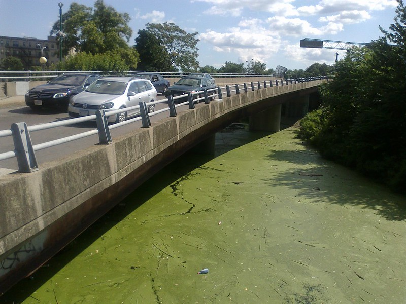
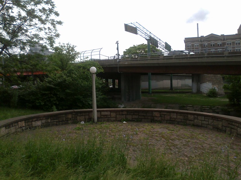
This is an unfortunate, though not entirely unexpected development. The Bowker Overpass crosses the Mass Pike and covers the Charlesgate Park: once the "crown jewel" of Olmsted's Emerald Necklace; now reduced to an overgrown, weedy hideout for bums.


The portion over the Mass Pike can't be escaped, but the overpass of Charlesgate Park is actually redundant with the surface roads. It was built at a time when grade-separation was all the rage: the 1950s and the heady days of highways. The Bowker Overpass combines with a spaghetti mess of ramps to interchange with Storrow Drive: consuming large portions of the Esplanade which never should have been taken in the first place.


Mostly unusable "greenspace" due to the ramps (google)

All of this was constructed before the Mass Pike was extended into downtown Boston. It has not aged well. Storrow Drive is decrepit, a blight on the city that acts as a barrier between Boston and the Charles River. The Storrow Drive tunnel/double-deck roadway is in miserable shape; it was even recently rated the Most Dangerous Bridge in the country. Repairing the Bowker Overpass without talking about the Storrow Drive tunnel is irresponsible.

The fact is: the city and MassDOT need to have a serious conversation about grounding Storrow Drive. The 1950s grade-separations are falling apart: they have long exceeded their lifetimes and were not properly maintained either. And we should not shackle ourselves to outdated 1950s ideas about automobiles and the city. It is not such a fascinating idea anymore that you could drive your car on swirling ramps through the air to avoid intersections. Nowadays, we're more focused on connectivity, and accessibility; two things which grade-separation is bad at achieving within reasonable expense.

Once you manage to get on the grade-separated Storrow Drive, you're essentially trapped. You have very poor access to the various streets in Beacon Hill, the Back Bay, Kenmore, or Allston. And there are very few places to cross the highway: so if you are looking to spend time near the river, you have to find one of the few bridges across. This also hurts safety: poor connectivity leads to fewer "eyes on the park" at night, and makes it harder for police to patrol the area.

Grounding Storrow Drive and the Bowker Overpass could achieve many things:

  1. Rid us of a festering sore under the overpass.
  2. Restore a ton of parkland currently cordoned by ramps.
  3. Connect the Esplanade more closely to the city, increasing accessibility and safety.
  4. Connect more of the street grid to Storrow Drive, easing access for all modes.
  5. Save a boatload of money not rebuilding the $300+ million separation structures.
  6. Reduce construction nightmare that rebuilding the Storrow tunnel would entail.
What's the catch? Well, it might take a little bit longer to drive to your destination via the same route you used in the past. On the other hand, you might also save a lot of time by not having to go around and around in loops on one-way streets. I know that some traffic engineers will be screaming that this represents a "downgrade" but they can take that attitude back to the 1950s where it came from. For the rest of us, this would represent an upgrade: a better city. Plus, $300 million saved! Heck maybe more. I suspect that any attempt to replace the Storrow tunnel will quickly turn into it's own "little Big Dig" with rapidly inflating costs. That's a lot of money that could be put into so many other, better, actual improvements. Like making the MBTA an attractive option for people who currently feel like they have no alternative but to drive along this way.

How MassDOT approaches the impending dilemma of the Bowker Overpass and the related Storrow Drive tunnels will tell if they are really serious about their "GreenDOT" proposal or not.

Sunday, August 4, 2013

The upcoming municipal election: housing

Based on the sources from the previous post, I've collected some notes about each of the candidates based on their public statements. Apologies for the rawness. I've tried to put quotation marks around text which is directly quoted and the rest is paraphrased. Candidates appear in alphabetical order, by last name, and I've included everyone who has raised at least $100,000 according to the OCPF.

Felix Arroyo

  • “One, we must increase the supply of housing. We should make sure that people who want to build housing have the opportunity to do that. It’s simple economics: supply and demand. But I don’t believe that that is the final answer.” 
  • “There are some things that government has to invest in: public schools, public streets, public safety, and affordable housing.” 
  • His parents lived in subsidized housing in the South End when he was born. 
  • “We must invest in affordable housing.” 
  • “We need to look at our zoning code to make sure that we are not by zoning code restricting the creation of different types of housing that could lead to affordability.” 
  • Transparent and predictable processes for development. 
  • “We need all types of housing & to encourage mixed use development of market, moderate rate & affordable housing “ 
  • Split the BRA into separate planning and development agencies.


John Barros

  • Worked in Boston for 13 years as executive director of Dudley Street Neighborhood Initiative.
  • Sponsored 800 units of both market-rate and affordable housing during my time.
  • “We can create different incentives for developers to build next to transit nodes.”
  • “It’s still not easy enough to develop in Boston, the process is obscure, it’s unclear, we need to streamline it when developers are trying to do the right thing.”
  • “Transit nodes: we can drop the parking ratio, we can increase density, we shouldn’t be afraid of going high. These are kinds of things we can do to increase affordability in Boston.”
  • More realistic planning and zoning to incentivize development
  • Tax abatements, TIPS and density bonuses for parts of Boston that are not developed. “We’ve got land, too much of it, let’s take it off the city rolls and put it in production.”
  • Need to invest in transit that allows for developers to build and increase density.


Dan Conley

  • “Housing development is critical to the economic success of our city.”
  • Many entrepreneurs starting businesses here in Boston can’t afford to live here even though they want to. Need to expand workforce housing.
  • Embrace Menino’s “2020 vision” of 30,000 new units by 2020, and do even more.
  • “We need to rethink density. Density does not need to be a bad word when talking about housing policy. Look at Paris: it’s about the size of Boston geographically and has three times as many residents and is thought to be one of the great cities of the world.”
  • “Micro-units need also to be looked at, it’s not for everyone, but it’s a good opportunity for young professionals to get a foothold in the housing market.”
  • Increase the number of three-bedroom "Family Friendly" homes by making city-owned lots available for that purpose.
  • Consider density and transit oriented development.
  • Housing is also a regional problem and needs to be coordinated regionally.
  • Some kind of financial incentive for renovation of housing.
  • "Scrutiny" of off-site affordable housing.
  • Provide a "proper mix of services, entertainment and recreation options to support and sustain a community."
  • “I don't want to solve overcrowding by pricing all but the wealthiest Bostonians out of our city.”


John Connolly

  • More transparency at the BRA.
  • Term limits for BRA board members.
  • “We do too much zoning-by-variance.”
  • “Building more 3 bedroom units for young families”
  • “Increasing the supply of microlofts to create affordable options for recent graduates, young artists, and young professionals”
  • “Expanding programs that increase home ownership among our city workers.”
  • “Getting already-foreclosed properties into the hands of Community Development Corporations who can remarket units to eligible families.”


Rob Consalvo

  • We need to make funding a priority for programs like “Leading the Way”
  • We need to invest in workforce housing relating to TOD, we see that now with the Fairmount line.
  • Think about linking workforce housing in places other than Innovation District, out on a different ring, in places such as Allston/Brighton, Roslindale, Readville and Hyde Park that has quick and easy access via new transportation systems to downtown.
  • Meet and exceed Menino’s “2020 Vision”.
  • Not just jamming it all downtown, or in hot spots, but moving it out to the neighborhoods of the city, where there’s real opportunity to grow more housing.
  • The zoning code should be regularly updated.
  • “We can solve overcrowding by providing more market rate and affordable housing and expanding public transportation into Boston.”
  • “With better public transportation we can connect ALL our neighborhoods to downtown and the universities – opening up new housing options citywide.”
  • “As mayor, I'll work with schools to develop more on-campus housing”
  • Increase transparency at the BRA.


Charlotte Golar Richie

  • Led DND for 8 years and served with Menino as Chief of Housing.
  • “You can’t just go to a landlord and say I want your units to be affordable, please do it out of the goodness of your heart.”
  • “As mayor I absolutely will advocate and lead the charge to get the funds that we need to buy the affordability so we have affordable units for our workforce.”
  • Build more on-campus housing for students.
  • “Will work to increase the supply of rental housing for neighborhood residents.”
  • “The BRA has important powers like eminent domain which I do not want the city to lose.”
  • Must increase transparency and predictability at the BRA.
  • “I will define more clearly the agency's planning functions and ensure that planning precedes development in a clear, predictable, and transparent manner.”


Mike Ross

  • “To create more affordable housing, we need to build more housing.”
  • “We’re not building fast enough for the graduating college kids, for the empty nesters, for the life-long residents, and for the citizens of the world who want to move here.”
  • “We need to build more, not just in the downtown core, but in all of our neighborhoods.”
  • “When I first started the Fenway was a gas station, parking lot, fast food strip along Boylston Street.”
  • Got together, planned, and over the past ten years we built the Fenway community.
  • We can do that while we build affordable housing on-site.
  • “If inclusionary zoning and affordable housing is a principle of our city then it should not be the first thing we negotiate away.”
  • “If micro-units work in some places then they should be allowed to be built in those places.”
  • “We need great education opportunities in our neighborhoods, but we also need amenities that and places to gather and go that draw people throughout the year and throughout the day.”
  • For example, worked to bring a supermarket, banks, restaurants to Mission Hill through planning.
  • Transit-oriented development, similar to what we did with restaurants and other development around the Ashmont T stop in Dorchester
  • Resilient, sustainable design principles to ensure that our buildings, infrastructure and people are prepared for climate change
  • Fast-track permitting for neighborhood-friendly housing
  • Resources for elders to remain in their homes
  • “We also need to work with our colleges and universities to build more dorms, so students can stay on campus and aren't putting more pressure on the strained housing market.”


Bill Walczak

  • “I think the first problem is that affordable housing is just not affordable -- it costs way too much to develop.”
  • “We need to construct more affordable housing throughout every neighborhood in Boston.”
  • “I favor transit oriented development -- I favor building large, dense projects closer to our subway stations, bus stations, commuter rail stations, because that’s what we need to do. The density will allow for lower cost.”
  • Convene business community, developers, construction companies, architects, to figure out why it costs so much to develop our housing in Boston.
  • Figure out ways to develop good, sound quality housing at lower cost.
  • Need to expedite processes through master planning.
  • Audit the BRA and then redesign the agency.
  • The new BRA needs transparency as its goal
  • “Planning needs to be equal in function to development”


Marty Walsh

  • Reform the BRA:
  • Need quantitative metrics for evaluating the BRA
  • Bifurcated system of permitting to separate small projects from larger projects for better efficiency.
  • A permits tracking system.
  • A system of receiving feedback and providing information to residents.
  • As a State Rep: Helped pass transit-oriented mixed-use “smart growth district” legislation
  • Has been a strong supporter of infrastructure and zoning improvements

Sunday, July 28, 2013

The upcoming municipal election

September 24th is the date of the preliminary election, when the field of 12 mayoral candidates and many more city councilor candidates are pared down to the top front-runners in preparation for the general election on November 5th. This will be the most significant local election in thirty years. The mayor of Boston, in particular, has a large amount of power in setting the policy and path of the city, for better or for worse. There are many areas which must be covered well: housing, jobs, transportation, schools, policing, parks, among others.

The questions I will be investigating in particular are: how will the next mayor calm rising housing prices, foster livable communities, improve walking conditions, encourage bicycling, and push for a better MBTA?

This is not to disparage the other issues, and many of them are connected to housing and transportation. Business owners will be interested in creating jobs in strong neighborhoods near where people live, if allowed. Parents would like to have neighborhood schools to which their kids can safely walk. Families need housing that they can afford and communities they can feel part of. Controlling crime is not just a question of policing but also of urban geography and neighborhood structure.

So with this in mind, here are some links to get started:


Saturday, July 20, 2013

Is fare evasion really a problem?

(continued from previous post)

Something that caught my eye in the MBTA ROC report was that it was the first time that I've seen anyone take a real crack at estimating fare evasion. Usually the T just makes up numbers. In this case, it was CTPS that supplied the data, which is found in Appendix D. The ROC is proposing that the student pass program would eliminate the "need" for the "front door-only policy" that is currently in effect. I don't think that the "front door-only policy" was ever a good idea at all, student passes or not, but let's take a look at the data that we finally get to see.


A few notes: This table claims that FY12 trips on Light Rail were at 52,418,000 and Heavy Rail 128,803,000 which, if true, represents a decline of over 20,000,000 trips in each mode, down from what's shown in FY11 NTD data. That seems strange, even considering the fare hike. On the other hand, Bus and Trackless Trolley ridership is up by a million or so.

The table at the bottom shows "Non-AFC" Light Rail trips as being about 12% of all Light Rail trips, but there's no rationale given for that 12%. It's hard to reconstruct this number without knowing how many of the trips counted came through fare-gates and how many were surface-originating.

There's a similar problem when comparing the Total "Evasion" count to Non-AFC Trips, which is about 32% but I have no idea where that proportion is sourced from either.

The average fare is scaled by a factor of 1.25 -- presumably due to the fare hike of last year, and because the average fare is otherwise being determined from FY11 data.

The top table seems to indicate that the rate of people using the rear door is about 9% of riders. Caveat: this doesn't mean they were not paying, it just means nobody checked -- the MBTA's old "Show'n'Go" policy encouraged folks to use the rear door but they would be counted as "DNP" under this category.

At the bottom, there is a handwritten note that $912,000 was lost "from rear door" and this is quoted in the report as "lost approximately one million dollars per year." Putting aside all the other concerns from above, let's assume this is true. The lost million dollars sounds pretty significant, but let's put it in context. The table claims that there were 52.4 million trips on Light Rail at an average fare of $1.21 per trip. That means a total revenue of $63.4 million. If one million in revenue was lost, then that means a loss rate of 1.5% which is significantly lower than 9%, and even lower than past estimates of 2-4%.

In pretty much any system, a 1.5% fare evasion rate would be regarded as a resounding success. Nothing is perfect, and fare collection has very significant costs. Trying to pursue the last 1% could easily cost more than it's worth. And that's assuming that the revenue was "lost" which is not necessarily true. It could be mostly people with passes.

If these numbers are actually correct (admittedly, I am starting to doubt) then there is no reason to pursue fare evasion as an issue. It's a total waste of time and money that will actually cost more than it will collect. And it also harms the riding public, by slowing down trains, bunching them up, dragging down performance and schedules. And that costs real money: if extra trains are needed then you're talking over $200/vehicle hour just to keep on schedule. And that doesn't count the time-cost to passengers on board, something which T management never seems to think about, because they treats their customers like their time is worthless. Likely a holdover attitude from the bad old days of "managed decline": when the T was supposed to die in favor of universal car ownership.

Even if the fare evasion rate was doubled to 3%, that would still not be significant enough to worry about. When should it be worried about? That's easy: when the cost of enforcement is lower than the cost of loss. And the first step towards understanding that is getting real data.

Moral grandstanding about fare evasion is selfish and foolish. Show me the numbers, show me the money, don't waste my time.

The prospect of a student pass program

The MBTA Rider Oversight Committee released an interesting new report on the prospect of an unlimited ride student pass that could be issued through universities to their population. If the university commits to bringing 100% of their student body into the system, then the MBTA can offer a steep discount for the passes. The author went through the trouble of interviewing and collecting data from three other cities: Chicago, Milwaukee, and San Francisco regarding their student pass programs. The second part of the report considers using the revenue generated by the student pass program for funding late night bus service (a.k.a. Night Owl) and some other improvements.

My personal experience with student passes comes from Pittsburgh where I attended my undergraduate program. My freshman year, the university offered a $35/semester unlimited bus pass "sticker" to be applied to our ID card. I didn't know much about the bus system but it seemed to be a no-brainer: I took it. Apparently, many other people felt the same way, because the following year the sticker was automatically bundled with the ID, and that remains the case to this day. I never had to pay cash for an individual ride while I lived there and I began using the bus system quite regularly. Looking back, I realize that this was a pretty significant benefit. The monthly pass cost appears to be $97.50 now, although that is after several rounds of fare hikes and a complete system reconfiguration that happened long after I left.

I don't want to dwell too long on Pittsburgh because they have some other, more fundamental problems to deal with. The question is, should we bring this kind of program here? I believe the answer is: most definitely yes. Plenty of students are already using the T, as anyone who rides it can attest. The value proposition is tremendous, with the discount that can be offered. And the convenience is key. I remember it was always nice to know that a group of us could always easily hop on the bus because we all had passes linked to our IDs. We didn't have to think about it at all. It doesn't seem like much, but it makes a big difference.

I would also like to point out a quote from this article (see also: older article) which popped up last week, about Mark Aesch who found ways to turn a sputtering Rochester bus agency into a lean and self-sustaining success:
His biggest achievement came through securing partnerships with the community. Once bus service improved, Aesch sent out a sales force to college campuses, shopping centers, apartment complexes, and the like, and asked them to pay for the better service that now carried so many students and customers and residents through their corridors. Sometimes he drew a comparison to a utility: just as a housing development might pay the water bill for tenants, so too should it pitch in for transit.
Working out student pass agreements with local universities would fit right into this kind of mold.

Now regarding the proposal to fund Night Owl service this way: it's good that we're talking about bringing this kind of service back, but I'm not sure it should be tightly linked to "student passes" because that gives the impression that the service is primarily for students. It's not. It's for everyone, and it'll be a big boon to late-night workers who need a way to get home, as well as a tool to reduce incidences of drunken driving. That's not to say that we shouldn't use the revenue from student passes to help fund Night Owl, but it shouldn't be linked. Night Owl is a justifiable service that stands on its own. I already wrote about how Night Owl ought to be designed, so I won't go further into that right now.

The MBTA ROC report includes an Appendix D about fare evasion statistics collected by CTPS. The presumption seems to be that students are a prime suspect in fare evasion. Leaving aside whether that is a fair characterization, this marks the first time I've seen anyone attempt to provide hard data about fare evasion on the MBTA. However, I will push this topic to the next blog post because this post is already too long.

Wednesday, July 10, 2013

The BRA looks at reducing minimum requirements

Recently the Boston Restaurant Authority has indicated a desire to reduce their minimum soda requirements in new restaurants.

These requirements have been in place since the founding of the BRA in the 1950s, in order to assure that every patron has access to at least one free soda with every meal. In some cases, the BRA had been requiring two sodas per customer.

This measure had been intended to reduce demand for the depleting supplies of on-street soda machines.

Over the years, minimum soda requirements have been blamed for causing over-consumption of sugary drinks. The obesity epidemic, some say, is directly related to the excessive number of soda drinks being forced upon restaurant patrons, whether they order it or not.

"We don't need to push a soda with every meal," Peter Mead, head of the Boston Restaurant Authority, said in a recent interview. He cited US census data showing that one in three Boston residents is between 20 and 35, and most drink water, juice, or beer primarily.

Critics of the new policy claim that elimination of minimum soda requirements will cause a terrible soda shortage, as restaurants may choose to devote resources to other products, such as food. They say this will put a strain on already-short supplies in on-street soda machines.

A local woman complained, "If the BRA gets their way then families will leave Boston and move to the suburbs where they can get soda for free."

Another explained, "While I appreciate the idea of promoting public health, the city's public water transporter, MWRA, is not good enough to replace soda for everyday needs."

"The reality is that Americans love their soda and BRA officials are sticking their heads in the sand," said Charlie Sodalis, "it's policies like this that make me want to dissolve the BRA in a bucket of cola." But, when told that the BRA was the agency responsible for the minimum soda requirement in the first place, Charlie's head exploded in a fizz of cognitive dissonance.

An official said that the city will continue to explore relaxation of soda requirements in neighborhoods across the city, whether in Brighton, South Boston, or Jamaica Plain. This would not prevent people from purchasing and consuming soda in restaurants there, if they so choose, but instead would make it optional.

“We want to leave some room for negotiation in every community,” he said. “But if we don’t start to push people to pay for their own soda and consider other options, then that behavior is never going to change.”

Sunday, June 30, 2013

Tiny signs

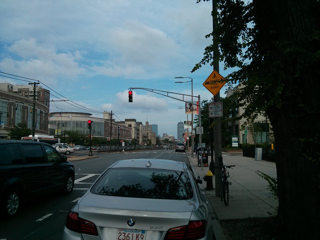
Lately, these street signs have been popping up on and near Commonwealth Avenue:

"Caution: High Bicycle & Pedestrian Activity Zone. 25 M.P.H."

It seems that this is the follow-up to this announcement: Mayor Menino and Boston University Launch Bike-Safety Initiative.
In a continuing five-year effort to improve safety and calm traffic along its 1.5 mile-long main campus straddling Commonwealth Avenue, Boston University today announced with the City of Boston a series of measures to further protect cyclists and pedestrians, encourage bike use, and promote awareness of cyclists and pedestrians among motor-vehicle drivers. They will include new signage, enhanced bike-lane markings, and highway reflectors in the pavement.
Sounds good. I appreciate the consideration. But I have to wonder: does posting these tiny signs really accomplish anything? Personally, I barely notice them when I'm walking past. I can't imagine anyone in a car stopping to squint at a sign like this. Some are a bit more visible, some are not so much.

"Share the Road"

And there's still legacy screw-ups like this:


"Turning Vehicles - Yield to Bike"
The glowing green arrow is at driver's eye-level. The yield sign is up and off to the side. Which do you think will get noticed? Fortunately, this is not a high-volume turn.

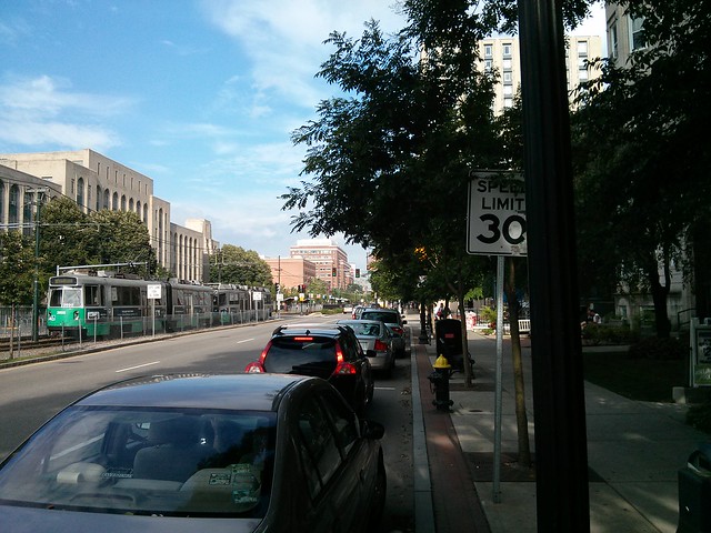
Going back to the 25 M.P.H. sign in the first picture: is this setting the legal limit? Or is it just a suggestion? It is an orange sign instead of the MUTCD standard design. I know that Commonwealth Avenue is signed for 30 M.P.H. elsewhere, which is the standard speed limit for these sorts of roads in Massachusetts (*).

It's not really clear how these signs are supposed to help. Judging by the speeds at which motorists fly down Comm Ave, I don't think they're noticing the signs either, or caring. Signs don't substitute for good design. Instead of merely telling motorists that this is a busy pedestrian area, the layout of the street should show it.


(*) Write to your legislators in support of H. 3129 to change the default speed limit to 25 M.P.H. in urbanized areas.

Thursday, June 20, 2013

The replacement of the Cambridge Street overpass of I-90

MassDOT has decided to expedite project 606376 to replace the deck of an overpass of the Mass Pike that is located in Allston, along Cambridge Street. The plans are already in 100% design state because they have been sitting around for a few years. However, they are offering a chance to comment over the next ten days, and at Tuesday's public meeting, they pledged to incorporate suggestions if possible. This is probably a once-in-a-generation opportunity to help fix a blight that has plagued Allston since the construction of the Mass Pike extension in the mid-60s.
[The comment period for all this is now, ending by July 3rd. Please e-mail dot.feedback.highway@state.ma.us and reference the Cambridge Street overpass over I-90 project number 606376. You may also read more on http://cambridgestreetoverpass.blogspot.com/.]


View Larger map (final design bus stops shown as blue markers)

The project scope extends from the intersection with Harvard Avenue in the west, to the intersection with Lincoln Street in the east. It also includes several minor repairs to the pedestrian footbridge across the pike at Franklin Street, but nothing more significant. MassDOT has suddenly gotten interested in this plan after it languished for several years, because the deck is deteriorating to the point where replacement must happen within the next couple of years. Conditions above the deck have been nearly intolerable for the past few years as well.
The sidewalk is fenced off because it has gaping holes
Dangerous conditions

A little history: prior to the construction of the Mass Pike extension in the mid 1960s, Cambridge Street had a smaller overpass of the Boston and Albany railroad. Lincoln Street, Mansfield Street, and Royal Street all connected directly to Cambridge Street.


Cambridge Street in 1925

The construction of the highway meant widening the right-of-way. Homes along the south side of Lincoln Street were taken (including Fred Salvucci's grandmother's home), as well as some homes on Mansfield and Royal, and the streets were reconfigured. Lincoln Street was redirected to curve to the northeast, paralleling the new highway. The ends of Mansfield and Royal were chopped off and reconnected to Lincoln Street. Then, Lincoln Street was rerouted over the Empire Street right of way and re-attached to Cambridge Street where Mayflower Street is shown on the map above. The net effect was to sever the street grid and create an overly long, uninterrupted block from Linden Street to the new Lincoln Street intersection. Motorists treat this stretch as if it were part of the highway, racing at high speeds along the excessive capacity, and creating a scary environment for anyone not surrounded by 2 tons of steel.

Eagle-eyed readers will notice there is a "tunnel" marking by Franklin Street. This was the location of a 19th century grade-separated walkway under the tracks. This was covered over and replaced in the 1960s by the current Franklin Street pedestrian overpass, which connects a point opposite Highgate Street on the south side, with Franklin Street on the north side.

The Cambridge Street berm
There is also a ramp at Mansfield Street, to replace the street connection that once existed. It climbs the berm so that people walking from Mansfield Street can reach Cambridge Street directly.

The Cambridge Street overpass of I-90 was given six lanes of automobile travel, small sidewalks, and no safe means of crossing, over 45 years ago. It has remained so since, but the bridge deck has reached the end of its lifespan and must be replaced.

Both MassDOT and BTD have shown a willingness to improve conditions on the bridge for walking and bicycling. They have recognized that six travel lanes is massive overkill: the feeder streets only have one lane in each direction, so there is simply not enough connecting capacity to fill six lanes anyway. As a result, they have drawn up buffered bike lanes and wider sidewalks into the current plans.

Crossing Cambridge Street
Unfortunately, in the same plans, they have decided to place a quarter-mile long fence right down the middle of Cambridge Street, from end-to-end of the scope. The claim is that they are concerned about "safety":  many people trying to get between North and South Allston are unwilling to walk a half-mile out of their way to use one of the intersections. So, instead of providing safe places to cross the street, the state agency is simply try to block all crossing. But that's unacceptable to the community. We need north-south permeability here. The sheer number of people willing to walk down the center median and climb the current concrete barrier attests to that. Many of these people live in North Allston and need to access jobs, shopping or bus stops in South Allston. Others live in South Allston and want to reach neighborhood resources in North Allston. MassDOT needs to accept that north-south travel is just as valid as east-west travel on this city street.


Now, MassDOT wants to stick to their scope and their schedule because they feel hurried to get this done. I also agree that this project needs to get done as soon as possible. So this comment period will likely be the last chance to ask for improvements in the final design.

What's exciting about this project is that the city has apparently been making plans quietly for a kind of "corridor to the river" from Allston to the Charles that uses Cambridge Street. For many decades, this street has been a barrier to walking and biking, with dangerous highway ramps and speeding trucks, but it could be transformed into a gateway instead.


View Cambridge Street corridor to the river in a larger map

The River Street Bridge replacement project (shown in blue) will be underway right after the Anderson bridge is complete. So, after that, the missing piece is in the middle: Cambridge Street.
  • Cambridge Street is a city street, and should look and feel like a city street, not a "mini-highway."
  • MassDOT and BTD are both onboard, in principle, with fixing Cambridge Street and building this "corridor to the river" but they seem to be fragmented in planning. Management of the corridor is split between the two agencies. We need them to be on the same page so that the final outcome is coherent.
  • A quarter-mile long fence with no crossings is not acceptable to the Allston community. There needs to be a safe place to cross. Some possibilities include the Linden Street intersection, or the Mansfield Street stairs. It should be possible to put a coordinated traffic signal at Linden Street which helps crossing with no impact on motor traffic.
  • During construction, a 2 year period, portions of the bridge will be closed. There will be three phases: each third of the bridge will be shutdown and replaced, from north to south. Although I understand that there will be unavoidable impacts, MassDOT needs to ensure that non-motorized access is considered seriously during this time-frame.
  • The Franklin Street overpass attracts heavy foot and bicycle traffic, which must share a narrow sidewalk along the north side of Cambridge Street near Harvard Avenue. The MassDOT plans call for directing the bicycle lane up a ramp and onto that same sidewalk. It will be widened to 13 feet, but, it turns MassDOT engineers had not anticipated that there currently is (and will be) 2-way bicycle traffic on this segment because of the overpass. Luckily, there is a grassy strip adjacent to the sidewalk which could be taken for a sidewalk-widening easement. That needs to be considered.
Two bicycles take up all the space already; but look at that potential width!

The comment period for all this is now, ending by July 3rd. Please e-mail dot.feedback.highway@state.ma.us and reference the Cambridge Street overpass over I-90 project number 606376. Or you may write a letter to:
Thomas F. Broderick, P.E., Chief Engineer
MassDOT - Highway Division
Attn: Bridge Project Management
10 Park Plaza
Boston, MA 02116-3973
You may also read more, including the 100% design plans, on http://cambridgestreetoverpass.blogspot.com/.